Midday Nowcast: Waiting and Watching for Strong Storms
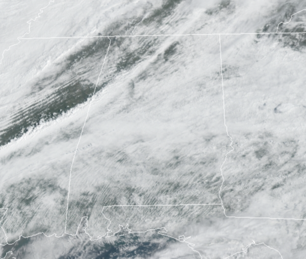
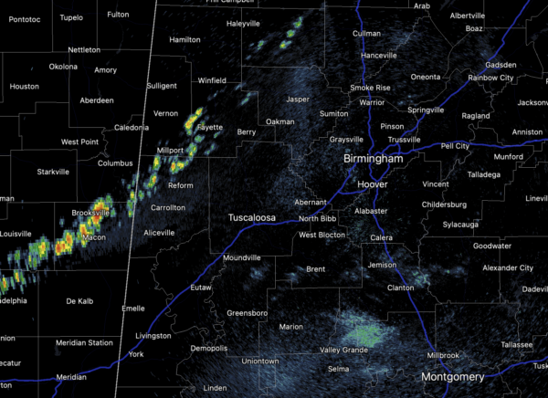
A cold front is dropping into Alabama today and this front will cause a line of strong to severe storms to move through Alabama later today. Ahead of the front, it is a very warm and muggy day with temperatures heading into the upper 70s and lower 80s. There is a lot of instability available, so storms are expected to develop well-ahead of the front across Central Alabama, and these will be strong, packing a punch possibly producing damaging winds, large hail, and some tornadoes. As of late this morning, we are beginning to see some showers and storms develop across West Alabama and East Mississippi.
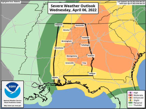
All of Alabama remains under a threat for severe storms today, with an “enhanced risk” (level 3/5) for much of Central and East Alabama, including places like Birmingham, Anniston, Gadsden, Huntsville, Cullman, Clanton, Selma, Montgomery, Auburn, and Ashland. The rest of the state is in a “slight risk” (level 2/5).
The broad window for the stronger thunderstorms will come from about NOON-10PM with the activity forming initially over the western counties, followed by an eastward progression. The main threat will come from strong winds and hail; wind profiles aren’t really favorable for tornado development. Still, a brief tornado or two can’t be totally ruled out where small scale boundaries are involved. Storms will end from northwest to southeast early tonight as the cold front pushes through the state.
CALL TO ACTION: It is another day to remain weather aware; pay attention to warnings if and when they are issued. Again, this is the core of our severe weather season in Alabama, so events like this are not uncommon. Many of you have anxiety about severe weather, especially those that have gone through tornadoes or other kinds of violent weather. Have comfort knowing that even on the biggest severe weather days, odds of any one home being hit by a tornado are very low. But, you have to pay attention and be prepared. We will get through the day together.
As always, be sure you have multiple ways of hearing and receiving severe weather warnings, and an action plan if you are in a tornado warning polygon, take severe thunderstorm warnings seriously too. Have a NOAA Weather Radio in your home and business, properly programmed with a fresh battery in case of power failure. Be sure WEA (Wireless Emergency Alerts) enabled on your phone… this is not an app, but built into every phone sold in the U.S. Check settings, and notifications, and be sure emergency alerts are on. Have the free ABC 33/40 weather app on your phone as a secondary way of getting warnings. Search the App Store for “ABC 33/40 Weather” if you don’t have it already.
COOLER AIR RETURNS: A deep trough will begin to dig down into the eastern half of the U.S. behind the front. Tomorrow and Friday will be dry with a significant cooling trend; expect partly sunny days with a high in the mid 60s Thursday, and likely only in the upper 50s Friday…well below average for April in Alabama.
WEEKEND FROST/FREEZE THREAT: We expect lows well down in the 30s Saturday and Sunday morning over the northern half of the state, with potential for widespread frost, and a freeze for colder spots. Growers will need to watch temperature forecasts both mornings. Otherwise, the weekend will feature lots of sunshine with a high near 60°, followed by low 70s Sunday.
NEXT WEEK: Forecast confidence is fairly low in the details, but the main threat of severe storms during the week will likely be well to the west of Alabama, across parts of Texas, Oklahoma, Kansas, and Arkansas. We could see a few showers on a day or two, but no major rain events are expected thanks to an upper ridge over the region.
BEACH FORECAST CENTER: Get the latest weather and rip current forecasts for the beaches from Fort Morgan to Panama City on our Beach Forecast Center page. There, you can select the forecast of the region that you are interested in visiting.
WORLD TEMPERATURE EXTREMES: Over the last 24 hours, the highest observation outside the U.S. was 114.8F at Nawabshah, Pakistan. The lowest observation was -96.5F at Vostok, Antarctica.
CONTIGUOUS TEMPERATURE EXTREMES: Over the last 24 hours, the highest observation was 104F at Falcon Lake, TX. The lowest observation was 7F at Big Sky, MT.
Category: Alabama's Weather, ALL POSTS, Severe Weather
About the Author (Author Profile)
Macon, Georgia Television Chief Meteorologist, Birmingham native, and long time Contributor on AlabamaWX. Stormchaser. I did not choose Weather, it chose Me. College Football Fanatic. @Ryan_StinnetSubscribe
If you enjoyed this article, subscribe to receive more just like it.


