Scattered Showers Tomorrow; Strong To Severe Storms Late Wednesday Night
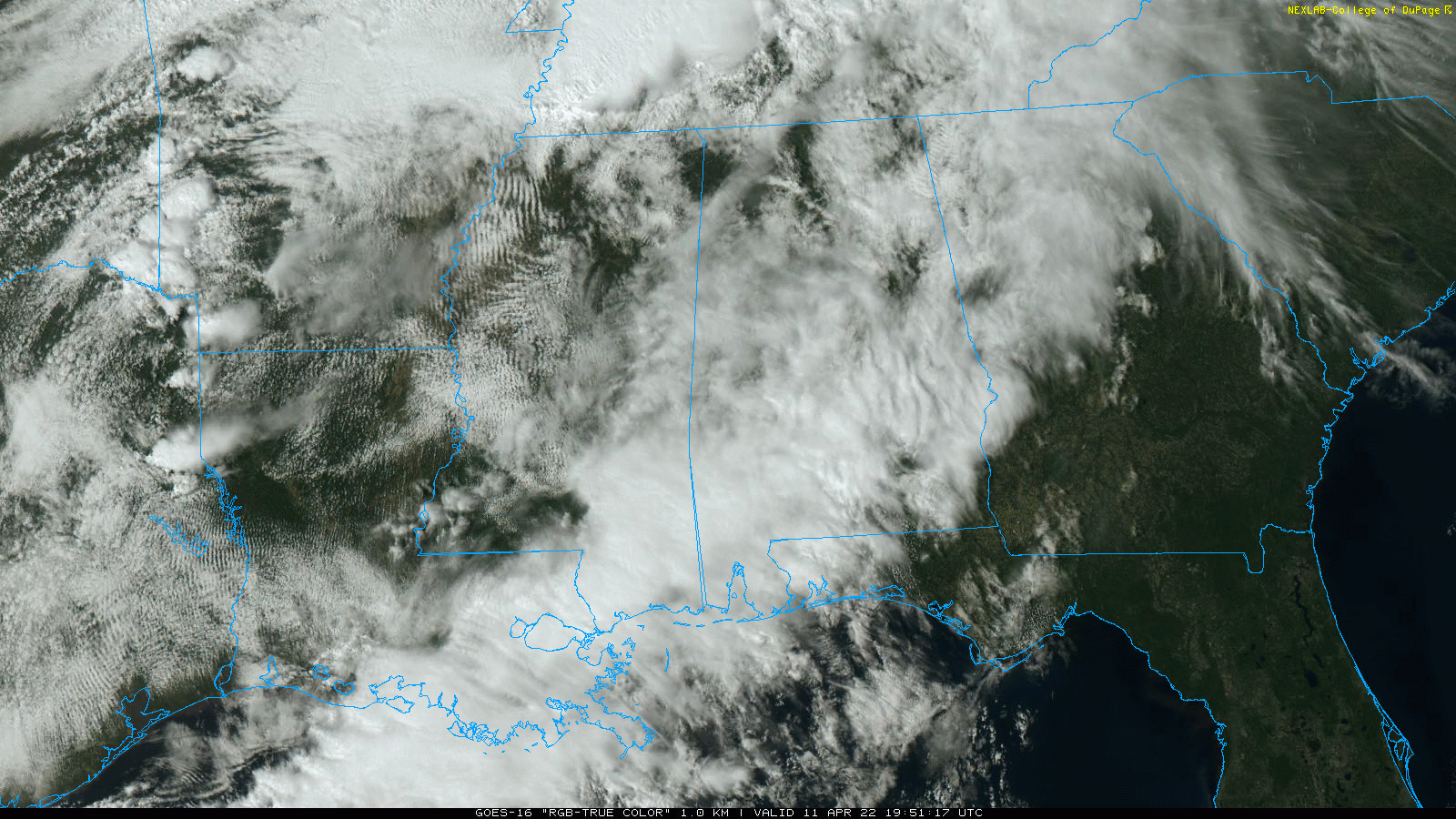
RADAR CHECK: Showers are confined mainly to the southern half of Alabama this afternoon, otherwise the sky is mostly cloudy with temperatures in the 60s… below forecast levels due to persistent clouds. Showers over South Alabama will diminish this evening, and the sky will be mostly fair later tonight.
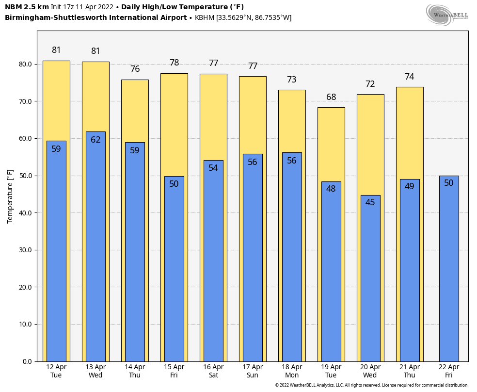
Look for a mix of sun and clouds tomorrow and Wednesday with a few scattered showers or storms around; the high both days will be in the 77-81 degree range. Odds of any one spot getting wet will be in the 20-30 percent range, much like a summer day.
WEDNESDAY NIGHT/THURSDAY: A cold front will bring an organized band of showers into Alabama late Wednesday night into the pre-dawn hours Thursday. SPC has an “enhanced risk” (level 3/5) of severe thunderstorms defined for the northwest corner of the state… most of Alabama is in a level 2 “slight risk”. The exception is over the southeast counties, where the storms will be weakening, and a “marginal risk” (level 1/5) is in place there.
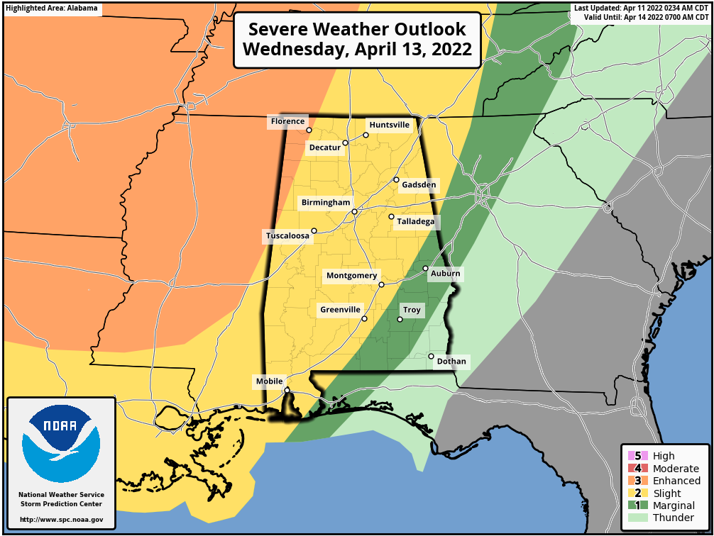
The line of storms will enter Northwest Alabama around midnight Wednesday night, and will pass through the state during the early morning hours Thursday. For most places, the line will be moving through late Wednesday night between midnight and 7:00 a.m. Thursday. The core threat will come from strong, potentially damaging straight line winds. With the surface low well to the north (near the Canadian border), shear values won’t be especially high, and the tornado threat for now looks low. But, as always in a case like this, you can’t rule out an isolated tornado in the line.
The sky becomes partly to mostly sunny during Thursday afternoon as dry air returns… and Friday looks mostly dry with a good supply of sunshine; a few showers will be possible over the southwest corner of the state. The high both days will be in the mid 70s, right at seasonal averages.
THE ALABAMA WEEKEND: A northward moving warm front will bring rain back into Alabama over the Easter weekend. New guidance shows rain becoming widespread during the day Saturday, continuing Saturday night, before diminishing Sunday. Some thunder is possible, but for now this doesn’t look like a severe weather setup. Highs will remain in the 70s.
NEXT WEEK: Periods of rain are likely Monday, then drier air will likely move in during the mid-week period. Highs during the week will be mostly in the 76-81 degree range… See the Weather Xtreme video for maps, graphics, and more details.
ON THIS DATE IN 1965: The “Palm Sunday Outbreak” consisted of fifty-one tornadoes, killing over 250 people and causing more than 200 million dollars damage. Indiana, Ohio and Michigan were hardest hit. Although no F5s were officially reported, at least 22 were rated as F3 or F4.
ON THIS DATE IN 2011: A line of severe thunderstorms producing signifiant wind damage across Alabama… some of the hardest hit areas were in Aliceville in Pickens County, Brent in Bibb County and many spots around the Birmingham metro area. Most of the damage reports consisted of single trees or groups of trees that had been uprooted, and though there were sporadic reports of structural damage. This was the beginning of an extremely active severe weather month; historic tornado outbreaks would follow on April 15 and April 27.
BEACH FORECAST: Click here to see the AlabamaWx Beach Forecast Center page.
WEATHER BRAINS: Don’t forget you can listen to our weekly 90 minute show anytime on your favorite podcast app. This is the show all about weather featuring many familiar voices, including our meteorologists here at ABC 33/40.
CONNECT: You can find me on all of the major social networks…
Look for the next Weather Xtreme video here by 6:00 a.m. tomorrow…
Category: Alabama's Weather, ALL POSTS, Weather Xtreme Videos
About the Author (Author Profile)
James Spann is one of the most recognized and trusted television meteorologists in the industry. He holds the AMS CCM designation and television seals from the AMS and NWA. He is a past winner of the Broadcast Meteorologist of the Year from both professional organizations.Subscribe
If you enjoyed this article, subscribe to receive more just like it.


