Midday Nowcast: Warm and Muggy; Strong Storms Arrive Tonight
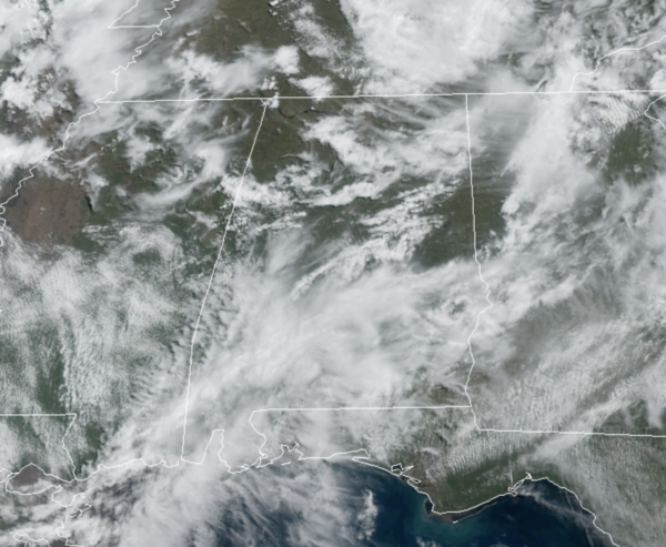
The rest of today will be mainly dry, with only scattered showers and warm temperatures with highs in the 80s. To our northwest, a cold front is causing a severe weather outbreak across the Mississippi Valley, and this front will bring an organized band of rain and storms into the state late tonight into the pre-dawn hours tomorrow.
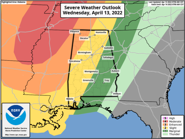
At the writing of this forecast, a large swath of the Lower Mississippi Valley was included in tornado watches. The SPC maintains an “enhanced risk” (level 3/5) of severe thunderstorms for Northwest Alabama… areas west of a line from Athens to Haleyville to Reform. A “slight risk” (level 2/5) extends as far east as Fort Payne, Sylacauga, and Bay Minette. A “marginal risk” (level 1/5) covers most of the rest of the state… parts of East and South Alabama.
This evening, some strong storms could develop over West and Northwest Alabama as early as 5-6PM, but the main line should enter the northwest corner of the state late tomorrow night around 10PM, it will reach I-59 (Tuscaloosa/Birmingham/Gadsden) around 2AM, and then moving into East and Southeast Alabama after 3-4AM.
The main threat will come from strong, potentially damaging straight-line winds. With the main dynamics well to the north, shear values won’t be especially high, so the tornado threat for now looks low in Central Alabama. But, as always in a case like this, you can’t rule out an isolated tornado in the line. Also, large hail will be a concern. With this being a “middle of the night” event, but sure you have you NOAA Weather Radio on, and don’t use the “do not disturb” feature on your phone so you can get notifications. Thankfully, the line should be weakening as it moves through the state.
The sky becomes mostly sunny by tomorrow afternoon, as dry air returns… and Friday looks dry with mainly sunny conditions. The high both days will be in the mid 70s, right at seasonal averages.
EASTER WEEKEND WEATHER: The front will move back north as a warm front, bringing rain back into Alabama both days this weekend. Showers will begin as early as Friday night, and periods of rain are likely Saturday, Saturday night, and Sunday as the front stalls out over the region. Some thunder is possible, but for now severe storms are not expected. Highs will remain in the mid 70s.
FOOTBALL WEATHER: For the Alabama “A Day” game in Tuscaloosa Saturday (2:00p CT kickoff)… the sky will be cloudy with periods of rain likely. Temperatures will be in the 70-74 degree range.
The Birmingham Stallions will most the New Jersey Generals Saturday evening at Protective Stadium (6:30p CT kickoff)… expect a cloudy sky with occasional showers; temperatures will fall from near 72 at kickoff, into the upper 60s by the final whistle.
NEXT WEEK: Periods of rain are likely Monday, then drier air will return Tuesday and Wednesday. A cold front will bring a chance of showers Thursday, followed by another shot of dry air Friday. Highs will be mostly in the 70s through the week
BEACH FORECAST CENTER: Get the latest weather and rip current forecasts for the beaches from Fort Morgan to Panama City on our Beach Forecast Center page. There, you can select the forecast of the region that you are interested in visiting.
WORLD TEMPERATURE EXTREMES: Over the last 24 hours, the highest observation outside the U.S. was 113.7F at Yelimane, Mail The lowest observation was -95.6F at Vostok, Antarctica.
CONTIGUOUS TEMPERATURE EXTREMES: Over the last 24 hours, the highest observation was 106F at Cotulla, TX. The lowest observation was -17F at Lake Yellowstone, WY.
Category: Alabama's Weather, ALL POSTS, Severe Weather
About the Author (Author Profile)
Macon, Georgia Television Chief Meteorologist, Birmingham native, and long time Contributor on AlabamaWX. Stormchaser. I did not choose Weather, it chose Me. College Football Fanatic. @Ryan_StinnetSubscribe
If you enjoyed this article, subscribe to receive more just like it.


