Dry Tomorrow; Showers Return Over The Weekend
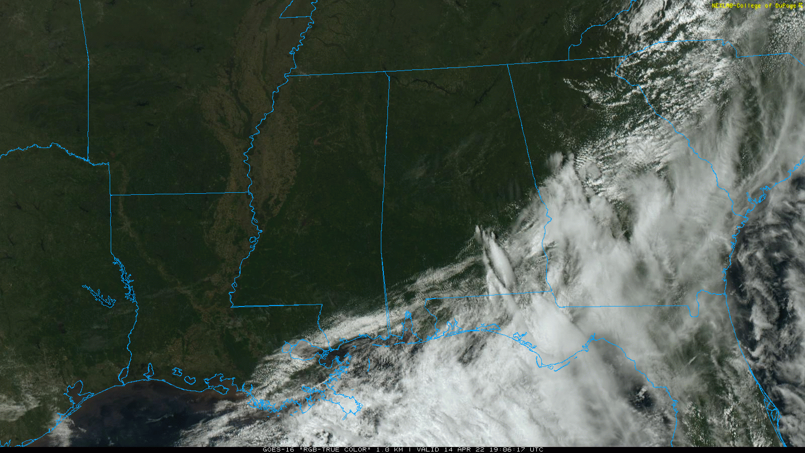
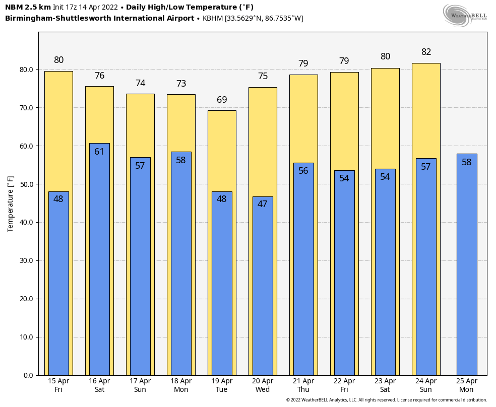
SUNNY APRIL AFTERNOON: Most of Alabama is enjoying sunshine in full supply this afternoon… temperatures are in the 66-74 degree range. Some clouds are lingering across the southeast counties, but most places will be clear tonight with a low in the 40s. Tomorrow will be another dry day with ample sushine along with a high in the upper 70s.
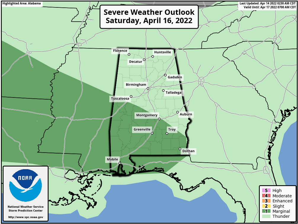
EASTER WEEKEND: Clouds move in tomorrow night, and showers and a few storms will likely push into the state after midnight. A few strong storms are possible early Saturday morning across Northwest Alabama, where SPC has defined a “marginal risk” of severe storms.
During the day Saturday, the sky will be generally cloudy with occasional showers and a few thunderstorms. Understand this won’t be a “wash-out” or an all day rain, but it will be wet at times. A strong thunderstorm is possible over the southern half of the state… SPC maintains a “marginal risk” (level 1/5) for areas south of a line from Aliceville to Montgomery to Abbeville. Stronger storms in that area Saturday could produce small hail and strong gusty winds; there is no tornado threat. The high Saturday will be in the 71-76 degree range.
Clouds will linger on Easter Sunday, and a few passing showers are likely during the day. But, like Saturday, the day won’t be a “wash-out”. The high Sunday will be in the mid 70s.
NEXT WEEK: A few lingering showers are possible Monday… then most of the state will be dry Tuesday and Wednesday. A cold front will bring a chance of showers an storms Thursday; for now it doesn’t look like a severe weather setup. See the Weather Xtreme video for maps, graphics, and more details.
FOOTBALL WEATHER: For the Alabama “A Day” game in Tuscaloosa Saturday (2:00p CT kickoff)… the sky will be cloudy with a few passing showers during the game, and possibly a thunderstorm. Temperatures will be in the low to mid 70s.
The Birmingham Stallions will most the New Jersey Generals Saturday evening at Protective Stadium (6:30p CT kickoff)… expect a cloudy sky with a few showers; temperatures will fall from near 72 at kickoff, into the upper 60s by the final whistle.
LAST NIGHT’S STORMS: NWS damage surveys are being conducted today; the damage in the Branch Heights section of Eutaw (Greene County) was caused by an EF-0 tornado. Still awaiting survey results in Northport, in the Flatwoods neighborhood.
ON THIS DATE IN 1886: The deadliest tornado in Minnesota history razed parts of St. Cloud and Sauk Rapids, leaving 72 dead and 213 injured. 11 members of a wedding party were killed including the bride and groom. The bottom of the Mississippi River was seen during the tornado’s crossing.
ON THIS DATE IN 1935: Black Sunday refers to a particularly severe dust storm that occurred on April 14, 1935, as part of the Dust Bowl. During the afternoon, the residents of the Plains States were forced to take cover as a dust storm, or “black blizzard,” blew through the region. The storm hit the Oklahoma Panhandle and Northwestern Oklahoma first and moved south for the remainder of the day.
ON THIS DATE IN 2019: A total of eleven tornadoes touched down across Alabama on Palm Sunday 2019; they were all short lived and rated either EF-0 or EF-1.
BEACH FORECAST: Click here to see the AlabamaWx Beach Forecast Center page.
WEATHER BRAINS: Don’t forget you can listen to our weekly 90 minute show anytime on your favorite podcast app. This is the show all about weather featuring many familiar voices, including our meteorologists here at ABC 33/40.
CONNECT: You can find me on all of the major social networks…
Look for the next Weather Xtreme video here by 6:00 a.m. tomorrow…
Category: Alabama's Weather, ALL POSTS, Weather Xtreme Videos
About the Author (Author Profile)
James Spann is one of the most recognized and trusted television meteorologists in the industry. He holds the AMS CCM designation and television seals from the AMS and NWA. He is a past winner of the Broadcast Meteorologist of the Year from both professional organizations.Subscribe
If you enjoyed this article, subscribe to receive more just like it.


