Ida Not Far From Becoming Tropical Storm Again

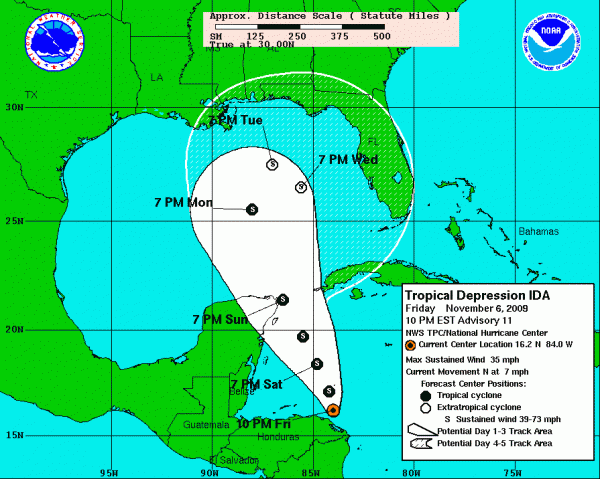
Ida is back over the northwestern Caribbean after a jaunt over Nicaragua and Honduras.
The center is a little less than 400 miles south southeast of the northeastern tip of the Yucatan.
It is currently a tropical depression with top winds of 35 mph.
The system will almost certainly become a tropical storm overnight over the warm waters of the Caribbean.
As is often the case, there is a great deal of uncertainty about the amount of strengthening that will occur as the storm moves steadily north northwestward and grazes the Yucatan Sunday night, on its way into the southern Gulf.
But I would bet that it does become a hurricane by Sunday afternoon over the Caribbean.
Ida will move into the Central Gulf and likely merge with a frontal system, becoming extratropical by late Tuesday, when it is just 300 miles south of Mobile.
As it encounters increasing shear, it should weaken. It might even turn south over the Gulf before dissipating.
This is the forecast. But as we always say with tropical systems, expect the unexpected, so stay tuned.
Category: Uncategorized


