Midday Nowcast: More Oppressive Heat; Watching Storms to the East
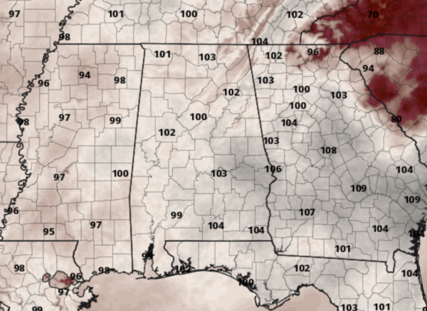
HOT, HOT, HOT: New day, same forecast as Alabama swelters under the upper ridge across the Deep South. Dew points remain in the mid to upper 70s, and temperatures are again in the low to upper 90s across Alabama today, and the next several days. The combination of hot temperatures and high humidity is causing our heat index values to surge well over 100°, and in many places, exceeding 105° which is why the Heat Advisory continues today and through at least tomorrow across much of Alabama.
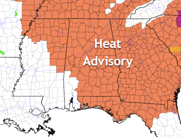
Before noon this morning, many locations are seeing the values over 100° and these will persist, making for another very oppressive afternoon of heat.
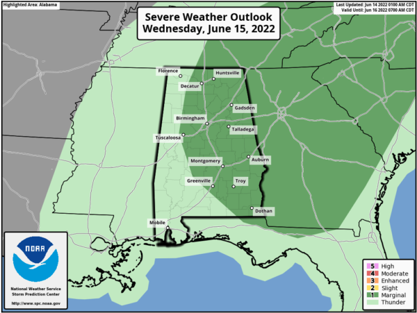
Each day we continue to watch the radar for those random storms and some storms could be strong due to the very high instability in place…Big HEAT means Big STORMS.
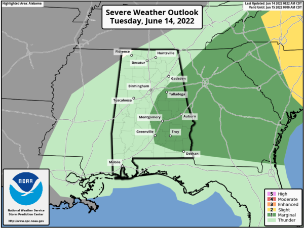
We note SPC has defined a “marginal risk” (level 1/5) of severe thunderstorms for parts of East and Central Alabama today and tomorrow; a storms in these areas could produce strong winds. Also, expect lots of lightning with any storm this time of year.
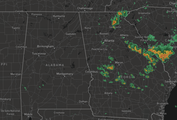
At the midday hours, storms are developing across Georgia and these are drifting west towards Alabama and should give some locations some heat relief this afternoon. The chance of any one location seeing rain today and tomorrow is in the 30-40% range.
A surface front will bring the chance of a few scattered storms to the northern half of the state Friday, but again the rain won’t be widespread.
THE ALABAMA WEEKEND: Temperatures will remain hot both Saturday and Sunday, but humidity values will come down some, so the heat should not be as oppressive. Expect highs in the 90-94 degree range, with mainly sunny days and fair nights. Chance of a cooling shower is very, very small both days.
NEXT WEEK: The upper ridge holds; highs again will be in the mid 90s most days with only isolated afternoon storms. Most likely the pattern will hold through the rest of June.
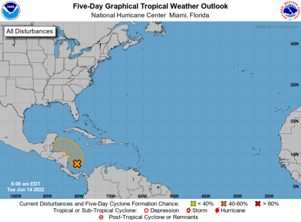
IN THE TROPICS: All is quiet for now, but disorganized showers and thunderstorms over the southwestern Caribbean Sea continue in association with a trough of low pressure. Gradual development of this system is possible while it drifts northwestward near the coasts of Nicaragua and Honduras, and it could become a tropical depression late this week if the disturbance remains over water. Regardless of development, this system could produce periods of heavy rainfall across portions of eastern Nicaragua and eastern Honduras late this week. Formation chance through 48 hours…low…20 percent. Formation chance through 5 days…medium…40 percent.
BEACH FORECAST CENTER: Get the latest weather and rip current forecasts for the beaches from Fort Morgan to Panama City on our Beach Forecast Center page. There, you can select the forecast of the region that you are interested in visiting.
WORLD TEMPERATURE EXTREMES: Over the last 24 hours, the highest observation outside the U.S. was 119.7F at Jahra, Kuwait. The lowest observation was -84.6F at Dome A, Antarctica.
CONTIGUOUS TEMPERATURE EXTREMES: Over the last 24 hours, the highest observation was 114F at Death Valley, CA. The lowest observation was 24F at Lowman, ID.
Category: Alabama's Weather, ALL POSTS
About the Author (Author Profile)
Macon, Georgia Television Chief Meteorologist, Birmingham native, and long time Contributor on AlabamaWX. Stormchaser. I did not choose Weather, it chose Me. College Football Fanatic. @Ryan_StinnetSubscribe
If you enjoyed this article, subscribe to receive more just like it.


