Typical Summertime Weather for Now; Heat Builds Back In Next Week
We’ll start off today with partly to mostly sunny skies, but clouds will build during the heating of the day, and scattered to numerous showers and thunderstorms can be expected to form this afternoon through the early evening hours. Not everyone will see rain today, but chances are rather high. Highs will be in the upper 80s to the lower 90s.
Same story for Sunday… partly sunny, with scattered to numerous afternoon to early evening showers and storms. Highs in the upper 80s to the lower 90s.
Hotter temperatures start to return for Independence Day. We’ll have mostly sunny skies, with a few scattered afternoon showers and storms. Highs in the upper 80s to the mid 90s.
Not much change in the thinking for Tuesday… mostly sunny and hot, with scattered afternoon showers and storms possible. Highs in the upper 80s to the mid 90s.
Lower to mid 90s can be expected on Wednesday as we’ll have mostly sunny skies and a small chance of isolated to scattered afternoon showers and storms.
Heat relief will be hard to find on Thursday, as a few isolated showers and storms will be possible. It will be mostly sunny, with highs ranging from the lower 90s to the upper 90s.
At the end of the forecast period on Friday, we can expect mostly sunny and hot conditions, with a small chance of a few isolated to scattered showers and storms. Highs will once again range throughout the 90s.
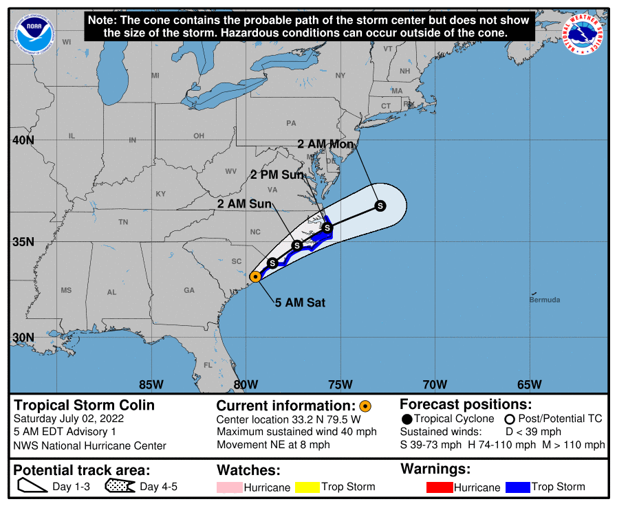
And taking a look at the tropics… Tropical Storm Colin formed earlier this morning on the South Carolina coastline with winds at 40 mph. Colin is forecast to move northeast along the coast and eventually moving out into open water by Monday while staying as a weaker tropical storm. Heavy rain will be the main threat as some flash flooding issues may occur.
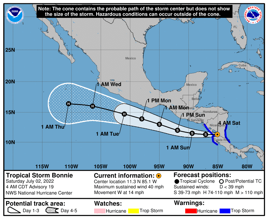
Tropical Storm Bonnie is over land in Central America with 40 mph winds and will move out over the Pacific Ocean later today. Bonnie is forecast to become a hurricane by late Monday or early Tuesday while staying just south of Mexico.
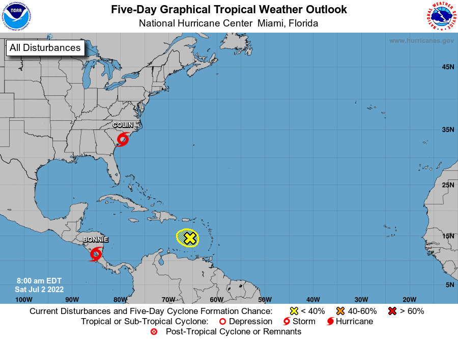
And we have a tropical wave just west of the Windward Islands that is moving to the west-northwest, but it is moving into a harsh environment and further development is not expected through the next five days.
Category: Alabama's Weather, ALL POSTS, Tropical, Weather Xtreme Videos
About the Author (Author Profile)
Scott Martin is an operational meteorologist, professional graphic artist, musician, husband, and father. Not only is Scott a member of the National Weather Association, but he is also the Central Alabama Chapter of the NWA president. Scott is also the co-founder of Racecast Weather, which provides forecasts for many racing series across the USA. He also supplies forecasts for the BassMaster Elite Series events including the BassMaster Classic.Subscribe
If you enjoyed this article, subscribe to receive more just like it.


