Very Hot with Strong Storms Possible Today; A Little Cooler on Sunday
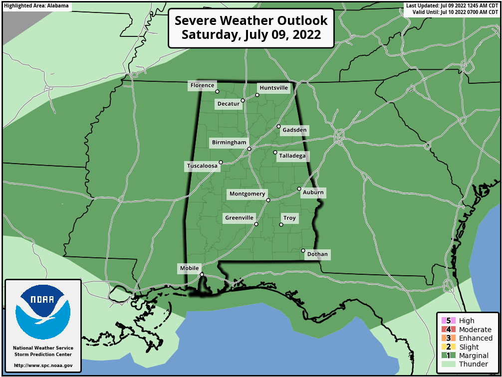
Today will be another very hot day for most places across Central Alabama as we’ll have mostly sunny skies, but we do have a good chance of thunderstorms as a front will be working its way southward through the area. All of Alabama is under a Marginal Risk of severe storms today, as downburst winds will be the main threat. However, we could see a good bit of rain with some storms and a few isolated flooding issues may occur. Highs will be in the mid to upper 90s.
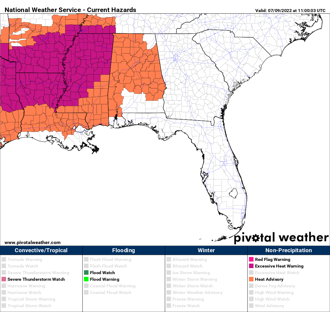
With the heat and high humidity across the area, a Heat Advisory continues for all of Central Alabama and nearly all of North Alabama until 7 pm tonight. Take extra precautions if having to work or spending an extended amount of time outdoors, as heat index values will be around or over 105º.
Sunday will be a cooler day as we’ll have variable cloudiness across the area with scattered to numerous showers and thunderstorms possible, especially during the afternoon and evening hours. The best chance of rain will be along and south of I-59. Highs will be in the upper 80s to the lower 90s.
A very moist tropical airmass will continue to hang over the southeast as the heat ridge retreats westward on Monday. It looks like a more typical summertime forecast for the area, as we’ll have a good bit of sun and a chance of a few scattered afternoon storms. Highs will be in the upper 80s to the lower 90s.
Tuesday will be about the same story… partly to mostly sunny with a chance of scattered afternoon storms. Highs in the upper 80s to the lower 90s.
A trough develops on Wednesday over the mountains of the eastern US, and a shortwave looks to swing through the area. Scattered to numerous storms will be likely across Central Alabama, some of which may be strong. Highs will be in the mid 80s to right around 90º.
After that shortwave moves out, Thursday looks to be a typical summertime day in the southeast. Partly to mostly sunny skies, with scattered afternoon storms. Highs in the mid 80s to the lower 90s.
Rain chances will be a little lower on Friday, and we’ll start to see the heat start to creep back in from the west. We’ll keep a chance of a few isolated to scattered afternoon storms in the forecast, with highs in the upper 80s to the lower 90s.
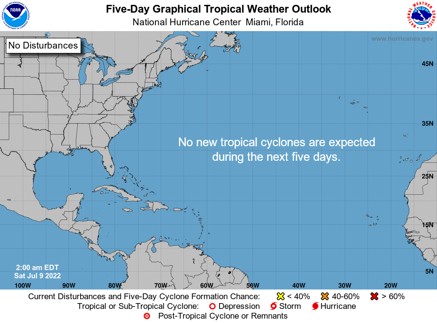
The tropics are quiet for now and no new tropical cyclones are forecast to develop over the next five days in the Atlantic Ocean, Gulf of Mexico, or the Caribbean Sea.
Category: Alabama's Weather, ALL POSTS, Severe Weather, Weather Xtreme Videos
About the Author (Author Profile)
Scott Martin is an operational meteorologist, professional graphic artist, musician, husband, and father. Not only is Scott a member of the National Weather Association, but he is also the Central Alabama Chapter of the NWA president. Scott is also the co-founder of Racecast Weather, which provides forecasts for many racing series across the USA. He also supplies forecasts for the BassMaster Elite Series events including the BassMaster Classic.Subscribe
If you enjoyed this article, subscribe to receive more just like it.


