EXPIRED — Severe T-Storm Warning: Parts of Blount, Etowah Co. Until 4:30 pm
BULLETIN – IMMEDIATE BROADCAST REQUESTED
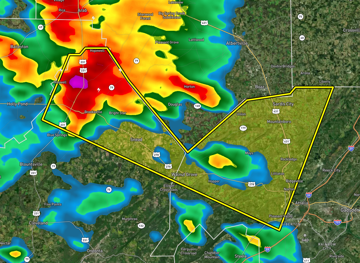
Severe Thunderstorm Warning
National Weather Service Birmingham AL
349 PM CDT Sat Jul 9 2022
The National Weather Service in Birmingham has issued a
* Severe Thunderstorm Warning for…
Northeastern Blount County in central Alabama…
Northwestern Etowah County in northeastern Alabama…
* Until 430 PM CDT.
* At 348 PM CDT, a severe thunderstorm was located near Brooksville,
or 7 miles south of Arab, moving east at 20 mph.
HAZARD…60 mph wind gusts.
SOURCE…Radar indicated.
IMPACT…Expect damage to roofs, siding, and trees.
* Locations impacted include…
Attalla, Sardis City, Altoona, Snead, Susan Moore, Walnut Grove,
McLarty, Aurora, Strawberry, Brooksville, Howelton, Mountainboro,
Rockledge and Ramsey.
PRECAUTIONARY/PREPAREDNESS ACTIONS…
For your protection move to an interior room on the lowest floor of a
building.
Category: Alabama's Weather, ALL POSTS, Severe Weather
About the Author (Author Profile)
Scott Martin is an operational meteorologist, professional graphic artist, musician, husband, and father. Not only is Scott a member of the National Weather Association, but he is also the Central Alabama Chapter of the NWA president. Scott is also the co-founder of Racecast Weather, which provides forecasts for many racing series across the USA. He also supplies forecasts for the BassMaster Elite Series events including the BassMaster Classic.Subscribe
If you enjoyed this article, subscribe to receive more just like it.


