SPC adds “Slight Risk” of Severe Storms for Alabama Today
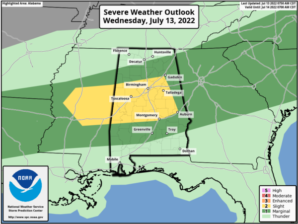
Thunderstorms capable of producing severe gusts and isolated hail will be likely across as parts of Mississippi and Alabama today. Showers and storms are ongoing this morning, but scattered thunderstorms — some in locally dense multicellular clusters — are possible this afternoon along/ahead of the cold front. Damaging to severe gusts should be the main concern.
CAPE values will be in the 1500-2500 J/kg range. Hail probabilities also have been added in and near the “slight” wind-threat area for today. Despite the weak low/level and deep shear, forecast soundings across portions of the area indicate a deep growth zone containing with abundant moisture and buoyancy. An approximately southward-moving convective band is possible, yielding the most-concentrated severe potential.
Category: Alabama's Weather, ALL POSTS, Severe Weather
About the Author (Author Profile)
Macon, Georgia Television Chief Meteorologist, Birmingham native, and long time Contributor on AlabamaWX. Stormchaser. I did not choose Weather, it chose Me. College Football Fanatic. @Ryan_StinnetSubscribe
If you enjoyed this article, subscribe to receive more just like it.


