Midday Nowcast: Some Showers and Storms Now, Stronger Storms Later
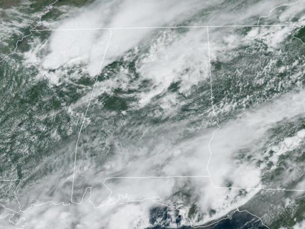
We have an approaching front from the north and a tropical system to the south of us, that puts most of Alabama in a “tropical sandwich” with more clouds than sun and high rain chances.
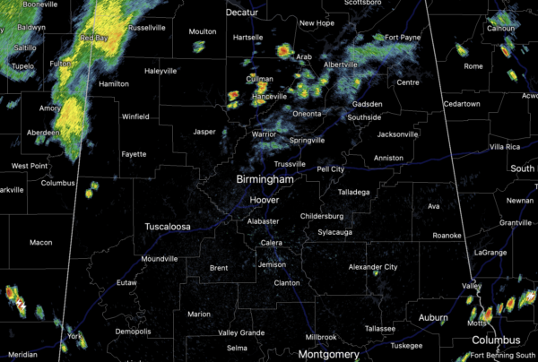
Moisture levels are very high so expect limited sunshine with numerous showers and storms today. Temperatures are mainly in the upper 80s for most locations.
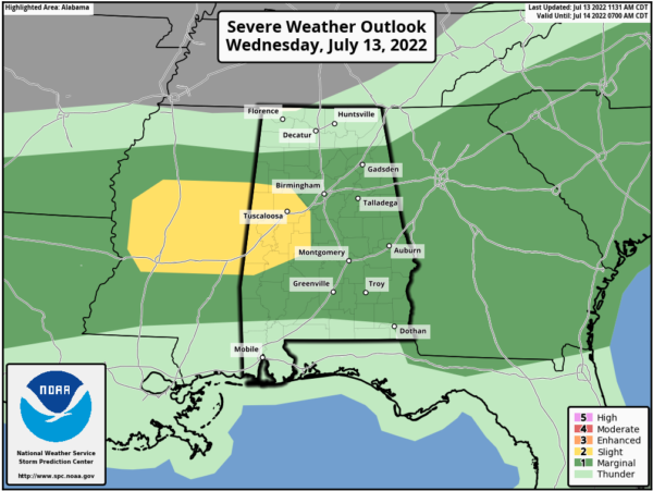
The SPC maintains a “slight risk” (level 2/5) for severe storms today for West/Central Alabama, including Tuscaloosa, Reform, Livingston, Demopolis, Greensboro, and Brent, and a “marginal risk” (level 1/5) for the rest of Central Alabama today as a storms could produce damaging wind gusts, and some hail. And, of course, all summer storms pack lots of lightning and tropical downpours, which could cause areas of isolated flash flooding.
THURSDAY/FRIDAY: Drier air filters into North Alabama, while rain and storms remain in the forecast for much of South and Central Alabama as the feature along the Gulf Coast continues produce widespread rain and storms. For North/Central Alabama, expect a mix of sun and clouds, which some a few scattered showers and storms. Highs will be in the around 90°. Clouds, rain and storms, and temps in the 80s will be more common to the south.
THE TROPICS: A surface trough extending from the Florida Panhandle west-southwestward along the northern Gulf coast is producing disorganized showers and thunderstorms over the northern Gulf of Mexico and adjacent land areas. The surface trough is forecast to drift northward over land during the next few days and significant tropical development is not anticipated. Regardless of development, heavy rains will pose a risk of flash flooding along portions of the northern Gulf coast from Louisiana to the Florida Panhandle over the next several days. For more information about the potential for heavy rain and flooding, please see products issued by your local National Weather Service office and the Weather Prediction Center. The rest of the basin is quiet for now.
If you have a trip planned to the Central Gulf Coast (Dauphin Island to Gulf Shores to Panama City Beach), it won’t rain all day every day, but it will be wet and stormy at times, with some intervals of sun. Also, rip currents are high right now, please pay attention to the flag warning systems along the beaches.
WEEKEND & NEXT WEEK: Pretty routine summer weather with partly sunny days, fair nights, and a few showers and storms around during the afternoon and evening hours. Afternoon highs not too far from 90 degrees as the core of the heat across the nation remains west of Alabama. This typical mid-July weather pattern looks to continue into next week as well. Expect highs in the low 90s and the usual risk of scattered, mostly afternoon and evening showers and thunderstorms on a daily basis.
BEACH FORECAST CENTER: Get the latest weather and rip current forecasts for the beaches from Fort Morgan to Panama City on our Beach Forecast Center page. There, you can select the forecast of the region that you are interested in visiting.
WORLD TEMPERATURE EXTREMES: Over the last 24 hours, the highest observation outside the U.S. was 116.4F at Jahra, Kuwait. The lowest observation was -106.2F at Concordia, Antarctica.
CONTIGUOUS TEMPERATURE EXTREMES: Over the last 24 hours, the highest observation was 123F at Death Valley, CA. The lowest observation was 27F at Peter Sinks, UT.
Category: Alabama's Weather, ALL POSTS
About the Author (Author Profile)
Macon, Georgia Television Chief Meteorologist, Birmingham native, and long time Contributor on AlabamaWX. Stormchaser. I did not choose Weather, it chose Me. College Football Fanatic. @Ryan_StinnetSubscribe
If you enjoyed this article, subscribe to receive more just like it.


