Midday Nowcast: Another Soupy Day
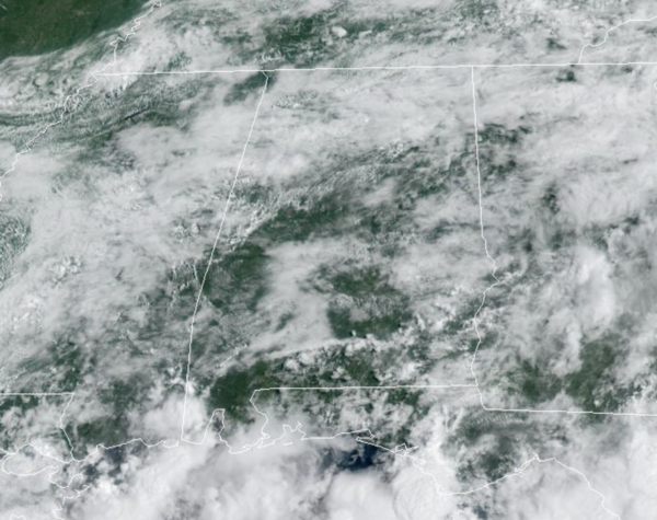
Watching the radar as it should be another active day with numerous showers and storms, due to the moisture-rich air mass in place across Alabama. This morning, just some light activity for much of Alabama, but daytime heating will allow storms to develop this afternoon. Additionally, the sea breeze front is very active to our south, and will move north into at least Central Alabama later today.
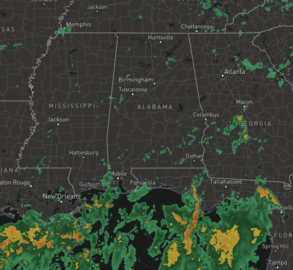
As in recent days, showers and storms will continue to be slow movers, producing heavy rain, strong gusty winds, and lots of lightning; and rainfall distribution will remain very uneven, with some locations getting way too much, while others remain dry. With these tropical downpours, it doesn’t take much to get areas of isolated flash flooding to develop. The odds of any one spot getting wet remains in the 50-70 percent range. Afternoon temps are generally in the mid to upper 80s.
FRIDAY AND THE WEEKEND: Drier air rolls into the much of Alabama tomorrow, lasting through the weekend. Expect generally dry conditions with more sun than clouds Friday, Saturday and Sunday, with lower humidity levels, and highs in the upper 80s to low 90s. Though rain chances are much lower, we will still mention the chance of an isolated afternoon shower in the forecast, but those will be mainly in the southern sections of the state and along the Northern Gulf Coast. Lows this weekend will likely settle into the soothing 60s for much of Central Alabama.
TROPICS: Shower activity is limited in association with a tropical wave located roughly midway between the west coast of Africa and the Lesser Antilles. Development of this system is not expected due to unfavorable environmental conditions while it moves west-northwestward at 15 to 20 mph during the next few days.
NEXT WEEK: Monday and Tuesday should remain mainly dry as well, but by mid week we will bring a more typical summer forecast back to North/Central Alabama. Expect partly sunny days with afternoon and evening showers and thunderstorms in random, scattered spots. Highs will remain in the upper 80s and low 90s.
BEACH FORECAST CENTER: Get the latest weather and rip current forecasts for the beaches from Fort Morgan to Panama City on our Beach Forecast Center page. There, you can select the forecast of the region that you are interested in visiting.
WORLD TEMPERATURE EXTREMES: Over the last 24 hours, the highest observation outside the U.S. was 124.5F at Omidieh, Iran. The lowest observation was -95.8F at Dome C, Antarctica.
CONTIGUOUS TEMPERATURE EXTREMES: Over the last 24 hours, the highest observation was 114F at Death Valley, CA. The lowest observation was 32F at Adin, CA.
Category: Alabama's Weather, ALL POSTS
About the Author (Author Profile)
Macon, Georgia Television Chief Meteorologist, Birmingham native, and long time Contributor on AlabamaWX. Stormchaser. I did not choose Weather, it chose Me. College Football Fanatic. @Ryan_StinnetSubscribe
If you enjoyed this article, subscribe to receive more just like it.


