Mostly Cloudy Skies for Your Sunday, Showers/Some Thunder Down South
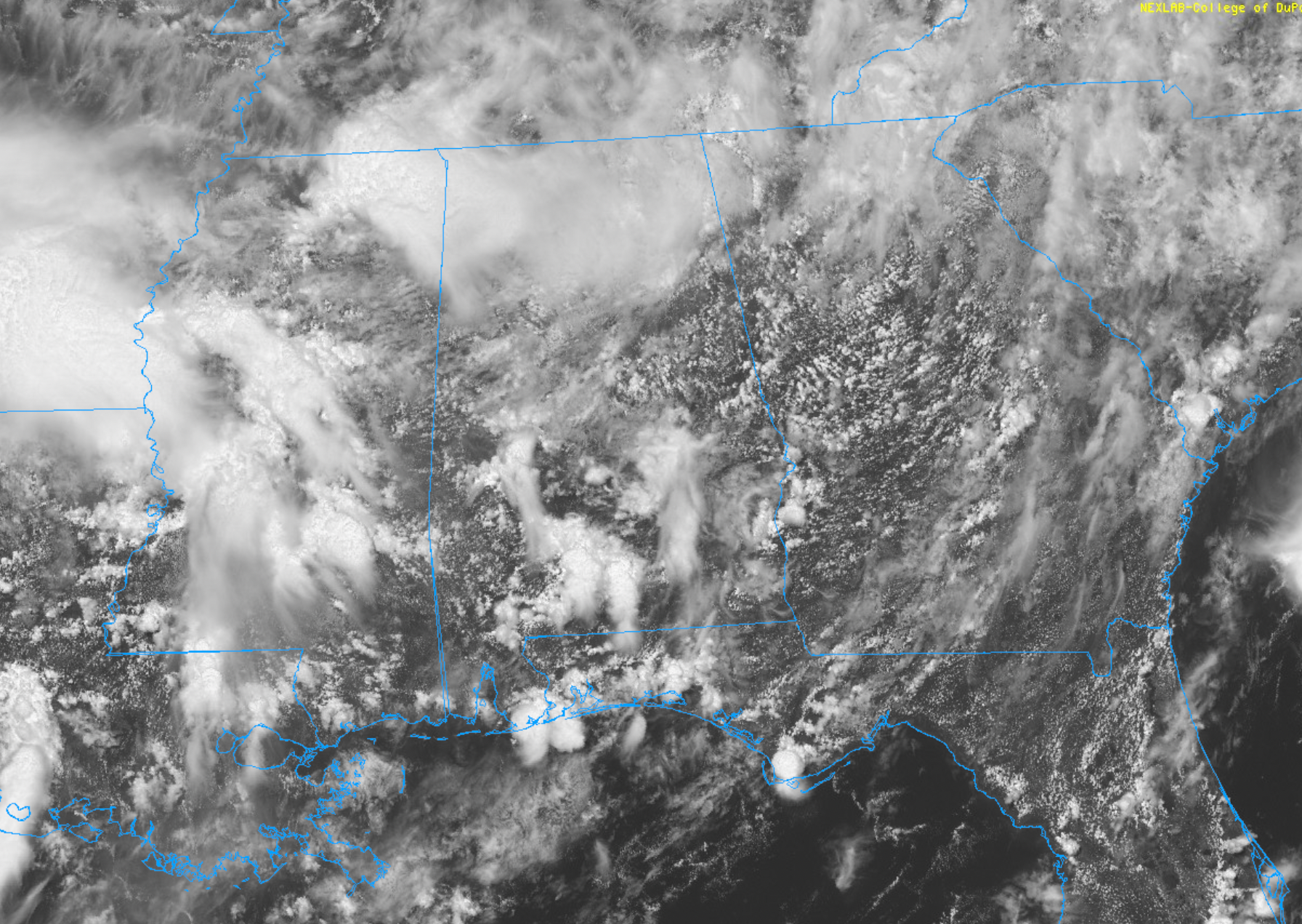
Skies are mostly cloudy across Alabama on this Sunday afternoon.
The frontal system that had been lying across the state has dissipated. Another cold front is edging southeastward into the Mid-South, approaching western Tennessee.
A large upper-level trough is powering this front, extending from the Great Lakes states southwestward into the Arklatex.
Disturbances riding along through the base of the trough are triggering widespread showers and isolated thunder over South Central Alabama. At 12:30 p.m., the rain extended from parts of Greene/Hale counties through Marengo and on southeastward into the I-65 COrridor from Montgomery down to Evergreen. From there, it extends into Southeast Alabama.
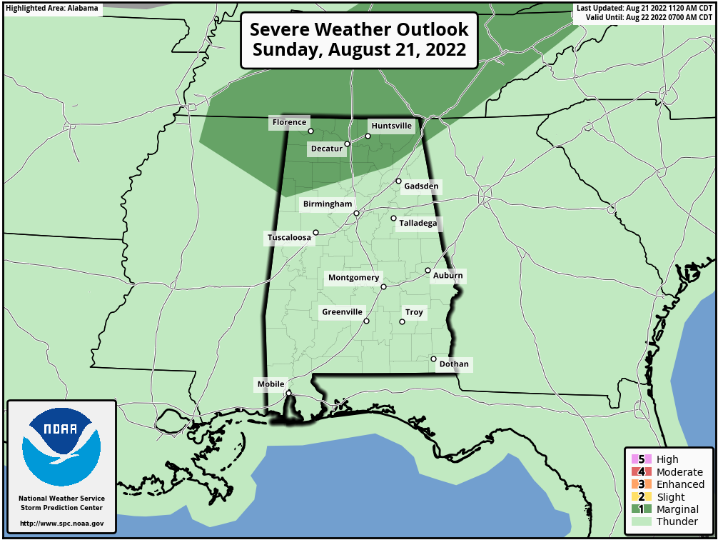
Some additional activity is moving into Northwest Alabama from northeastern Mississippi. The SPC does have the Tennessee Valley Region of North Alabama outlooked in the marginal category (level 1/5). Damaging winds would be the main threat. The main time of concern is from now until around 8 p.m. this evening.
Temperatures are in the upper 70s and lower 80s. Highs will generally be in the lower and middle 80s. Lows tonight will be in the upper 60s to near 70F.
Category: Alabama's Weather, Severe Weather
About the Author (Author Profile)
Bill Murray is the President of The Weather Factory. He is the site's official weather historian and a weekend forecaster. He also anchors the site's severe weather coverage. Bill Murray is the proud holder of National Weather Association Digital Seal #0001 @wxhistorianSubscribe
If you enjoyed this article, subscribe to receive more just like it.


