Midday Nowcast: Wet is the Word this Week
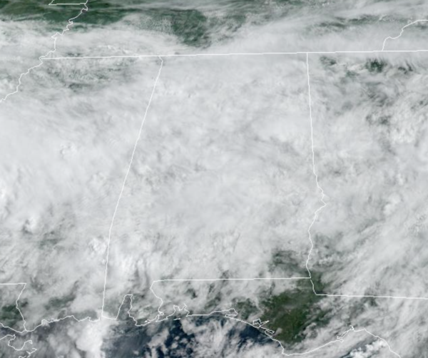
A soggy forecast this week for Alabama as we continue to deal with a stalled surface boundary in place across much of the Deep South. We air going to be seeing more clouds than sun with occasional periods of rain and storms, but no severe storms are expected.
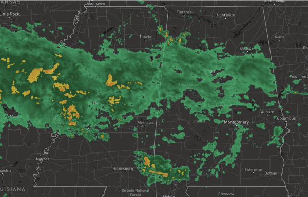
Rain is possible at anytime, and at times we will be seeing numerous showers and thunderstorms, and these are in the forecast each day through Thursday. Average rain amounts between now and Thursday will be in the 2-4 inch range for much of the state, with higher totals possible across some of the western counties, where some areas could exceed 5 inches. Amounts of 1-2 inches are expected over the Tennessee Valley of far North Alabama, and the southeast counties of the state. Again, keep the rain gear close each day this week, at some point you will need it.
SOMEWHAT DRIER: For Friday and the weekend, the pattern begins to change some and the weather begins to trend drier, as an upper high slowly builds. Showers and storms become more scattered in nature, and we should see increasing amounts of sun. Highs will be generally in the upper 80s, still below average for late August. The chance of any one spot getting wet on these three days is in 30-40 percent range, with the most activity during the afternoon and evening hours.
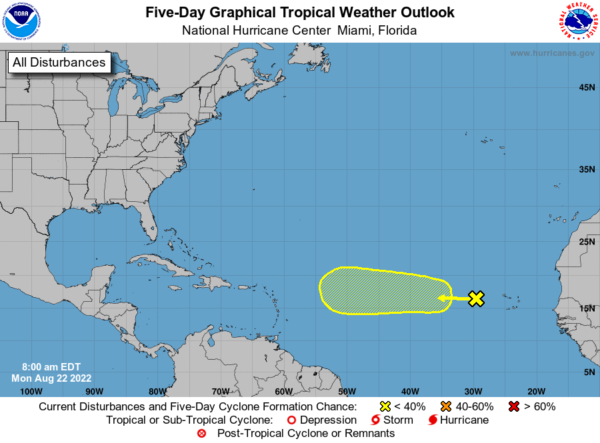
IN THE TROPICS: A tropical wave located a few hundred miles west of the Cabo Verde Islands continues to produce disorganized showers and thunderstorms. Environmental conditions could support some slow development of this system while it moves westward to west-northwestward at around 10 to 15 mph across the tropical Atlantic during the next several days. Formation chance through 5 days…low…20 percent.
FINAL WEEK OF AUGUST: For now we are expecting fairly routine late summer weather next week, with partly sunny days and the chance of a few scattered showers and storms each day, mostly during the afternoon and evening hours. Highs will remain in the upper 80s most days…
BEACH FORECAST CENTER: Get the latest weather and rip current forecasts for the beaches from Fort Morgan to Panama City on our Beach Forecast Center page. There, you can select the forecast of the region that you are interested in visiting.
WORLD TEMPERATURE EXTREMES: Over the last 24 hours, the highest observation outside the U.S. was 123.3F at Jarha, Kuwait. The lowest observation was -96.3F at Vostok, Antarctica.
CONTIGUOUS TEMPERATURE EXTREMES: Over the last 24 hours, the highest observation was 119F at Death Valley, CA. The lowest observation was 31F at Crescent, OR.
Category: Alabama's Weather, ALL POSTS
About the Author (Author Profile)
Macon, Georgia Television Chief Meteorologist, Birmingham native, and long time Contributor on AlabamaWX. Stormchaser. I did not choose Weather, it chose Me. College Football Fanatic. @Ryan_StinnetSubscribe
If you enjoyed this article, subscribe to receive more just like it.


