Midday Nowcast: Quiet at the Midday Hours
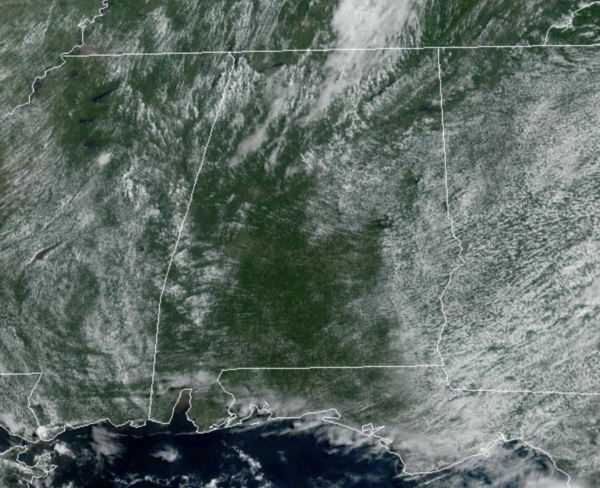
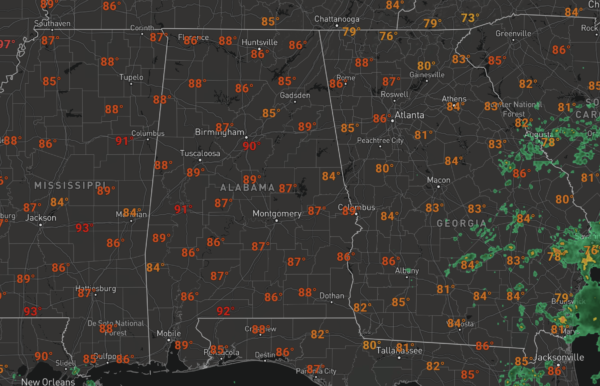
We are seeing plenty of sunshine today, along with hot and humid conditions as highs climb into the low 90s this afternoon. The radar is fairly quiet, but we will see a few widely scattered showers or storms this afternoon, but these will be few and far between.
BOUNDARY TOMORROW: Tomorrow will feature somewhat higher rain chances as a weak surface boundary drops south through the state. Tomorrow afternoon and evening should see rain chances in the 40-50% range, and there could be a few stronger storms, but severe ones are not expected. Highs tomorrow will again be in the lower 90s.
REST OF WEEK: Drier air moves settles in behind the boundary over most to the state, and Wednesday and Thursday will be dry with abundant sunshine. Highs these days will be in the upper 80s to lower 90s. Moisture levels begin to increase Friday and we will bring back the chance for scattered showers and storms during the afternoon and evening hours. Friday’s high will be in the upper 80s.
LABOR DAY WEEKEND: For the long holiday weekend, we are forecasting routine early September weather. Partly sunny days, fair nights, and a few pop-up afternoon and evening showers and storms each day. Of course, no way of knowing in advance exactly when and where they form in advance. The chance of any one spot getting wet daily is 30-40 percent, and most of the showers will come in the noon to midnight window. Afternoon highs Saturday through Monday will be in the mid to upper 80s, very close to seasonal averages.
NEXT WEEK: We will keep a persistence forecast going for the rest of the week with partly sunny days and scattered, mostly afternoon and evening showers and thunderstorms Tuesday through Friday. Highs will remain mostly in the mid to upper 80s.
IN THE TROPICS: Four areas the NHC is monitoring for potential development and we are likely to have Danielle sooner than later.
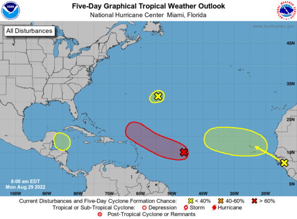
1. A broad area of low pressure over the central tropical Atlantic is producing a large area of disorganized cloudiness and showers. Although environmental conditions are only marginally favorable, some gradual development of this system is expected over the next several days and a tropical depression is likely to form later this week. The disturbance is forecast to move slowly toward the west and then west-northwest at 5 to 10 mph, toward the adjacent waters of the northern Leeward Islands. Formation chance through 5 days…high…80 percent. For now, the models keep this feature north of the islands and away from the Gulf of Mexico.
2. A small low pressure system located about 600 miles east of Bermuda continues to produce limited shower activity. Strong upper-level winds and dry air are expected to limit significant development of this system while it drifts southward and southwestward over the central Atlantic during the next couple of days, and likely dissipate by the end of the week. Formation chance through 5 days…low…10 percent.
3. A tropical wave is forecast to move off the west coast of Africa this evening or early Tuesday. Some gradual development of this system is possible after that time while it moves generally westward to west-northwestward across the far eastern tropical Atlantic. Formation chance through 5 days…low…30 percent.
4. A trough of low pressure could develop over the northwestern Caribbean Sea later this week. Environmental conditions could support some slow development of the system thereafter while it moves generally west-northwestward over the northwestern Caribbean Sea and toward the Yucatan Peninsula of Mexico. Formation chance through 5 days…low…20 percent.
BEACH FORECAST CENTER: Get the latest weather and rip current forecasts for the beaches from Fort Morgan to Panama City on our Beach Forecast Center page. There, you can select the forecast of the region that you are interested in visiting.
WORLD TEMPERATURE EXTREMES: Over the last 24 hours, the highest observation outside the U.S. was 120.4F at Khanaqin, Iraq. The lowest observation was -100.8F at Vostok, Antarctica.
CONTIGUOUS TEMPERATURE EXTREMES: Over the last 24 hours, the highest observation was 117F at Death Valley, CA. The lowest observation was 28F at Peter Sinks, UT.
Category: Alabama's Weather, ALL POSTS
About the Author (Author Profile)
Macon, Georgia Television Chief Meteorologist, Birmingham native, and long time Contributor on AlabamaWX. Stormchaser. I did not choose Weather, it chose Me. College Football Fanatic. @Ryan_StinnetSubscribe
If you enjoyed this article, subscribe to receive more just like it.


