Midday Nowcast: No Signs of Rain Anytime Soon
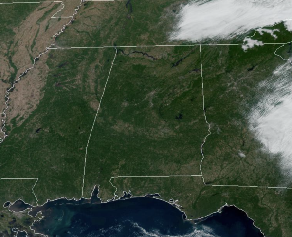
The long dry spell continues across Alabama and much of the Deep South as we see no chance of rain the next 10-14 days for Alabama. Remember, this is not too unusual for October in Alabama as it is a driest month of the year statistically. The forecast this week will feature sunny days and clear nights. Highs will be in the upper 70s to lower 80s, while night will be in the 50s. On Friday, a cold front will pass through the state, but with no moisture to work with, it will come through in dry fashion. However, it will deliver much cooler air for the upcoming weekend.
THE ALABAMA WEEKEND: The cooler air arrives Saturday as the high drops into the low 70s. Sunday morning will be our coolest morning so far this season with lows well down in the 40s… and cooler spots could visit the 30s. Sunday will be sunny and gorgeous with highs staying in the 70s.
IN THE TROPICS: The NHC is monitoring two tropical waves for possible development later this week. If they develop, the next names up are Julia and Karl. Remember that hurricane season runs through November 30th.
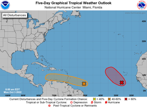
1. An elongated area of low pressure located a few hundred miles south-southwest of the Cabo Verde Islands continues to produce disorganized showers and thunderstorms. Environmental conditions are forecast to be favorable for some gradual development, and a tropical depression is likely to form around the middle part of this week. Further development will become less likely by the end of the week due to increasing upper-level winds. The system is forecast to move westward, then turn northwestward or northward by the end of the week over the eastern tropical Atlantic. Formation chance through 5 days…high…70 percent.
2. Showers and thunderstorms associated with a tropical wave located several hundred miles east of the southern Windward Islands have become slightly better organized since yesterday. Some further development of the wave is possible, and a tropical depression could form within the next few days while it moves generally westward at 15 to 20 mph, reaching the Windward Islands and the eastern Caribbean Sea by midweek. Interests in the Windward Islands should monitor the progress of the system. Formation chance through 5 days…medium…40 percent.
NEXT WEEK: No real change in the pattern with sunny pleasant days and clear cool nights. No promising signs of rain through at least mid-month for Alabama.
BEACH FORECAST CENTER: Get the latest weather and rip current forecasts for the beaches from Fort Morgan to Panama City on our Beach Forecast Center page. There, you can select the forecast of the region that you are interested in visiting.
WORLD TEMPERATURE EXTREMES: Over the last 24 hours, the highest observation outside the U.S. was 110.7F at Nuwasib, Kuwait. The lowest observation was -89.7F at Concordia, Antarctica.
CONTIGUOUS TEMPERATURE EXTREMES: Over the last 24 hours, the highest observation was 106F at Death Valley, CA. The lowest observation was 20F at Roscommon, MI.
Category: Alabama's Weather, ALL POSTS
About the Author (Author Profile)
Macon, Georgia Television Chief Meteorologist, Birmingham native, and long time Contributor on AlabamaWX. Stormchaser. I did not choose Weather, it chose Me. College Football Fanatic. @Ryan_StinnetSubscribe
If you enjoyed this article, subscribe to receive more just like it.


