EXPIRED Severe T-Storm Warning — Parts of Bullock, Macon, Montgomery Co. Until 3:30 pm
The National Weather Service in Birmingham has issued a
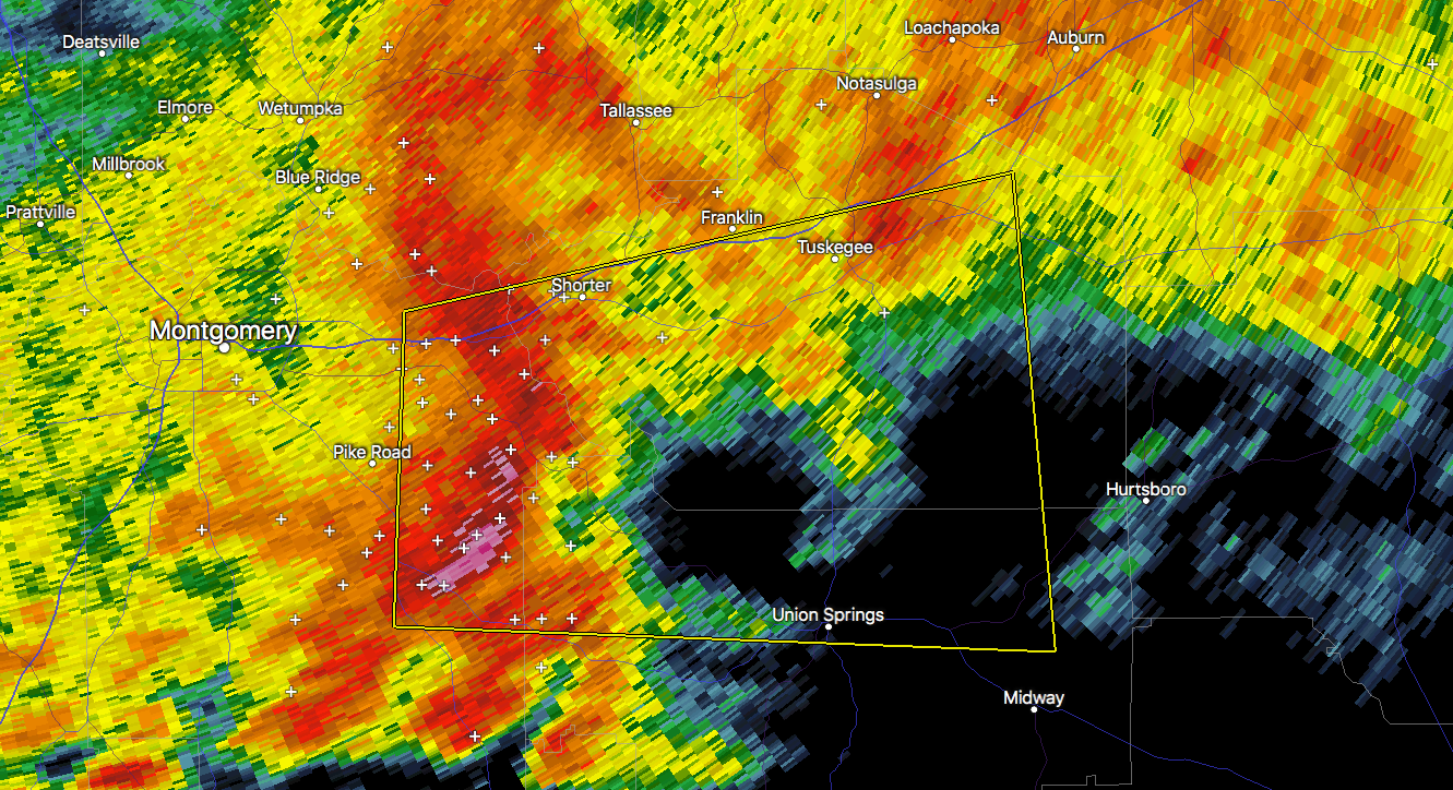
* Severe Thunderstorm Warning for…
Northern Bullock County in southeastern Alabama…
Macon County in southeastern Alabama…
Northeastern Montgomery County in south central Alabama…
* Until 330 PM CDT.
* At 249 PM CDT, a severe thunderstorm was located 7 miles southeast
of Waugh, or 12 miles southwest of Milstead, moving east at 45 mph.
HAZARD…60 mph wind gusts and quarter size hail.
SOURCE…Radar indicated.
IMPACT…Hail damage to vehicles is expected. Expect wind damage
to roofs, siding, and trees.
* Locations impacted include…
Tuskegee, Union Springs, Pike Road, Shorter, Franklin, Franklin
Field, Lake Tuskegee, Tuskegee National Forest, Davisville, Waugh,
Liverpool, Hardaway, Mount Meigs, Tysonville, Victoryland,
Warriorstand, Carters Hill, Fort Davis, Brassell and Three Notch.
PRECAUTIONARY/PREPAREDNESS ACTIONS…
For your protection move to an interior room on the lowest floor of a
building.
Category: Alabama's Weather, ALL POSTS, Severe Weather
About the Author (Author Profile)
Scott Martin is an operational meteorologist, professional graphic artist, musician, husband, and father. Not only is Scott a member of the National Weather Association, but he is also the Central Alabama Chapter of the NWA president. Scott is also the co-founder of Racecast Weather, which provides forecasts for many racing series across the USA. He also supplies forecasts for the BassMaster Elite Series events including the BassMaster Classic.Subscribe
If you enjoyed this article, subscribe to receive more just like it.


