Showers/Storms End Late Tonight; Drier Tomorrow
RADAR CHECK: A large mass of rain with embedded thunderstorms is over Central Alabama this afternoon… it will continue to push into the southeast part of the state over the next few hours. There is a break in the rain for the northern counties, but one more line of showers and storms will roll through tonight ahead of a cold front.
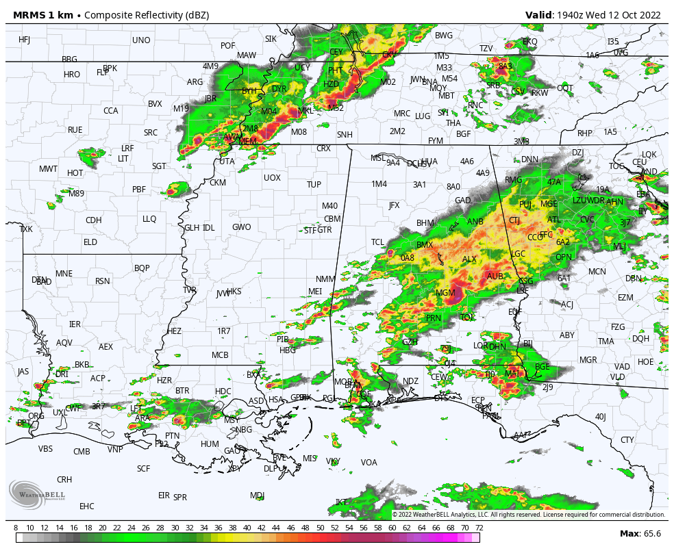
SPC maintains some risk of severe thunderstorms for much of the state through tonight, including a “slight risk” (level 2/5) over some of the west and Northeast counties…
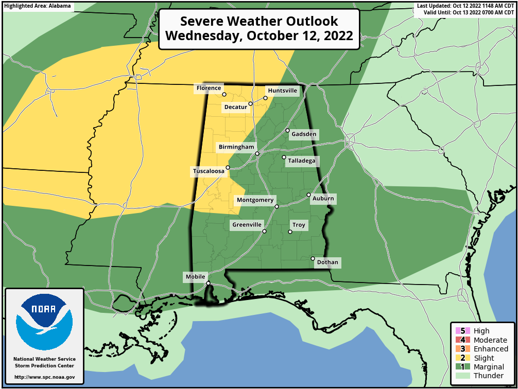
But, the air over most of the state is rain-cooled and stable, and it seems unlikely that the air can recover for any real meaningful chance of severe storms tonight. Still, as always, we will watch radar trends as the line moves through. A few of the storms within the line could produce gusty winds.
Showers and storms will end after midnight as drier air returns to the state. It looks like most communities will wind up between 1 and 2 inches of rain with this event; it is our biggest rain day since September 5, when Birmingham measured 1.55″.
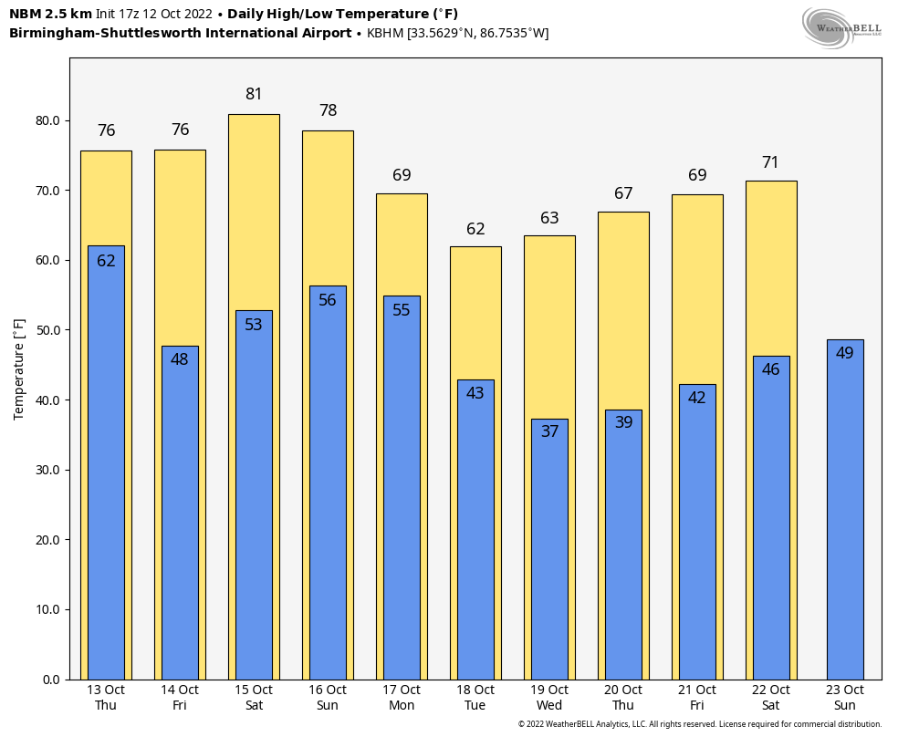
TOMORROW THROUGH THE WEEKEND: Look for sunny days and clear nights tomorrow through Saturday. Friday morning will be very cool with a low between 40 and 45 degrees for most places, but afternoons will be warm. The high tomorrow will be in the mid 70s, followed by low 80s Friday and Saturday. On Sunday we will forecast a mix of sun and clouds with some risk of widely scattered showers as a cold front approaches. Still, a decent part of the day should be dry with a high in the mid 70s.
NEXT WEEK: The cold front will bring occasional showers to the state Monday; the rest of the week looks dry and much cooler. In fact, it should be the coolest air so far this season as highs drop into the 60s. Wednesday morning will feature lows in the 30s with potential for the first widespread frost of the season. Colder spots will likely drop below freezing. See the daily Weather Briefing video for maps, graphics, and more details.
FOOTBALL WEATHER: Another perfect night for high school football games across Alabama Friday night; the sky will be clear with temperatures falling from the mid 70s at kickoff into the 60s by the second half.
Saturday Auburn travels to Oxford to play Ole Miss (11a CT kickoff)… the sky will be partly sunny, and there is an outside risk of a passing shower during the game. Temperatures will rise from near 78 at kickoff into the low 80s by the second half.
Alabama will take on Tennessee in Knoxville (2:30p CT kickoff)… the sky will be partly sunny; about 77 degrees at kickoff, falling to near 70 by the final whistle. There is a small risk of a shower by the end of the game, but the better chance of rain there will come Saturday night.
UAB will host Charlotte at Protective Stadium in downtown Birmingham Saturday (2:30p CT kickoff)… expect a mostly sunny sky; about 82 at kickoff, upper 70s by the fourth quarter.
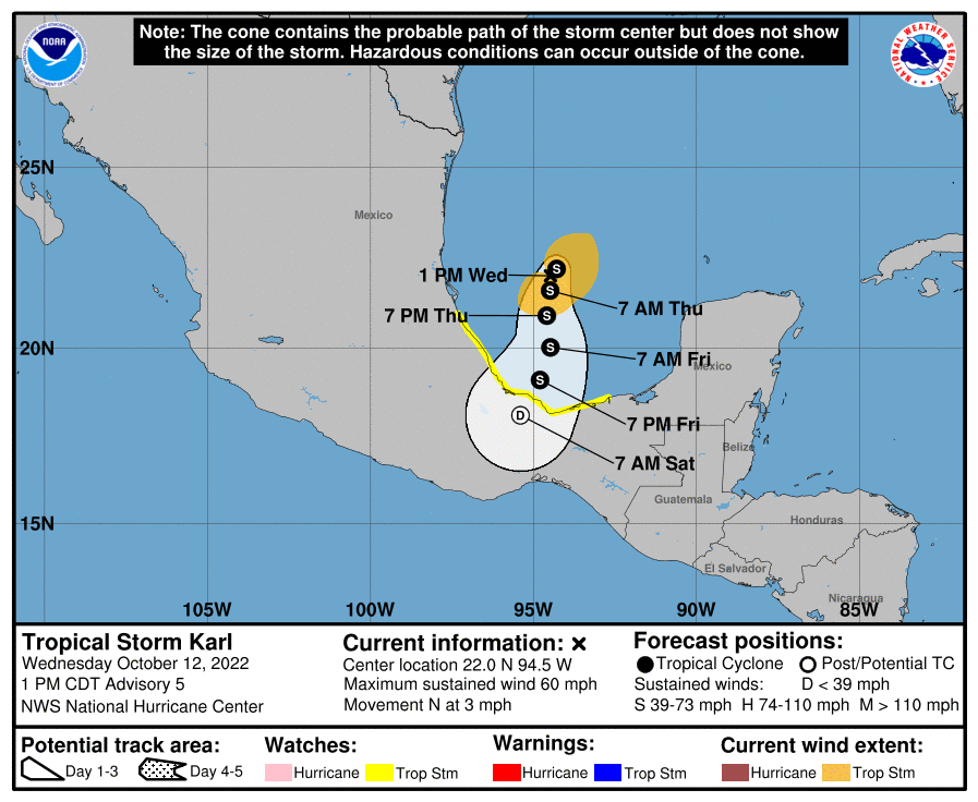
TROPICS: Tropical Storm Karl is in the far Southwest Gulf of Mexico this afternoon with sustained winds of 60 mph; it will move into the coast of Mexico Friday evening far south of Brownsville, Texas. The rest of the Atlantic basin is very quiet, and additional tropical storm formation is not expected through early next week.
ON THIS DATE IN 1962: The Columbus Day Storm of 1962 was a Pacific Northwest windstorm that struck the West Coast of Canada and the Pacific Northwest Coast of the United States. It is considered the benchmark of extratropical wind storms. The storm ranks among the most intense to strike the region since at least 1948, likely since the January 9, 1880 “Great Gale” and snowstorm
ON THIS DATE IN 1979: The lowest barometric pressure ever recorded occurs in the center of Typhoon Tip on this day. A fly reconnaissance mission recorded the low pressure of 870 hPa or 25.69″. Typhoon Tip was the most extensive tropical cyclone on record with a wind diameter of 1380 miles at its peak.
BEACH FORECAST: Click here to see the AlabamaWx Beach Forecast Center page.
Look for the next Weather Xtreme video here by 6:00 a.m. tomorrow…
Category: ALL POSTS
About the Author (Author Profile)
James Spann is one of the most recognized and trusted television meteorologists in the industry. He holds the AMS CCM designation and television seals from the AMS and NWA. He is a past winner of the Broadcast Meteorologist of the Year from both professional organizations.Subscribe
If you enjoyed this article, subscribe to receive more just like it.


