CANCELLED Severe T-Storm Watch Issued for Northwest Corner of Alabama Until 10 pm
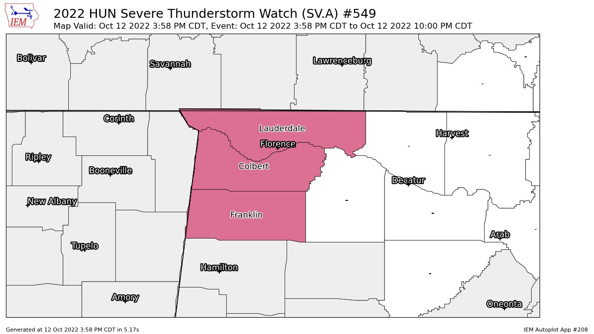
The SPC and NWS Huntsville has issued a Severe Thunderstorm Watch until 10 pm tonight for the following counties in North Alabama: Colbert, Franklin, and Lauderdale.
• A couple tornadoes possible
• Scattered hail up to ping pong size possible
• Scattered wind gusts up to 70 mph possible
The NWS Storm Prediction Center has issued a
* Severe Thunderstorm Watch for portions of
— Northwest Alabama
— Southern Arkansas
— Northern Mississippi
— Western and Middle Tennessee
* Effective this Wednesday afternoon and evening from 355 PM until 1000 PM CDT.
* Primary threats include…
— Scattered damaging wind gusts to 70 mph possible
— Scattered large hail events to 1.5 inches in diameter possible
— A tornado or two possible
SUMMARY… A well-organized line of storms capable of wind damage will continue eastward across Middle Tennessee and northern Mississippi, while additional storms will develop through late afternoon/early evening across southern Arkansas into northern Mississippi. Large hail and damaging winds are the primary risks, but a tornado could also occur.
Category: Alabama's Weather, ALL POSTS, Severe Weather
About the Author (Author Profile)
Scott Martin is an operational meteorologist, professional graphic artist, musician, husband, and father. Not only is Scott a member of the National Weather Association, but he is also the Central Alabama Chapter of the NWA president. Scott is also the co-founder of Racecast Weather, which provides forecasts for many racing series across the USA. He also supplies forecasts for the BassMaster Elite Series events including the BassMaster Classic.Subscribe
If you enjoyed this article, subscribe to receive more just like it.


