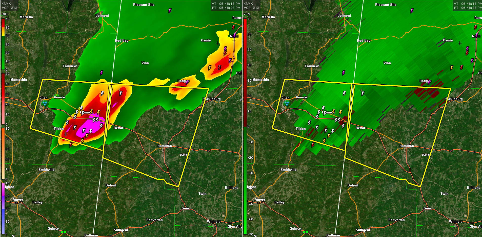
Severe Thunderstorm Warning for Parts of Marion County Until 730 pm
The most dangerous part of the storm will move down I-22 and US-278 through Bexar and toward Hamilton.
Be alert for very heavy rain, strong winds to 60 mph and quarter sized hail.
Lots of lightning as well…
The National Weather Service in Birmingham has issued a
* Severe Thunderstorm Warning for…
Northwestern Marion County in northwestern Alabama…
* Until 730 PM CDT.
* At 646 PM CDT, a severe thunderstorm was located over Tremont, or 8
miles southeast of Fulton, moving east at 30 mph.
HAZARD…60 mph wind gusts and quarter size hail.
SOURCE…Radar indicated.
IMPACT…Hail damage to vehicles is expected. Expect wind damage
to roofs, siding, and trees.
* Locations impacted include…
Hamilton, Weston, Bexar, Pigeye, Marion County Public Lake,
Shottsville, Rankin Fite Airport and Pikeville.
Category: Alabama's Weather, ALL POSTS, Severe Weather
About the Author (Author Profile)
Bill Murray is the President of The Weather Factory. He is the site's official weather historian and a weekend forecaster. He also anchors the site's severe weather coverage. Bill Murray is the proud holder of National Weather Association Digital Seal #0001 @wxhistorianSubscribe
If you enjoyed this article, subscribe to receive more just like it.


