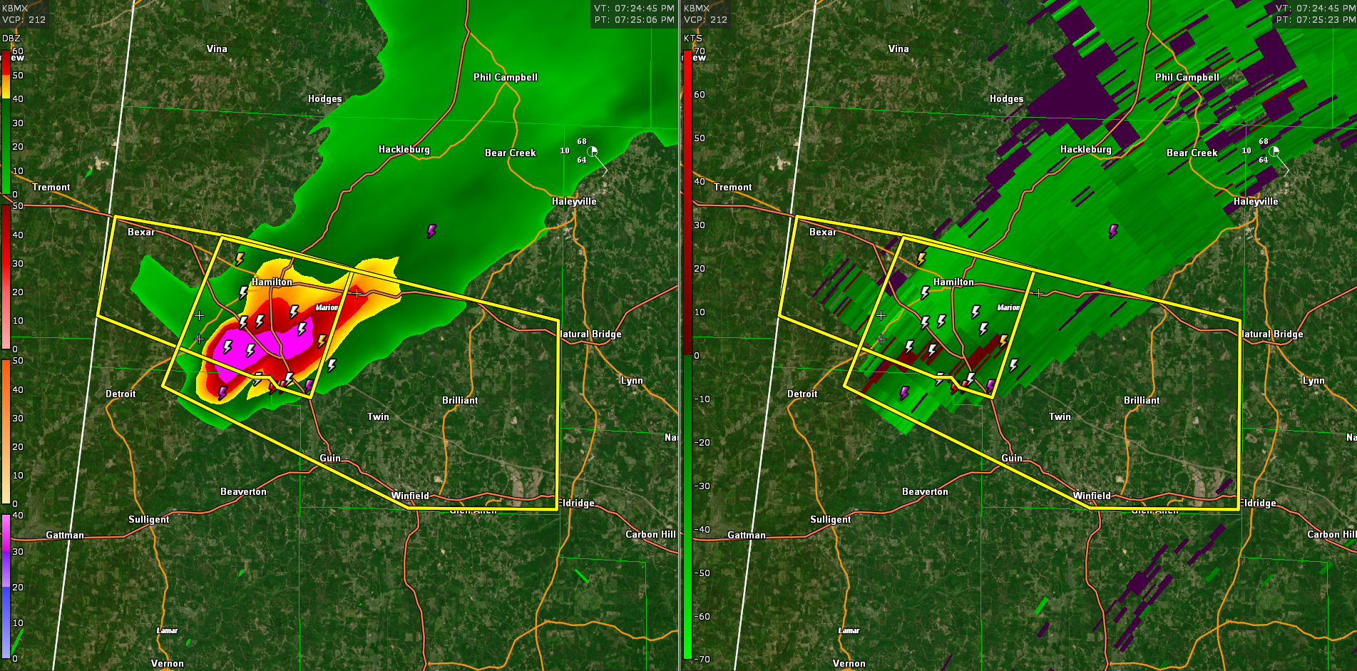
Severe Thunderstorm Warning for Parts of Marion and Lamar Until 815 pm
The storm is south of Hamilton tracking southeastward along I-22.
Hail could reach ping pong ball size.
UPDATE: Ping pong ball sized hail was reported at I-22 and AL-17 south of Hamilton.
The National Weather Service in Birmingham has issued a
* Severe Thunderstorm Warning for…
Southern Marion County in northwestern Alabama…
Northeastern Lamar County in west central Alabama…
* Until 815 PM CDT.
* At 724 PM CDT, a severe thunderstorm was located near Weston, or 7
miles west of Hamilton, moving east at 30 mph.
HAZARD…Ping pong ball size hail and 60 mph wind gusts.
SOURCE…Radar indicated.
IMPACT…People and animals outdoors will be injured. Expect hail
damage to roofs, siding, windows, and vehicles. Expect
wind damage to roofs, siding, and trees.
* Locations impacted include…
Hamilton, Winfield, Guin, Brilliant, Glen Allen, Gu-
Win, Weston, Lake Buttahatchee, Twin, Tucker, Henson Springs,
Pearces Mill, Rankin Fite Airport, Texas, Marion County Public
Lake, Piney Grove and Pikeville.
Category: Alabama's Weather, ALL POSTS, Severe Weather
About the Author (Author Profile)
Bill Murray is the President of The Weather Factory. He is the site's official weather historian and a weekend forecaster. He also anchors the site's severe weather coverage. Bill Murray is the proud holder of National Weather Association Digital Seal #0001 @wxhistorianSubscribe
If you enjoyed this article, subscribe to receive more just like it.


