An Improving Day Outdoors at the Midday Hour
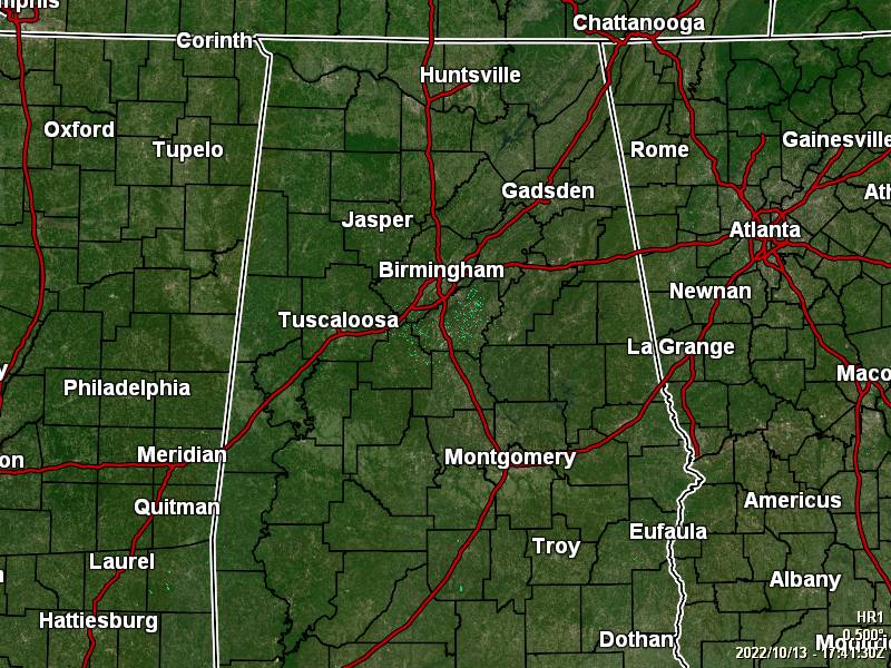
As of 12:44 pm, skies across the area are slowly clearing as all of the rain and thunderstorm activity has moved out of the state. Drier and cooler air has begun filtering in, as temperatures as of the noon roundup were in the upper 60s to the upper 70s for most spots. Troy was the only spot that has hit 80 degrees, while the cool spot was Auburn at 66 degrees. Birmingham was at 72 degrees.
Skies will continue to clear out today and afternoon highs will reach the lower 70s to the lower 80s across the area with a little breeze at times. Skies will be clear by this evening and through the overnight, with lows dipping down into the lower 40s to the lower 50s
Friday will be a bright, sunny, mild, and very comfortable day across Central Alabama with afternoon highs reaching the mid to upper 70s. Just a fantastic fall day to end off the work week and start the Central Alabama weekend.
Saturday will be another perfect day with slightly warmer temperatures will reach the lower to mid 80s. However, Sunday will bring another cool down as a front will work through the area, bringing some clouds and maybe a very small chance of a few showers late into the day and through the night. Highs will be in the mid 70s to the mid 80s.
Any shower activity will come to an end early on Monday with cooler and dry air moving into the area, as highs will only reach the mid 60s to the mid 70s. Dry and cooler weather will stick around on Tuesday and at the end of the forecast period on Wednesday. There will be plenty of sun, with highs in the mid 50s to the mid 60s on Tuesday, and in the upper 50s to the mid 60s on Wednesday. We may even have some scattered frost on Wednesday morning and even a few locations dipping below freezing as lows will be in the upper 20s to the upper 30s.
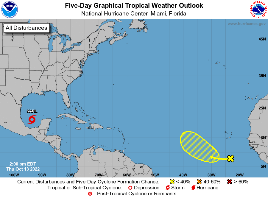
Tropical Storm Carl was located around 215 miles north of Coatzacoalcos, Mexico, and was moving to the south-southeast at 6 mph. Karl is expected to turn southward or south-southwestward over the Bay of Campeche on Friday, and this motion should continue through early Saturday. On the forecast track, the center of Karl should reach the coasts of Tabasco or Veracruz states in Mexico within the warning area late Friday night or early Saturday. Maximum sustained winds are near 45 mph, with higher gusts. Little change in strength is forecast during the next day or so before Karl reaches the Bay of Campeche coast of Mexico.
We also have a large area of disorganized showers and thunderstorms located several hundred miles south of the Cabo Verde Islands is associated with a tropical wave. Environmental conditions appear marginally favorable for some slow development of this system as it moves westward to west-northwestward at 5 to 10 mph over the tropical Atlantic through early next week.
* Formation chance through 48 hours…low…near 0 percent.
* Formation chance through 5 days…low…20 percent.
ON THIS DAY IN WEATHER HISTORY – 1846
A great hurricane tracked across Cuba, Florida, Georgia, the Carolinas, Virginia and Pennsylvania. The hurricane inflicted major damage along its entire path, which was similar to the path of Hurricane Hazel 108 years later. The hurricane caused great damage at Key West, FL, and at Philadelphia, PA. It was the most destructive storm in thirty years.
Category: Alabama's Weather, ALL POSTS, Tropical
About the Author (Author Profile)
Scott Martin is an operational meteorologist, professional graphic artist, musician, husband, and father. Not only is Scott a member of the National Weather Association, but he is also the Central Alabama Chapter of the NWA president. Scott is also the co-founder of Racecast Weather, which provides forecasts for many racing series across the USA. He also supplies forecasts for the BassMaster Elite Series events including the BassMaster Classic.Subscribe
If you enjoyed this article, subscribe to receive more just like it.


