Weather Briefing — A Few Clouds Today, but Remaining Nice & Dry
THIS WEEKEND
Today will be a very nice and seasonal day across Central Alabama, but we will have some clouds move in throughout the day. Skies will be mostly cloudy as we reach the start of the evening, but no rain is in the forecast. Highs in the mid to upper 70s.
Sunshine returns on Sunday, and we’ll end off the weekend with very nice conditions. Highs in the mid to upper 70s.
NEXT WEEK
A closed low will be forming out to our west and will be heading in our direction on Monday, but we’ll continue to stay dry at this point. Highs in the upper 70s to the lower 80s.
The low with an associated cold front will eventually start to move across the area late on Tuesday and into the early morning hours on Wednesday. We’ll see rain and storms start to move in by the early evening hours on Tuesday and progress across much of the area by midnight. At this point, severe weather does not look likely. Highs in the upper 70s to the lower 80s.
The front will have moved through the area by Wednesday afternoon and skies will start to clear out. Any shower activity will have come to an end for Central Alabama during the morning hours. Highs in the upper 60s to the upper 70s.
We’ll be back to the outstanding seasonal weather on Thursday as skies will be sunny and highs in the lower 70s to the lower 80s.
And at the end of the forecast period on Friday… Much of the day will be nice and dry, but a shortwave moving into the area late in the day may bring a small chance of a few showers by late afternoon to early evening. Highs in the mid 70s to the lower 80s.
THE TROPICS
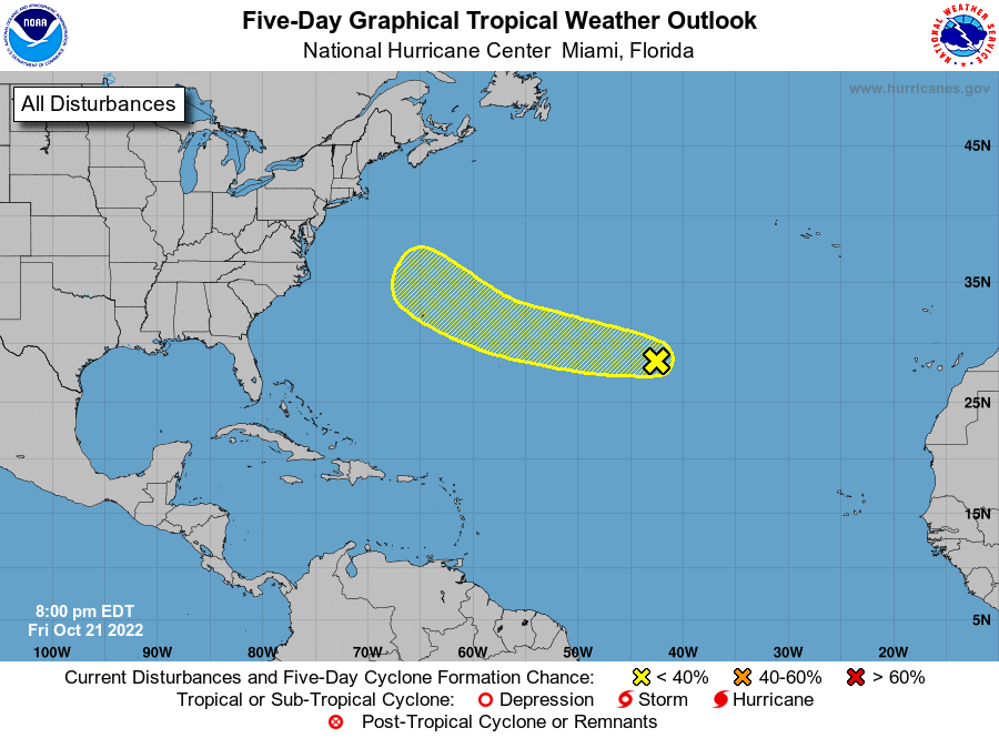
Central Subtropical Atlantic: As of 7 pm CDT Friday night, a small, non-tropical area of low pressure located about 1300 miles east of Bermuda is producing limited shower activity. Although the environmental conditions are forecast to be only marginally conducive for development during the next few days, the low could still acquire some subtropical or tropical characteristics by early next week while it moves westward to west-northwestward at 20 to 25 mph across the subtropical Atlantic. By the middle of next week, further development appears unlikely, as the system is forecast to move over cooler waters and encounter stronger upper-level winds.
* Formation chance through 48 hours…low…10 percent.
* Formation chance through 5 days…low…20 percent.
ON THIS DAY IN WEATHER HISTORY – 1985
A guest on the top floor of a hotel in Seattle, WA was seriously injured while talking on the phone when lightning struck. Several persons are killed each year when the electrical charge from a lightning bolt travels via telephone wiring.
BEACH FORECAST
Get the latest weather and rip current forecasts for the beaches from Dauphin Island, AL, to Panama City Beach, FL, on our Beach Forecast Center page. There, you can select the forecast of the region that you are interested in.
Category: Alabama's Weather, ALL POSTS, Tropical, Weather Xtreme Videos
About the Author (Author Profile)
Scott Martin is an operational meteorologist, professional graphic artist, musician, husband, and father. Not only is Scott a member of the National Weather Association, but he is also the Central Alabama Chapter of the NWA president. Scott is also the co-founder of Racecast Weather, which provides forecasts for many racing series across the USA. He also supplies forecasts for the BassMaster Elite Series events including the BassMaster Classic.Subscribe
If you enjoyed this article, subscribe to receive more just like it.


