Midday Nowcast: Sun Today, Storms Tomorrow
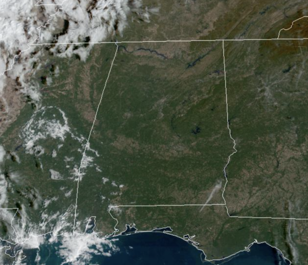
We are seeing plenty of sunshine again today and temperatures are approaching the 80° mark in many locations. It is dry today. To our west, a dynamic storm system is developing and will set the stage for an active day of weather tomorrow across Alabama.
RAIN/STORMS RETURN: Clouds will increase, and winds will pick out out of the south, averaging 10-20 mph by tomorrow afternoon. The SPC has defined a “slight risk” (level 2/5) of severe thunderstorms west of a line from Huntsville to Gadsden to Talladega to Rockford to Prattville to Jackson, and a “marginal risk” (level 1/5) for the rest of the state (the eastern counties).
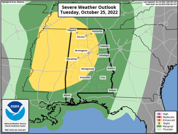
Through the day, a few showers and storms are possible, but the main threat with this system will be a line of strong to severe storms that will swing through the state tomorrow afternoon and evening. For now, the main window for strong to severe thunderstorms is from Noon-9PM and the higher severe weather probabilities are over the western half of the state, but again, all of Alabama is highlighted in a risk.
Stronger storms tomorrow afternoon and evening will be capable of producing large hail and strong winds. A few tornadoes are possible over the western half of the state, in the level 2 risk area, but the strong winds along the line will remain the main threat from this system. Good news, rain amounts of around one inch are likely for West Alabama, with amounts of 1/2 to 1 inch for the eastern counties. We certainly need the rain, and many locations should at least get enough to settle the dust.
It has been a while since we have had a severe weather threat; be sure you can hear severe weather warnings if they are needed. A NOAA Weather Radio is the baseline, and be sure WEA (Wireless Emergency Alerts) are enabled on your phone. Install the free ABC 33/40 weather app.
Review your severe weather plan; know the safe place in your home, which is a small room on the lowest floor. Near the center of the house, away from windows. And, if you live in a mobile home be sure you know the location of the nearest shelter or site built structure that is available, and the quickest way of getting there.
No need to be anxious, these setups are common in Alabama during our tornado season, which runs from November through May (this is a little pre-season action).
COOLER/DRIER: This system is in and out of here quickly tomorrow and dry weather returns to the state Wednesday and Thursday. Expect plenty of sunshine and cooler temperatures with highs Wednesday in the upper 60s, followed by low to mid 70s Thursday.
FRIDAY AND THE WEEKEND: The day Friday will be dry with a high in the 70s…but moisture will return Friday night. A shower can’t be ruled out in spots Friday night, but occasional showers are much more likely over the weekend. The weekend won’t be a total “wash-out”, but some rain from time to time is likely. There will be very little instability available, so there is no risk of severe storms, and we expect little thunder. Highs over the weekend will be in the 65-70 degree range for most communities. Again, we need the rain, so we will take it, whenever we can get it.
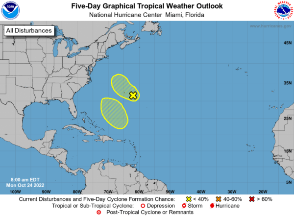
TROPICS: NHC is monitoring a couple of waves in the Atlantic, well east of the U.S. For now they have only a low chance of development… the Gulf of Mexico remains quiet. Hurricane season ends November 30. The next two names up are Lisa and Martin.
BEACH FORECAST CENTER: Get the latest weather and rip current forecasts for the beaches from Fort Morgan to Panama City on our Beach Forecast Center page. There, you can select the forecast of the region that you are interested in visiting.
WORLD TEMPERATURE EXTREMES: Over the last 24 hours, the highest observation outside the U.S. was 110.5F at Wyndham Aero, Australia. The lowest observation was -79.8F at Concordia, Antarctica.
CONTIGUOUS TEMPERATURE EXTREMES: Over the last 24 hours, the highest observation was 94F at Rio Grande Village and Zapata, TX. The lowest observation was 8F at Vernal, UT.
Category: Alabama's Weather, ALL POSTS
About the Author (Author Profile)
Macon, Georgia Television Chief Meteorologist, Birmingham native, and long time Contributor on AlabamaWX. Stormchaser. I did not choose Weather, it chose Me. College Football Fanatic. @Ryan_StinnetSubscribe
If you enjoyed this article, subscribe to receive more just like it.


