Strong Storms Over West Alabama…Fayette County Storm Bears Watching
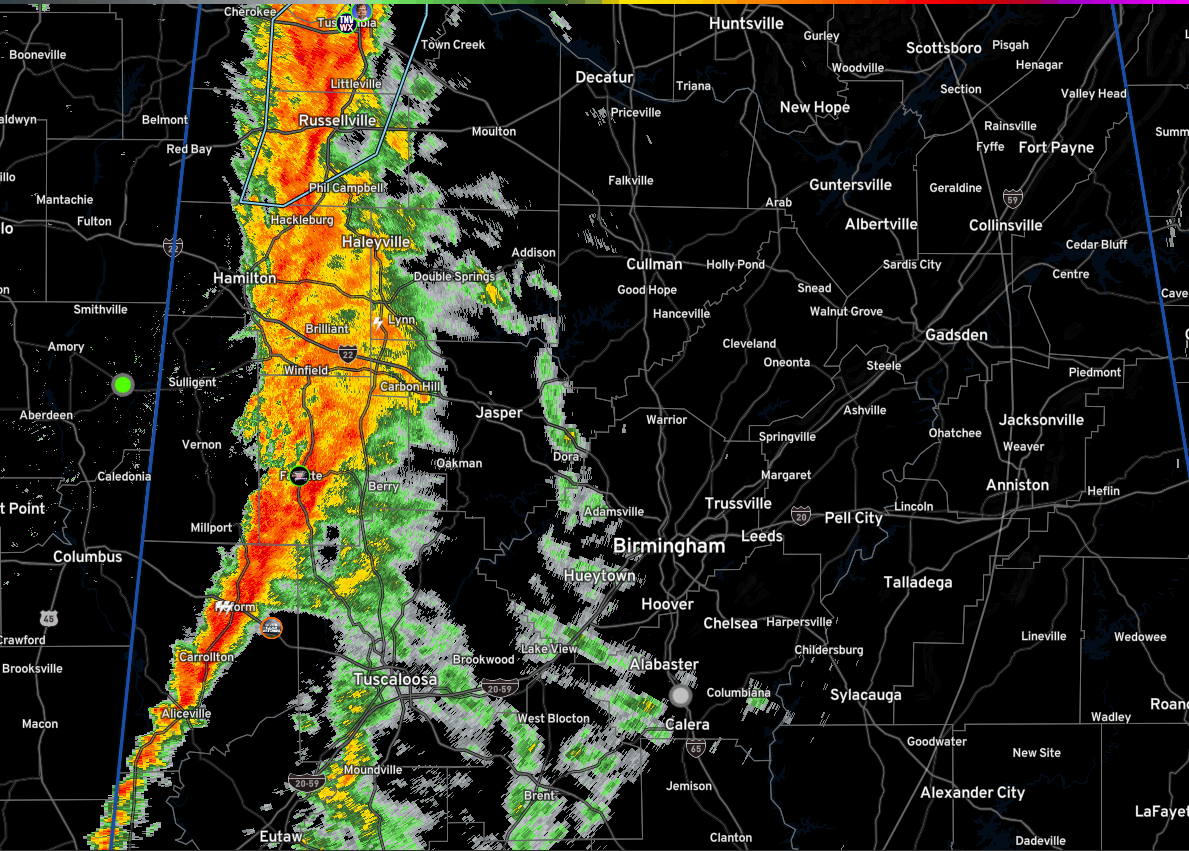
A line of strong storms covers much of western Alabama this afternoon from Lauderdale and Colbert Counties, down through Franklin, Marion, western Fayette, and into Pickens county.
In Northwest Alabama, the strongest storms are approaching the Quad Cities area. They are not severe but do pose an increasing damaging wind threat.
Further south, the storms from western Fayette into Pickens Counties pose the greatest concern. Some sort of vort max feature may be forming between Vernon and Fayette along the Lamar/Fayette county line. The low-level shear is fairly high in this area and the instability is slowly increasing. It will be an area to watch as it moves across Fayette, northern Tuscaloosa, and into Walker and eventually Winston and Cullman Counties as it could be a setup to produce a tornado or two. Nothing imminent now, but will bear watching. We do note that lightning is slowly increasing which is of course, a sign of intensification.
The timing on the line of storms looks like this:
…Northport and Carbon Hill 3:45 pm
…Tuscaloosa 3:55 pm
…Jasper 4:10 pm
…Hueytown 4:40 pm
…Birmingham 5:10 pm
…Hoover 5:15 pm
…Cullman 5:40 pm
A tornado watch remains in effect until 7 p.m. for much of North and Central Alabama.
Category: Alabama's Weather, ALL POSTS, Severe Weather
About the Author (Author Profile)
Bill Murray is the President of The Weather Factory. He is the site's official weather historian and a weekend forecaster. He also anchors the site's severe weather coverage. Bill Murray is the proud holder of National Weather Association Digital Seal #0001 @wxhistorianSubscribe
If you enjoyed this article, subscribe to receive more just like it.


