Showers Today & Tomorrow; A Strong Storm Possible in the Southwestern Parts of Central Alabama
SATURDAY’S WEATHER
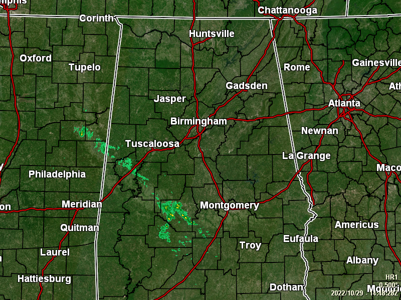
As of 9:54 am, we have a few showers already moving across the southwestern portions of the area, mainly from southern Pickens County down through the southwestern parts of Lowndes County. The rest of Central Alabama is dry, with partly to mostly cloudy skies. A few locations are seeing some good breaks to let a decent amount of sunshine in. Temperatures as of the 9 am roundup were in the mid 50s to the lower 60s. Troy and Tuscaloosa were the warm spots at 63º. The cool spots were Alexander City and Auburn at 56º. Birmingham was sitting at 58º.
We’ll continue to have mostly cloudy skies across the area, with rain chances starting to increase from the west and southwest. Showers will eventually move into the central portions of the area by sunset and eventually over the eastern parts by the overnight hours. Highs will top out in the 70s across the area, with overnight lows in the mid 50s to the lower 60s.
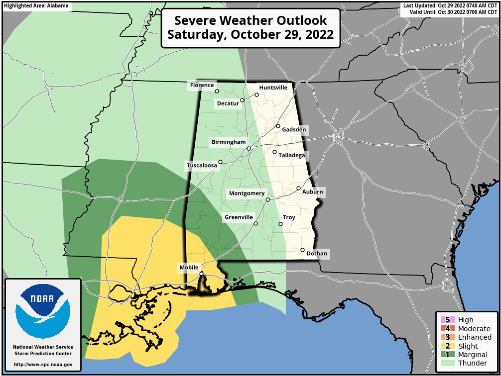
A level one Marginal Risk is up for the extreme southwestern parts of Central Alabama (southern half of Sumter County and the southwestern half of Marengo County) as there is the potential for a stronger to severe storm with gusty winds. For the rest of Central Alabama, the atmosphere will be stable enough that severe weather will not be likely, and thunder will be few and far between.
SUNDAY’S WEATHER
Showers look to be widespread across the area tomorrow, and when it is not raining, skies will be mainly cloudy. At this point, thunder may only be heard in a few locations in the southeastern parts of the area. Strong to severe storms are not expected throughout the day. Afternoon highs will be in the upper 60s to the upper 70s.
THE TROPICS
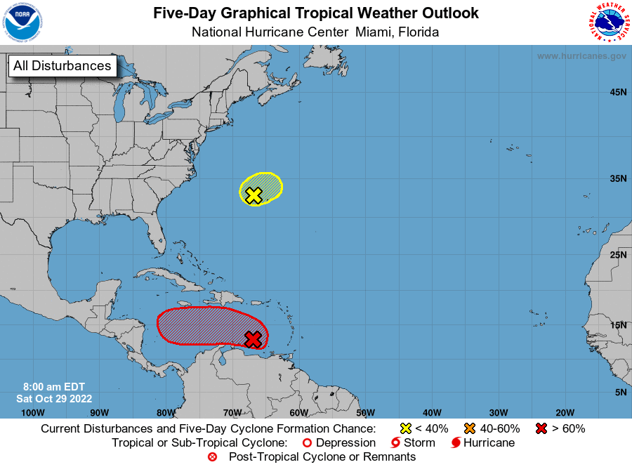
Eastern Caribbean: A broad area of low pressure over the eastern Caribbean Sea is producing a large area of disorganized showers and thunderstorms. Environmental conditions are forecast to be conducive for gradual development over the next few days, and a tropical depression is likely to form by early next week while the disturbance moves slowly westward or west-northwestward over the central Caribbean Sea. Regardless of development, locally heavy rainfall is possible over portions of the Lesser Antilles, the Virgin Islands, and Puerto Rico through this weekend.
* Formation chance through 48 hours… medium… 50 percent.
* Formation chance through 5 days… high… 70 percent.
Western Atlantic: A low pressure area located about 150 miles west-northwest of Bermuda is producing some shower and thunderstorm activity to the north of the center as it begins to interact with a nearby frontal system. Upper-level winds are forecast to increase over the system later today and tonight, and further development is not anticipated after that time.
* Formation chance through 48 hours… low… 20 percent.
* Formation chance through 5 days… low… 20 percent.
Category: Alabama's Weather, ALL POSTS, Severe Weather, Tropical
About the Author (Author Profile)
Scott Martin is an operational meteorologist, professional graphic artist, musician, husband, and father. Not only is Scott a member of the National Weather Association, but he is also the Central Alabama Chapter of the NWA president. Scott is also the co-founder of Racecast Weather, which provides forecasts for many racing series across the USA. He also supplies forecasts for the BassMaster Elite Series events including the BassMaster Classic.Subscribe
If you enjoyed this article, subscribe to receive more just like it.


