Tornado on the Ground Approaching Foley in Baldwin County
It has been a rough afternoon and evening in coastal Mississippi and Alabama.
There have been several reports of waterspouts, funnel clouds, and tornadoes from Mobile and Baldwin Counties.
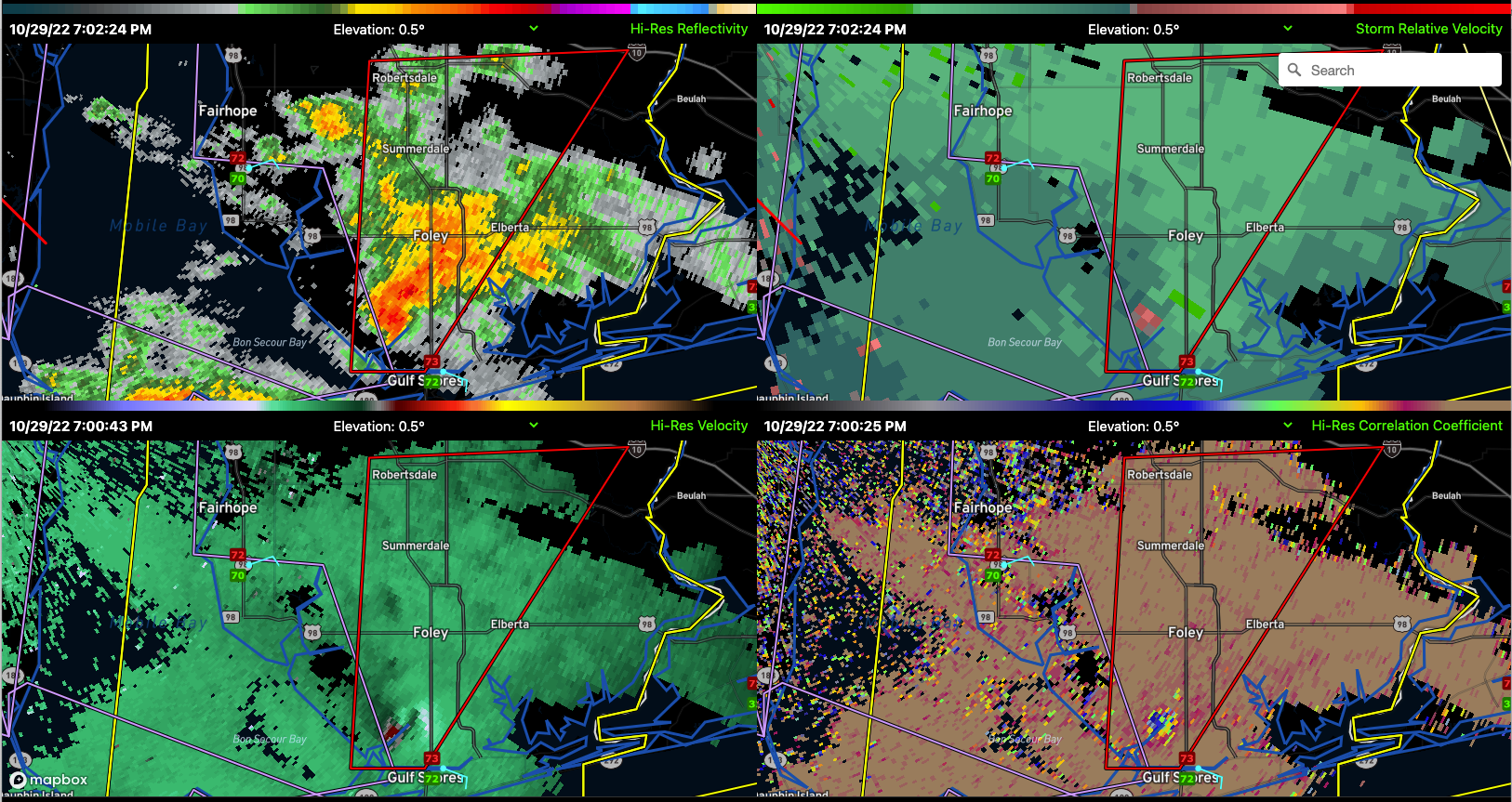
Currently, a confirmed tornado with debris is just west of highway 59 south-southwest of Foley. The circulation came onshore just west of Gulf Shore and is moving north northeast, appearing to stay west of AL-59 as it moves northward, but the tornado warning includes areas as far north as Ronertsdale and as far east as Elberta.
Damage has been reported in Bon Secour from this tornado.
The NWS in Mobile had to take shelter because of another tornado that passed near the Mobile Regional Airport, where the NWS and the Mobile radar are located. They are back in control after having passed their warning responsibilities to the NWS in Tallahassee. A tornado warning continues from Central Mobile County until 745 pm.
The activity is occurring near and south of a warm front that is over Southwest Alabama. In that warm sector, there is a slight risk (2/5) of severe weather including high winds and tornadoes this evening. A tornado watch is in effect for four counties in southeastern Mississippi until 9 p.m. and for several counties in Southwest Alabama until 10 pm.
Category: Alabama's Weather, Severe Weather
About the Author (Author Profile)
Bill Murray is the President of The Weather Factory. He is the site's official weather historian and a weekend forecaster. He also anchors the site's severe weather coverage. Bill Murray is the proud holder of National Weather Association Digital Seal #0001 @wxhistorianSubscribe
If you enjoyed this article, subscribe to receive more just like it.


