

Rain Covers Much of Western Alabama…Storms Have Calmed and Pose No Threat Overnight
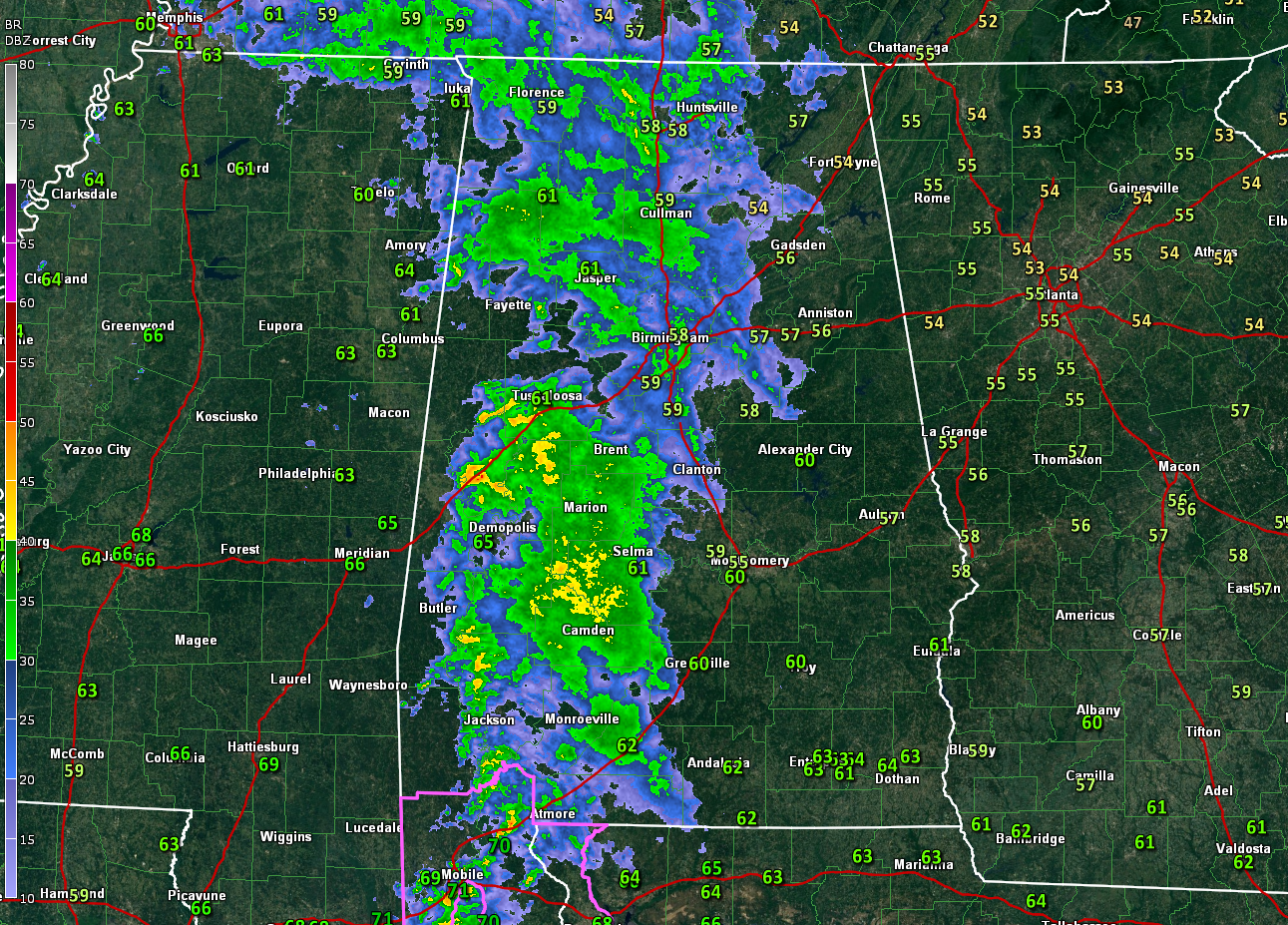
A tornado watch remains in effect for Mobile and Baldwin Counties in South Alabama until midnight along with Escambia County in Northwest Florida. Storms continue to be quite strong tonight in the Mobile Bay area, with lots of very heavy rain and gusty winds. But the severe weather that occurred earlier this evening has simmered down a bit.
Any severe weather over the next few hours will be limited to the tornado watch area.
To the north of the warm front, a large area of rain covers a large part of Alabama to the west of I-65 tonight. This precipitation will continue to push east and northeast overnight, weakening with time.
By morning, scattered showers and some limited lightning and thunder will be occurring across parts of Alabama. The back edge of the rainfall will be pushing northeastward during the early afternoon. The storms could make a bit of a comeback in the afternoon over southeastern sections but are not expected to be severe. Highs will be in the upper 60s with any lucky spots that see sunshine perhaps reaching the lower 70s. Lows tonight will be in the middle 50s.
Skies will remain mostly cloudy into Monday as a large upper low lurks to our northwest and plenty of low-level moisture remains over Alabama. There will be a few peeks of sunshine by afternoon and skies should be partly cloudy for trick-or-treat time. Highs will be in the upper 60s to lower 70s.
The rest of the week will be warm and beautiful, with just a small chance of a couple of showers early Wednesday. Highs all week will be in the 70s with lows in the 50s. Next weekend looks fabulous.
We are tracking a disturbance over the Central Caribbean that the NHC thinks has a good chance of becoming a tropical depression over the next few days. It will move into CZentral America if it is able to develop. A second tropical cyclone could form by next week over the southwestern Caribbean. It could move northeast over Cuba and the Bahamas, as could get steered back into the U.S. East COast or the Canadian Maritimes in the 2nd week of the forecast. We will be watching.
Category: Alabama's Weather, ALL POSTS, Severe Weather, Tropical
About the Author (Author Profile)
Bill Murray is the President of The Weather Factory. He is the site's official weather historian and a weekend forecaster. He also anchors the site's severe weather coverage. Bill Murray is the proud holder of National Weather Association Digital Seal #0001 @wxhistorianSubscribe
If you enjoyed this article, subscribe to receive more just like it.


