Midday Nowcast: Rain Ending, More Rain Late Tomorrow
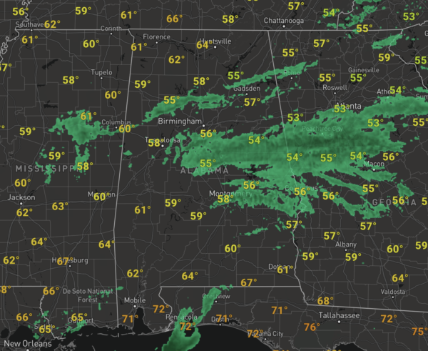
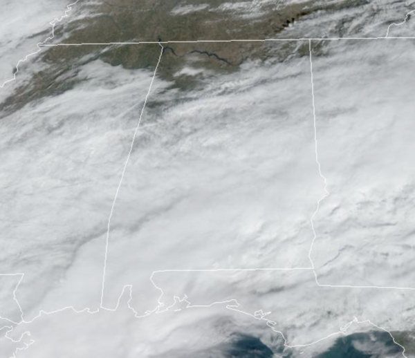
Over the next few hours, the rain will end across the area, and we could see some areas of sunshine this afternoon. Actually, there is some sunshine over North Alabama at the writing of this forecast.
It remains mild with upper 60s and lower 70s across the state. Tonight, will be partly cloudy with lows in the upper 40s and lower 50s.
FRIDAY NIGHT LIGHTS: The weather will be dry for the high school football games across Alabama tonight. The sky will be mostly cloudy with temperatures generally in the 50s.
WEEKEND WEATHER: A potent storm system lifting north to our west will bring more rain and some storms to Alabama tomorrow. The day will start off dry and will be very mild with highs close to 70°. Some scattered showers could move into West Alabama during the afternoon, but rain will become more widespread tomorrow night across the state.
The SPC maintains a “marginal risk” (level 1 of 5) of severe thunderstorms for the southwest corner of Alabama for Saturday night, areas around Mobile, Gulf Shores, Evergreen, and Grove Hill.
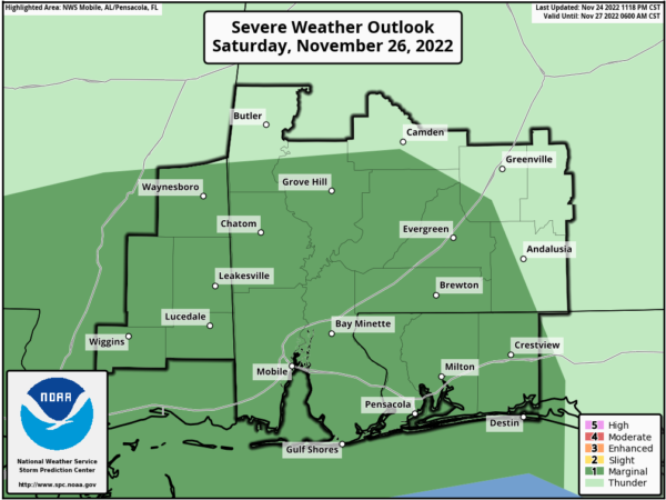
A few storms there could produce strong gusty winds, and there is a conditional threat for a tornado or two as well, but for the rest of the state no severe storms are expected and likely not much thunder. Rainfall amounts around one inch are possible tomorrow night. The sky becomes partly sunny Sunday afternoon as dry air returns; the high Sunday will be in the 60s.
IRON BOWL: To be safe, take the rain gear tomorrow if you are heading to the biggest game of the year in the state of Alabama (Auburn at Alabama, 2:30p CT kickoff)…It will be a mild day with temperatures near 70° at kickoff. A passing shower or two can’t be ruled out, but the widespread rain won’t arrive in Tuscaloosa until after the final whistle. We should note that tomorrow morning will be dry for the tailgaters.
NEXT WEEK: Dry weather is the story Monday and Tuesday with highs in the upper 60s and low 70s. Then, a dynamic system will push rain and storms into the state Wednesday. Some strong to severe storms are possible, and the SPC has already defined a risk of severe storms across Mississippi for Wednesday, but it is too early to define the threat or timing of what could happen, but just note, Wednesday looks stormy for Alabama. ry and cooler air arrives Thursday and Friday with highs in the 50s.
IN THE TROPICS: All is quiet in the Atlantic basin and no development is expected through the weekend. The season comes to an end at the end in five days.
BEACH FORECAST CENTER: Get the latest weather and rip current forecasts for the beaches from Fort Morgan to Panama City on our Beach Forecast Center page. There, you can select the forecast of the region that you are interested in visiting.
WORLD TEMPERATURE EXTREMES: Over the last 24 hours, the highest observation outside the U.S. was 107.6F at La Rioja, Argentina. The lowest observation was -57.6F at Dome A, Antarctica.
CONTIGUOUS TEMPERATURE EXTREMES: Over the last 24 hours, the highest observation was 90F at Big Cypress Reservation, FL. The lowest observation was -11F at Peter Sinks, UT.
Category: Alabama's Weather, ALL POSTS
About the Author (Author Profile)
Macon, Georgia Television Chief Meteorologist, Birmingham native, and long time Contributor on AlabamaWX. Stormchaser. I did not choose Weather, it chose Me. College Football Fanatic. @Ryan_StinnetSubscribe
If you enjoyed this article, subscribe to receive more just like it.


