A Brunch-Time Look at Alabama’s Weather
The surface low responsible for the weather we experienced yesterday and are having today is near Cleveland.
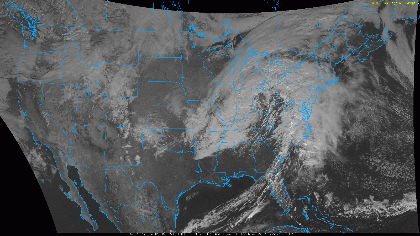
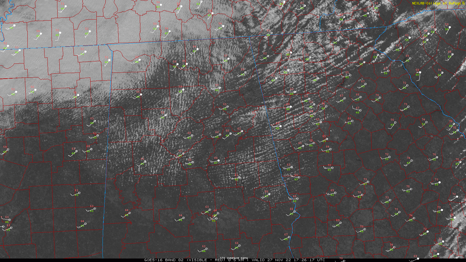
Clouds are thick across the Great Lakes and southward in the colder temps aloft where thick stratus and stratocumulus decks are common. The SC thins out the further south you go. I would expect with more daytime heating, the clouds will thicken as far south as I-20. I guess there could be a sprinkle under all those thicker stratocumulus clouds this afternoon and even tonight. But the precipitation won’t amount to much. Fog will likely form tonight as winds die down across the areas that manage to stay mostly clear.
Boy, that cold front really sliced through the state overnight, but the good news is that the airmass behind it is not exceptionally cold. The front lies along a line from Clemson SC to Claxton GA to Carrabelle FL. The nearest rain to Birmingham is now along a line from Savannah to Waycross.
Dewpoints are still in the 60s and even 70s across the Florida Peninsula, southeast Georgia, much of South Carolina, and North Carolina. Behind the front they are in the 40s across Alabama.
Temperatures are in the 50s across the Tennessee Valley, with 60s over the rest of the state. That’s about how the highs will shake out. Winds remain brisk, now out of the southwest. They will become more northwesterly tonight as the secondary front pushes through the state.
There is a marginal risk of severe weather today across parts of southeastern Virginia and eastern North Carolina. There is a small area outlooked for a marginal risk across parts of West Virginia, Pennsylvania, extreme southeastern Ohio, and the western Maryland Panhandle.
Lows tonight will be in the 40s areawide except for the extreme North, where 30s will be registered in a few spots.
Highs tomorrow will be in the 60s for the most part, except over Northwest Alabama, where readings may hang in the 50s with thicker clouds.
Tuesday will see a surface low moving through the Midwest that will bring rain and storms to Alabama Tuesday night into Wednesday. To the west of Alabama, an outbreak of severe weather is likely across the Mississippi River Valley. Here is the SPC Day 3 Outlook showing a large area of Enhanced Risk (3/5):
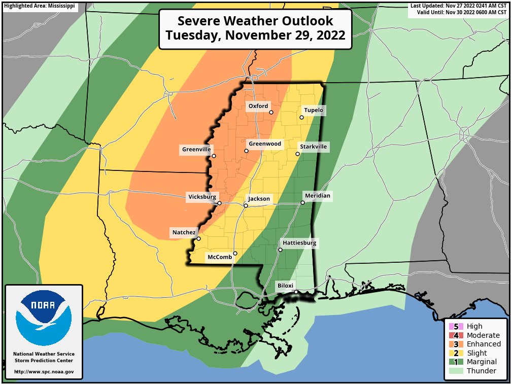
The storms should weaken over Alabama early Wednesday as they run out of fuel in the form of instability. We may have strong storms, but no major severe weather in Alabama. But as we always say in Alabama, when it comes to severe weather, expect the unexpected.
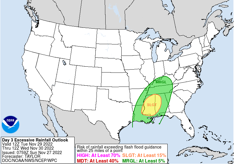
They will not run out of moisture though, and the Weather Prediction Center has western Alabama outlooked for a slight risk of excessive rainfall. This product works similarly to the SPC Outlooks. Widespread 1.5-2 inch amounts are expected across North and Central Alabama with a zone of 2-2.5 inch amounts likely as well. Flooding could be an issue.
Category: Alabama's Weather, ALL POSTS
About the Author (Author Profile)
Bill Murray is the President of The Weather Factory. He is the site's official weather historian and a weekend forecaster. He also anchors the site's severe weather coverage. Bill Murray is the proud holder of National Weather Association Digital Seal #0001 @wxhistorianSubscribe
If you enjoyed this article, subscribe to receive more just like it.


