Northern Mississippi Storms Pose a Hail Threat as They Move Into Tennessee Valley of North Alabama
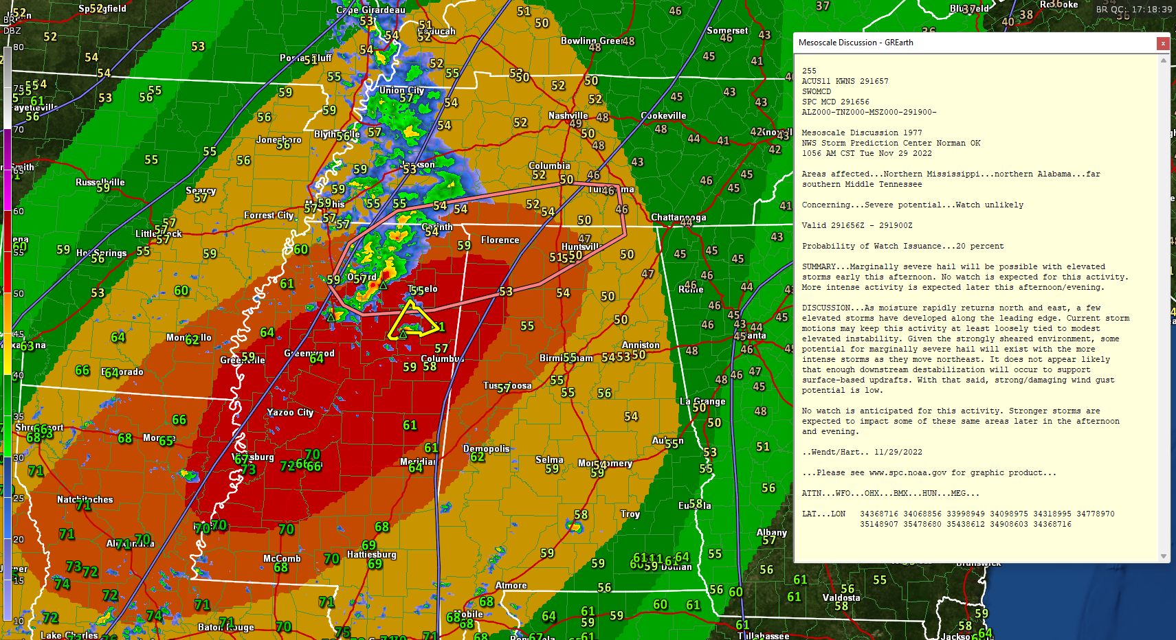
Moisture is surging back into Mississippi, Alabama, and western Tennessee. Non-surface-based storms have formed in that area where warmth and moisture is being advected, or transported northeastward.
Storms extend from near Selmer in southern Tennesseesouthward to near Walnut, MS along US-72 to southwest of New Albany, back to north of Grenada.
Torrential rains are occurring with many of the storms, and there is likely hail to near severe limits southwest of New Albany.

There is an isolated discrete storm in from of the main group of storms. It is south of Tupelo, southwest of Okolona. It will move northeastward toward Amory, Smithville, Tremont, and Fulton. A severe thunderstorm warning is in effect for parts of Chickasaw, Monroe, and Pontotoc counties in Mississippi.
Hail is the most likely threat from these storms as they are not rooted near the surface, but in the warmer, more unstable air aloft.
Category: Alabama's Weather, ALL POSTS, Severe Weather
About the Author (Author Profile)
Bill Murray is the President of The Weather Factory. He is the site's official weather historian and a weekend forecaster. He also anchors the site's severe weather coverage. Bill Murray is the proud holder of National Weather Association Digital Seal #0001 @wxhistorianSubscribe
If you enjoyed this article, subscribe to receive more just like it.


