Midday Nowcast: More Clouds, a Few Showers
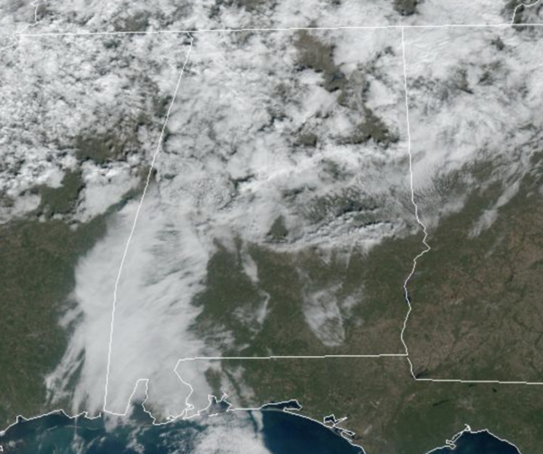
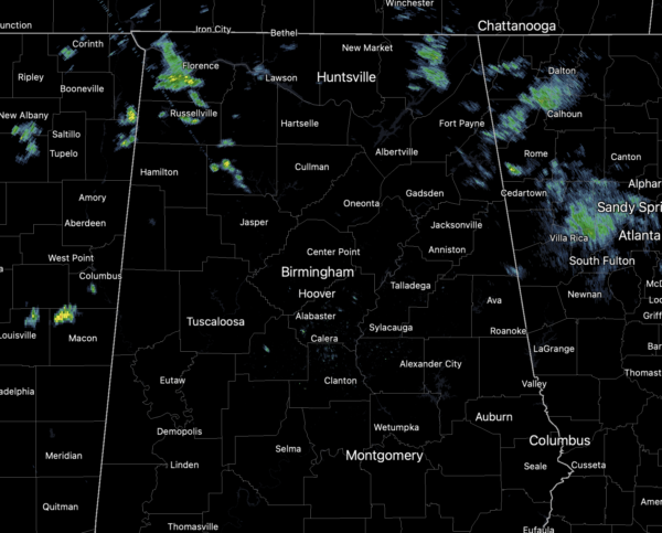
More clouds than sun today, and we have seen a few spotty showers across the northern portions of the state through the morning hours. These will continue through the afternoon hours, however, most locations will remain dry today.
It is a warmer day with temperatures climbing into the low and mid 60s this afternoon. Clouds will continue to increase tonight with increasing showers and lows in the mid 50s.
WEEKEND WEATHER: A surface front will be drifting down through state tomorrow, keeping our weather cloudy with occasional showers at times. It will not be raining all day, but showers are possible at anytime. No severe weather with this feature, and likely very little thunder. Highs tomorrow will be in the 60s. Sunday, the front will be closer to the coast, and that is where the better rain chances will be, with only isolated showers possible for the northern half of the state. Highs Sunday will be in the 50s. Weekend rainfall totals will be less than one-half inch.
NEXT WEEK: The surface front lifts north on Monday, and much of next week will feature more clouds than sun and mild temperatures. Highs much of the week will be in the 60s and 70s, and each day will the risk of showers. No signs of severe storms next week. Temperatures will trend colder by the following weekend (December 10-11), but still no sign of any bitterly cold Arctic air for the next 7-10 days across the Deep South.
BEACH FORECAST CENTER: Get the latest weather and rip current forecasts for the beaches from Fort Morgan to Panama City on our Beach Forecast Center page. There, you can select the forecast of the region that you are interested in visiting.
WORLD TEMPERATURE EXTREMES: Over the last 24 hours, the highest observation outside the U.S. was 112.8F at Ondangwa, Namibia. The lowest observation was -55.8F at Ojmjakon, Russia.
CONTIGUOUS TEMPERATURE EXTREMES: Over the last 24 hours, the highest observation was 85F at Marathon, FL. The lowest observation was -23F at Browning, MT.
WEATHER ON THIS DATE IN 1925: A late season hurricane caused extensive damage across the Florida peninsula, then moved off the Georgia coast crossing Cape Hatteras as a tropical storm. The storm produced whole gales along the Middle Atlantic and Southern New England coast. Winds gusted to 60 mph at Block Island, RI, and reached 64 mph at Atlantic City, NJ.
Category: Alabama's Weather, ALL POSTS
About the Author (Author Profile)
Macon, Georgia Television Chief Meteorologist, Birmingham native, and long time Contributor on AlabamaWX. Stormchaser. I did not choose Weather, it chose Me. College Football Fanatic. @Ryan_StinnetSubscribe
If you enjoyed this article, subscribe to receive more just like it.


