Sunday Afternoon Update: A Few Showers This Afternoon and Tonight, Rain on Monday with Some Thunder, Flooding Threat North

The sky across North and Central Alabama has been a mixed bag on this Sunday morning and early afternoon. Low clouds and fog were slow to burn off across eastern and southern portions of the state where the drier air had a harder time filtering in behind the cold front. It was as thick a pea soup across lots of the area last night and early this morning.
Where sunshine did manage to establish itself, higher clouds from our next disturbance are already beginning to cover the sky.
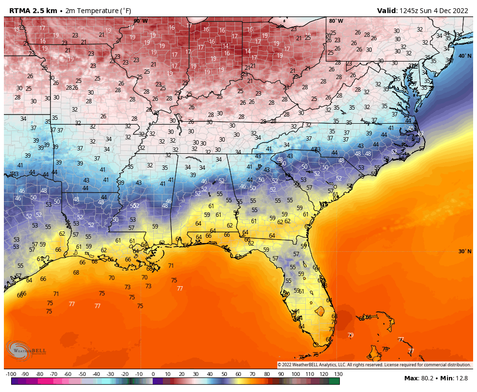
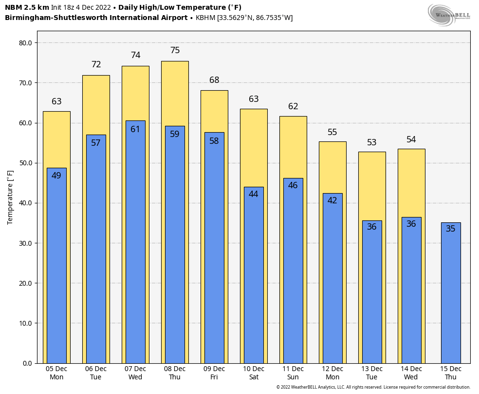
Here is where temperatures started out this morning:
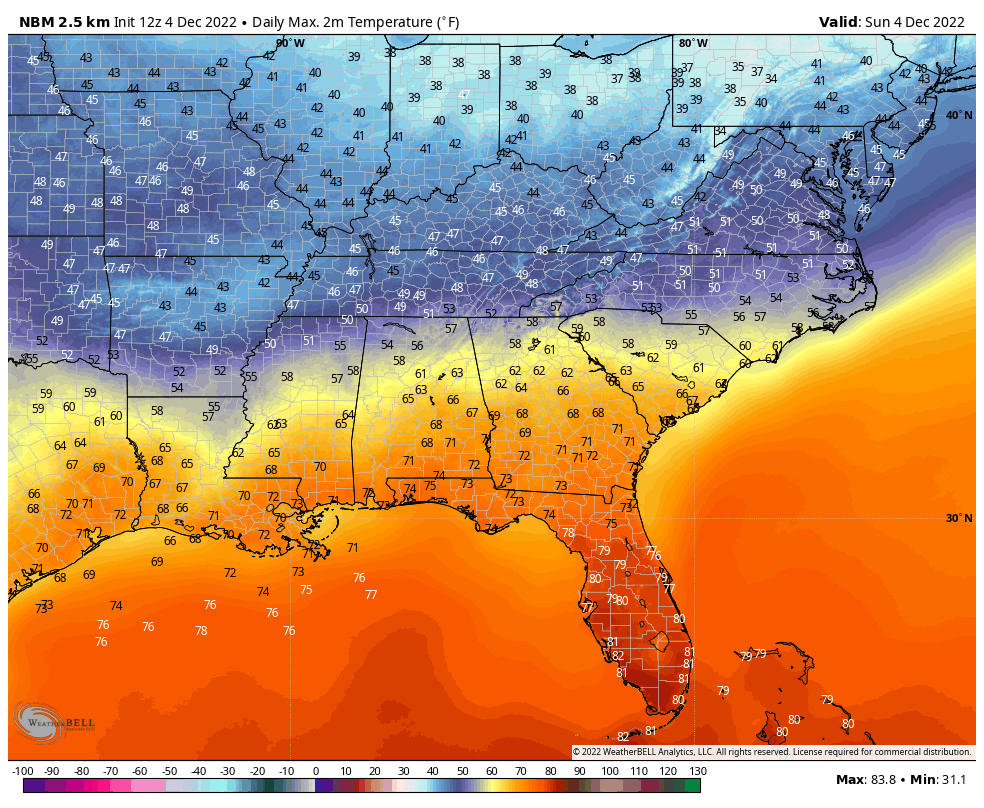
Here is where they will end up this afternoon:
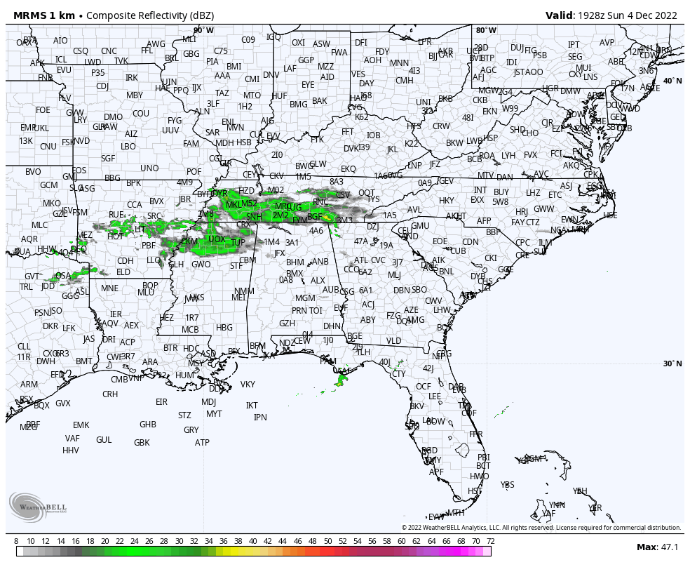
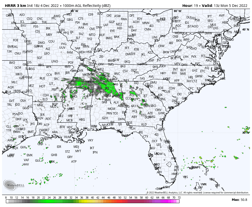
Radar shows showers moving through the Mid-South. They will be in North Alabama soon…
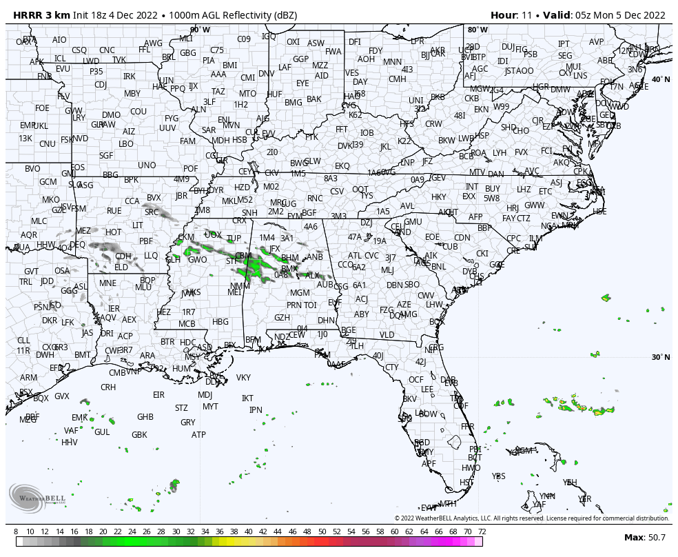
Here is a projected radar late this evening:
The morning could be wet in spots:
There could be some thunder Monday evening as well…but no severe weather is expected.
Showers will stay in the forecast the remainder of the week but it will be warm…
…Followed by a week two cooldown.
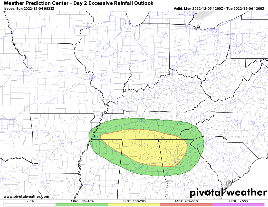
Oen thing to watch this week though is the risk of excessive rainfall across the Tennessee Valley invlucing North Alabaam. Here is the Excessive Rainfall Outlook from the WPC for Monday and Monday night:
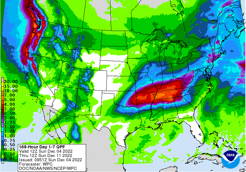
Here are expected rainfall amounts:
Category: Alabama's Weather, ALL POSTS
About the Author (Author Profile)
Bill Murray is the President of The Weather Factory. He is the site's official weather historian and a weekend forecaster. He also anchors the site's severe weather coverage. Bill Murray is the proud holder of National Weather Association Digital Seal #0001 @wxhistorianSubscribe
If you enjoyed this article, subscribe to receive more just like it.


