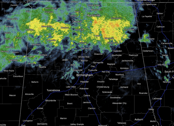
Midday Nowcast: Cloudy and Wet at Times
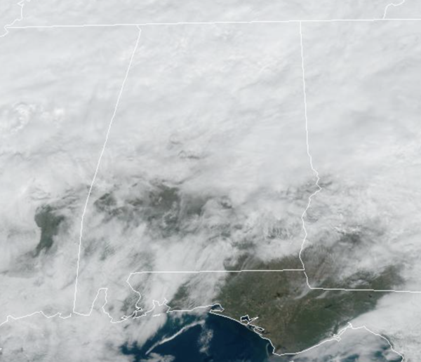
An upper ridge is building over the Gulf of Mexico this week a warm front is moving north today and will continue to allow for widespread, occasional showers over the northern half of the state today.
Temperatures this afternoon are ranging from the 50s across the Tennessee Valley, to the 70s over the southern third of the state. The warming trend continues the rest of this week, with 60s tomorrow and 70s statewide Wednesday and Thursday. Locations over south Alabama will likely see some low 80s this week. With the warm, southerly flow continuing, we will maintain the chance of showers tomorrow, but Wednesday and Thursday look mostly dry as an upper ridge builds northward. Rain amounts this week will vary from over two inches across the Tennessee Valley, to basically nothing over the southern third of Alabama.
ACROSS THE USA: A slow-moving storm in the West will continue to bring heavy snow to the California and northern Rocky mountains, and accumulating snow in the Intermountain West, Rockies, and the northern Plains. Moisture lifting across the Deep South may produce excessive rain in the Mid South. A strong Bering Sea storm will bring heavy snow, gusty winds, coastal flooding and ice shoves to western Alaska.
END OF WEEK FRONT: A cold front will bring the risk of scattered showers Friday and highs drop into the 60s. Then, for the weekend, highs will range from the upper 50s to low 60s. However, the is quite a bit of differences in global model output concerning rain chances for the weekend, and for now, there will be some risk of rain both days. Another front looks likely late Sunday and into Monday, likely bringing a risk of rain and storms Monday. Behind that front, drier and colder air flows into Alabama next week.
IN THE TROPICS: Yes, hurricane is officially over, but that doesn’t mean we can’t see some tropical mischief. The NHC as issued a Special Tropical Weather Outlook issued to discuss the potential for subtropical development this week over the central Atlantic.
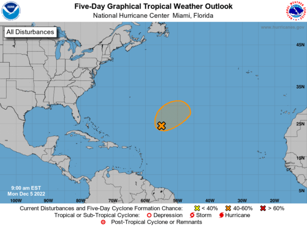
A large area of low pressure located over the central subtropical Atlantic about 750 miles northeast of the northern Leeward Islands is producing disorganized showers and thunderstorms. Environmental conditions appear conducive for this system to acquire some subtropical characteristics while it drifts northeastward during the next few days. By Thursday night or Friday, however, the low is expected to move over cooler waters, ending its chances of becoming a subtropical cyclone. Additional information on this system, including gale warnings, can be found in High Seas Forecasts issued by the National Weather Service. Formation chance through 5 days…medium…40 percent.
BEACH FORECAST CENTER: Get the latest weather and rip current forecasts for the beaches from Fort Morgan to Panama City on our Beach Forecast Center page. There, you can select the forecast of the region that you are interested in visiting.
WORLD TEMPERATURE EXTREMES: Over the last 24 hours, the highest observation outside the U.S. was 114.3F at Marble Bar, Australia. The lowest observation was -71.3F at Delyankir, Russia.
CONTIGUOUS TEMPERATURE EXTREMES: Over the last 24 hours, the highest observation was 77F at Marathon, FL. The lowest observation was -6F at Methow Valley, WA.
WEATHER ON THIS DATE IN 1886: A big snowstorm in the southeastern U.S. produced 11 inches at Montgomery AL, 18.5 inches at Rome GA, and 22.5 inches at Knoxville TN.
Category: Alabama's Weather, ALL POSTS
About the Author (Author Profile)
Macon, Georgia Television Chief Meteorologist, Birmingham native, and long time Contributor on AlabamaWX. Stormchaser. I did not choose Weather, it chose Me. College Football Fanatic. @Ryan_StinnetSubscribe
If you enjoyed this article, subscribe to receive more just like it.


