Warm Air Moving Northward; Rain Falling Over North Alabama
ON THE MAPS: We have a well defined warm front moving northward through Central Alabama this afternoon, creating a huge range of weather conditions across the state. South of the front, temperatures are in the 70s with some sun peeking through the clouds. But, north of the front, rain is falling over North Alabama with temperatures in the 47-55 degree range.
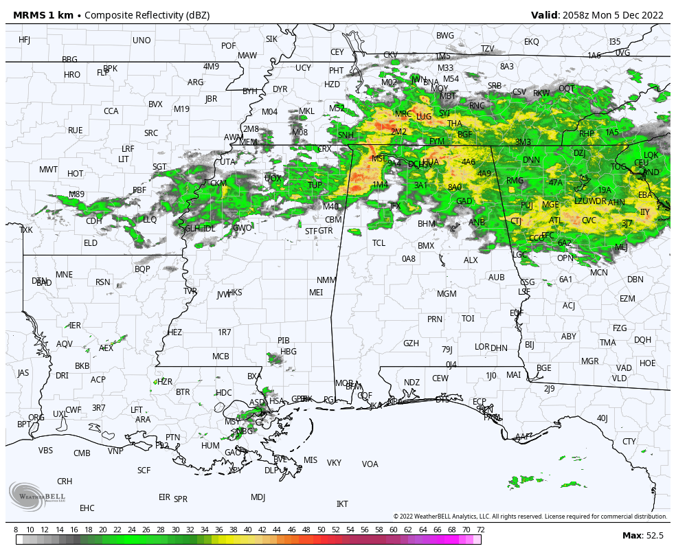
The front will continue to move northward tonight, and for those in North Alabama temperatures will actually rise through the 60s during the night with periods of rain continuing. Tomorrow will feature more clouds than sun with a few passing showers likely… the high will be in the 70s statewide. Warm December weather will persist through Thursday with temperatures not too far from record levels.
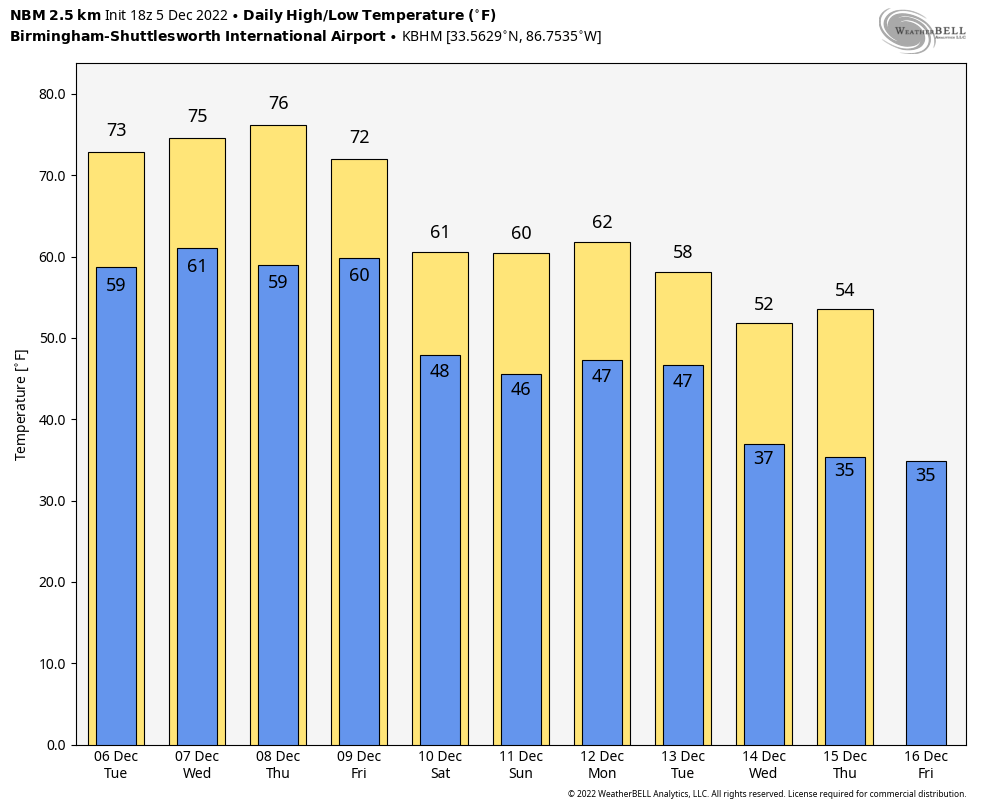
Here are the record highs for Birmingham on those days… not expecting to break them, but it will be close.
December 6 (tomorrow) 78, set in 1998
December 7 (Wednesday) 80, set in 1951
December 8 (Thursday) 79, set in 1978
Wednesday and Thursday look mostly dry as an upper ridge over the Gulf builds northward. Rain amounts this week will vary from over two inches across the Tennessee Valley, to basically nothing over the southern third of Alabama.
FRIDAY AND THE WEEKEND: A cold front will bring the risk of a few showers Friday; highs drop into the 60s over North Alabama, but ahead of the front it will be another day with 70s for the southern 2/3 of the state. Then, for the weekend, highs will be in the low to mid 60s for most of the state. There are considerable differences in global model output concerning rain chances for the weekend, making for a low confidence forecast, but the latest data suggests the main threat of rain will come Sunday.
NEXT WEEK: Forecast confidence is low with global models in disagreement. The reliable European model now suggests Monday will be dry, followed by a chance of rain and strong storms Tuesday and Tuesday night, followed by cooler, drier air for the latter half of the week. See the daily Weather Briefing video for maps, graphics, and more details.
ON THIS DATE IN 1953: At least four tornadoes touched down across northeastern Louisiana, southeastern Arkansas, and western Mississippi on this day. The strongest tornado was rated F5 as it destroyed the town of Vicksburg, Mississippi. This tornado first touched down just west of the Mississippi River in East Madison Parish in Louisiana. The tornado crossed the Mississippi River and tore through the downtown area of Vicksburg. On the ground for seven miles, this tornado caused 38 deaths, 270 injuries.
BEACH FORECAST: Click here to see the AlabamaWx Beach Forecast Center page.
Look for the next Weather Briefing video here by 6:00 a.m. tomorrow…
Category: Alabama's Weather, ALL POSTS, Weather Xtreme Videos
About the Author (Author Profile)
James Spann is one of the most recognized and trusted television meteorologists in the industry. He holds the AMS CCM designation and television seals from the AMS and NWA. He is a past winner of the Broadcast Meteorologist of the Year from both professional organizations.Subscribe
If you enjoyed this article, subscribe to receive more just like it.


