Midday Nowcast: Warm Days, Foggy Nights
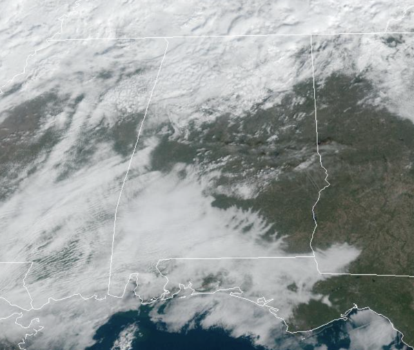
The December warmth continues today and into the upcoming weekend with temperatures running 15-20 degrees above average for this time of year. There are widespread mid and upper 70s on the maps again today, with low 80s down south. We continue to have more clouds than sun, due to the soupy air mass in place and on occasion, showers are on the radar. The better chance of rain continues to be across the northern third of the state. Not much change in the forecast tomorrow and Saturday. Sunday will be a few degrees cooler, in the upper 60s with more clouds and passing showers. The next several nights will continue to feature patchy dense fog, use caution if you out and about late at night and through the morning hours. Lows will be in the mid and upper 50s.
NEXT WEEK: Warm temperatures and some scattered showers are possible Monday and Tuesday. West of Alabama, we will be watching a significant severe weather event from North Texas, east into Mississippi, Monday and Tuesday. This system arrives here Wednesday with rain and thunderstorms, but it still looks like the best dynamic support will pull well to the north, and instability values look low. So, for now the severe weather threat in Alabama looks very limited, but understand this is still several days out, and things could change. As this system exits, colder, drier air returns Thursday and Friday with highs in the 50s and lows in the 30s. In fact, the week before Christmas is looking rather chilly for much of the country with well-below average temperatures as the overall weather pattern flips.
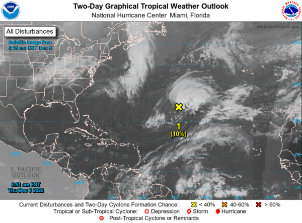
IN THE TROPICS: A non-tropical low pressure area located about 925 miles east-southeast of Bermuda continues to produce an extensive area of showers and thunderstorms. However, the system remains embedded within a frontal zone, which is expected to become even more pronounced later today as the low begins to move east-northeastward at 20 to 25 mph toward colder waters and interacts with a mid-latitude trough. Therefore, it is unlikely that the low will transition to a subtropical or tropical cyclone. Nevertheless, significant non-tropical development of this low is expected during the next couple of days. Formation chance through 5 days…low…10 percent.
BEACH FORECAST CENTER: Get the latest weather and rip current forecasts for the beaches from Fort Morgan to Panama City on our Beach Forecast Center page. There, you can select the forecast of the region that you are interested in visiting.
WORLD TEMPERATURE EXTREMES: Over the last 24 hours, the highest observation outside the U.S. was 114.8F at Rivadavia, Argentina. The lowest observation was -64.1F at Near, Russia.
CONTIGUOUS TEMPERATURE EXTREMES: Over the last 24 hours, the highest observation was 89F at Linn, TX. The lowest observation was -20F at Crane Lake, MN.
Category: Alabama's Weather, ALL POSTS
About the Author (Author Profile)
Macon, Georgia Television Chief Meteorologist, Birmingham native, and long time Contributor on AlabamaWX. Stormchaser. I did not choose Weather, it chose Me. College Football Fanatic. @Ryan_StinnetSubscribe
If you enjoyed this article, subscribe to receive more just like it.


