Enhanced Risk Introduced for Portions of Alabama on Wednesday
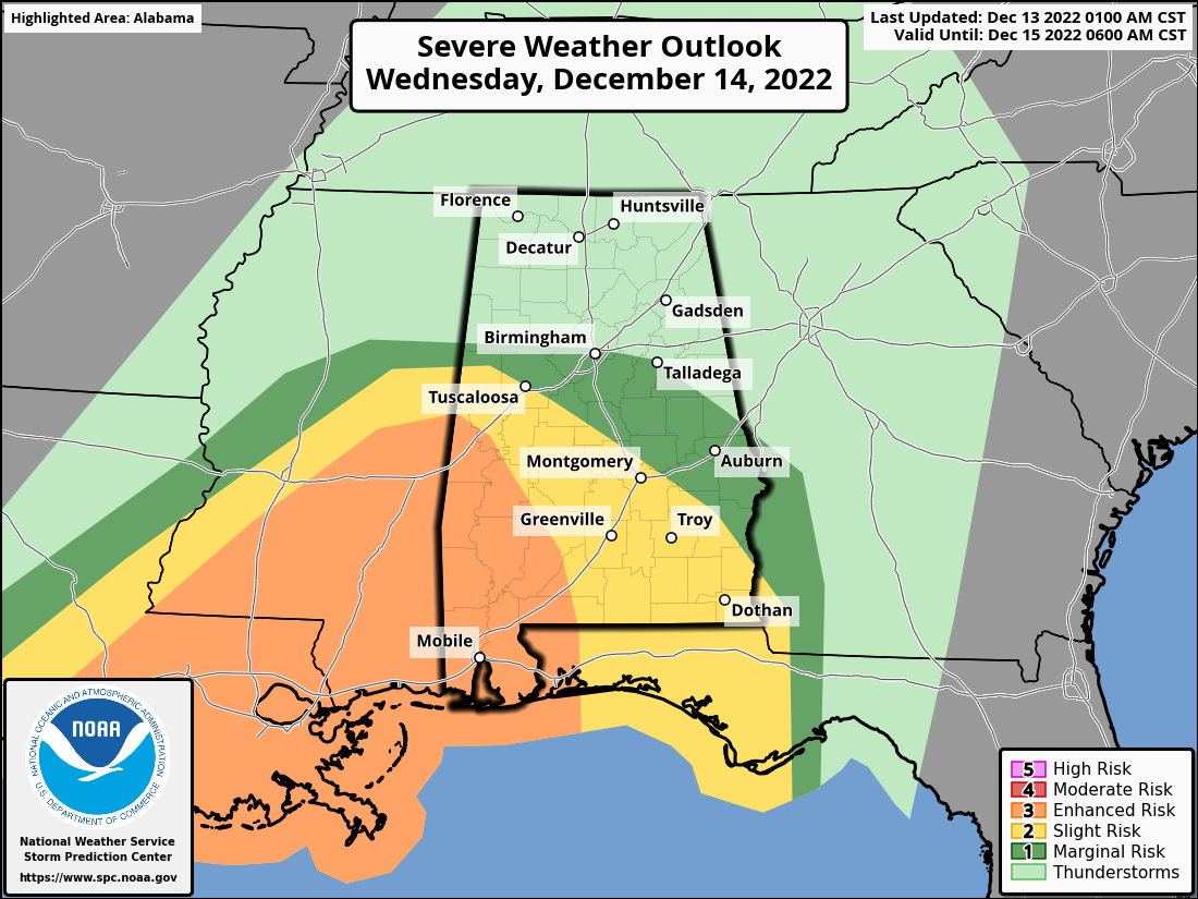
The Storm Prediction Center has just released its new Day 2 Severe Weather Outlook graphic valid on Wednesday 6 am to Thursday 6 am, and portions of Central Alabama have now been introduced into an Enhanced Risk for severe storms.
ENHANCED RISK — Locations along and south of a line from roughly Geiger to Demopolis to Thomaston.
SLIGHT RISK — Locations outside of Enhanced Risk to a line from roughly Reform to just south of Clanton to Clayton.
MARGINAL RISK — Locations outside of Slight Risk to a line from roughly Millport to Birmingham to LaFayette.
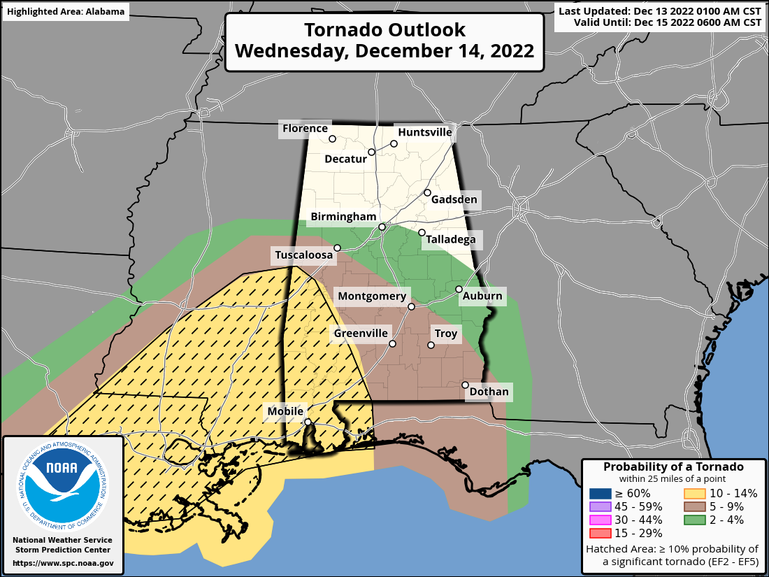
While all modes of severe weather will be possible, there is a risk of a strong tornado occurring somewhere in the Enhanced Risk locations, as the SPC has the hatched area over those locations. Otherwise, brief tornadoes, damaging wind gusts up to 60 mph, and large hail will be possible, mainly in those risk locations. However, thunderstorms do not follow the lines on a map or graphic, so it is not impossible for a strong to severe storm to occur outside of those risk areas. For now, timing still remains to be from approximately 2 pm on Wednesday through 3 am on early Thursday morning from west to east.
This will also be a heavy rain event, and some locations may experience some flash flooding issues, especially over the northern half of the area due to the rains received over the past week.
Category: Alabama's Weather, ALL POSTS, Severe Weather
About the Author (Author Profile)
Scott Martin is an operational meteorologist, professional graphic artist, musician, husband, and father. Not only is Scott a member of the National Weather Association, but he is also the Central Alabama Chapter of the NWA president. Scott is also the co-founder of Racecast Weather, which provides forecasts for many racing series across the USA. He also supplies forecasts for the BassMaster Elite Series events including the BassMaster Classic.Subscribe
If you enjoyed this article, subscribe to receive more just like it.


