

Rain/Storms Tomorrow; Colder Air To Follow
MOSTLY DRY TODAY: While an isolated shower could pop up today, most of the state will be dry; expect a mostly cloudy sky with a high in the 60s for most places… low 70s are likely near the coast.
ACTIVE DAY TOMORROW: A dynamic weather system will bring the dual threat of heavy rain and severe thunderstorms to Alabama tomorrow. SPC has now defined an “enhanced risk” (level 3/5) of severe thunderstorms for Southwest Alabama… areas west of a line from York to Monroeville to Brewton. A “slight risk” (level 2/5) extends as far north as Tuscaloosa, Montgomery, and Abbeville, and a “marginal risk” is in place to Birmingham.
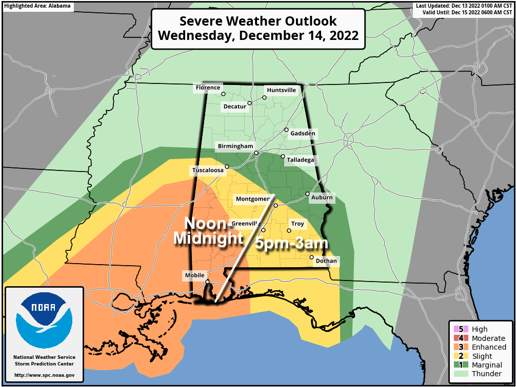
The core severe weather threat will be over the southern third of the state… the air over North Alabama is expected to be cool and stable. The higher tornado threat will be in the “enhanced risk” over Southwest Alabama. While a few storms could form during the afternoon (as early as noon), the core threat will come later, from about 5 p.m. until midnight. The threat will linger after midnight across Southeast Alabama.
People in places like Mobile, Fairhope, Gulf Shores, Atmore, Jackson, Grove Hill, Monroeville, and Butler (all of these places are in the “enhanced risk”) need to be sure you have a good way of hearing warnings if they are needed, and a good tornado safety plan.
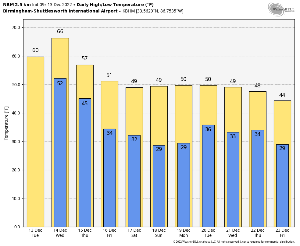
A soaking rain is likely statewide; amounts could exceed two inches across much of the state, and isolated flooding issues are possible by tomorrow night. The rain will end from west to east late tomorrow night and during the pre-dawn hours Thursday. The sky will become mostly sunny Thursday with a high in the 56-63 degree range.
FRIDAY AND THE WEEKEND: The weather looks dry for most of the state with a trend toward colder temperatures. A disturbance will bring some clouds into the state Saturday, and a sprinkle is possible a few spots, but the air will be dry and the best chance of rain with this feature will be over the northern Gulf of Mexico. Highs will be in the 40s and 50s, and we drop below freezing by early Sunday morning for first time since December 1.
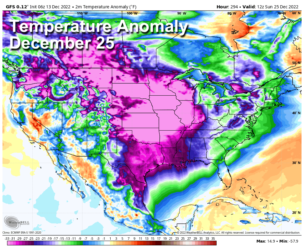
NEXT WEEK AND BEYOND: Some light rain is possible Monday or Tuesday, otherwise the week looks dry with highs in the 40s and 50s, and lows mostly in the 20s and 30s. We continue to see strong signals in global models of very cold air moving into the Deep South around Christmas. But December 25 is still 12 days away and there is no skill in a specific forecast for now. See the daily Weather Briefing video for maps, graphics, and more details.
ON THIS DATE IN 1997: A freak cold snap and snowstorm struck parts of northern Mexico left 12 people dead, and the area paralyzed. It snowed in the city of Guadalajara for the first time since 1881, leaving amazed residents to gawk at the white stuff and make snowmen. The temperature plunged to 5 degrees in Chihuahua.
BEACH FORECAST: Click here to see the AlabamaWx Beach Forecast Center page.
Look for the next Weather Briefing video here by 3:00 this afternoon… enjoy the day!
Category: Alabama's Weather, ALL POSTS, Weather Xtreme Videos
About the Author (Author Profile)
James Spann is one of the most recognized and trusted television meteorologists in the industry. He holds the AMS CCM designation and television seals from the AMS and NWA. He is a past winner of the Broadcast Meteorologist of the Year from both professional organizations.Subscribe
If you enjoyed this article, subscribe to receive more just like it.


