Heavy Rain Threat In Addition to Severe Weather Threat for Alabama and Areas to Our West
An amazing amount of moisture is being thrown up into the Mississippi Valley right now from an abnormally warm Gulf of Mexico, and that is leading to a severe weather threat now to our west, and for us here in Alabama tomorrow, but also a flooding threat.
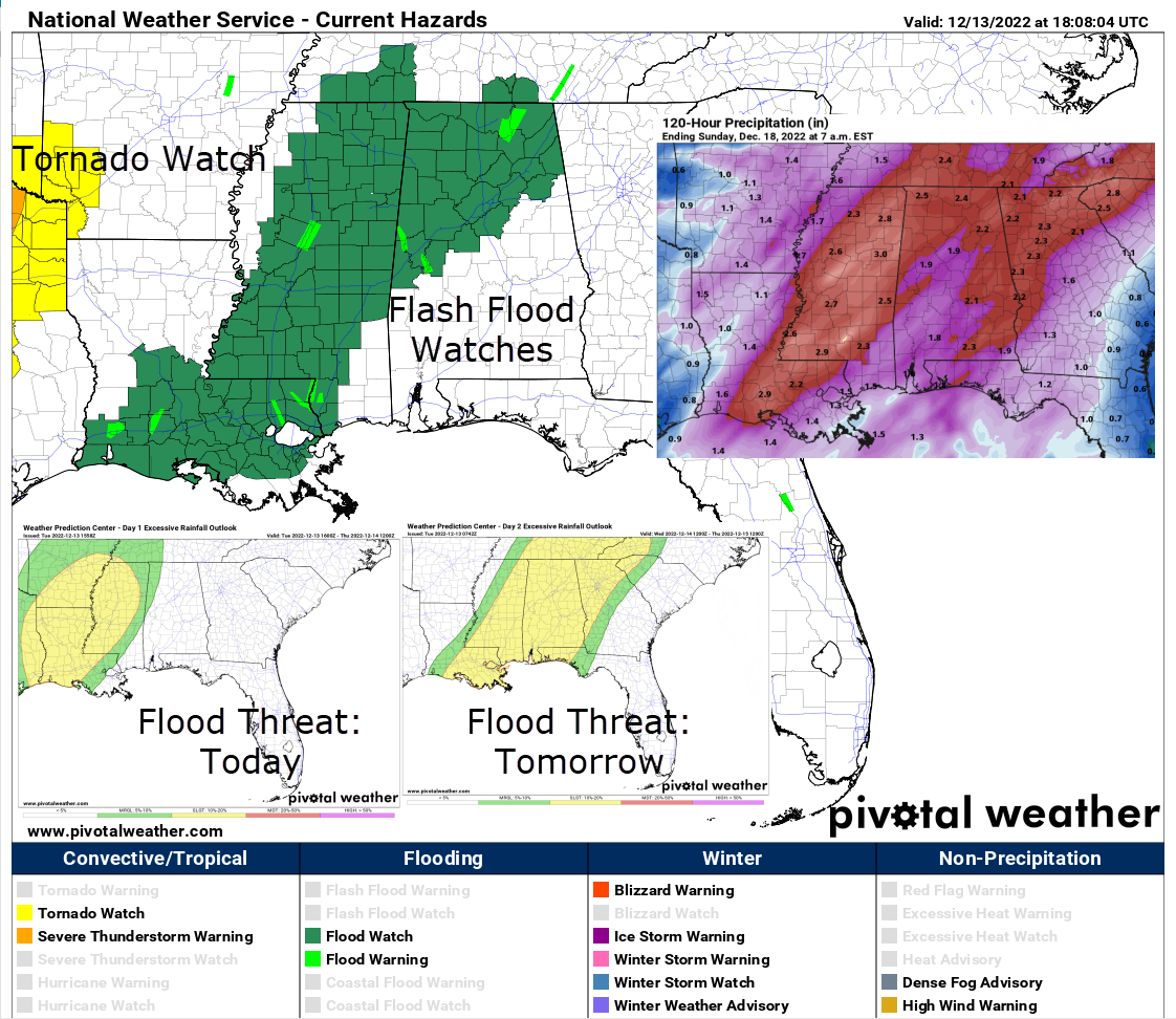
In anticipation of the heavy rainfall, NWS Offices across the Southern Region have issued Flood Watches, including one for our Tennessee Valley Counties from Huntsville and one for counties along and northwest of I-59 in the Birmingham County Warning Area.
Rainfall amounts over the next 36 hours will average 2-3 inches across North and Central Alabama. This could lead to flooding concerns.
Weather Service Offices have also been issuing river flood warnings for rivers like the Black Warrior south of Tuscaloosa and the Tombigbee at Bevill Lock and Dam where flooding by Friday could begin to cut off cattle. The NWS in Huntsville has River Flood Warnings for the Flint River and the Paint Rock River in their area. Those rivers will crest Friday morning.
To the west, there has been lots of active severe weather overnight in Oklahoma and North Texas. A tornado touched down near Grapevine, causing damage to the famous Grapevine Mills shopping center. Tennis ball sized hail was reported in Rockland County.
An apparent long-lived supercell tracked from the Fort Worth area across northern parts of the Metroplex to McKinney to near Paris causing quite a few reports of significant wind damage. Homes and businesses were damaged. There was at least 1 injury.
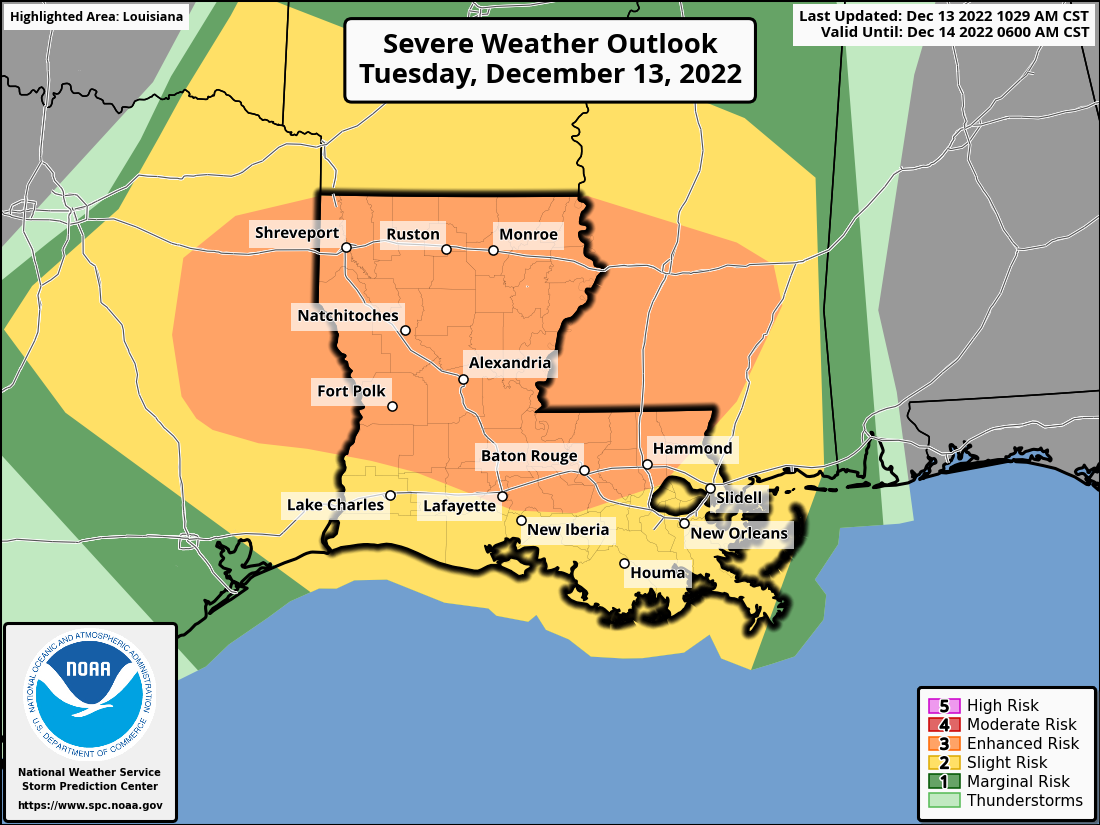
At 12:40 p.m. there are no severe weather warnings for the first time since last evening as the weather is taking a quick breather. The severe weather threat will be ramping up in the next few hours over Northeast Texas, , southeastern Oklahoma, southwestern Arkansas, and northwestern Louisiana. There is a significant threat of Ddamaging winds, large hail, and a few significant tornadoes (EF2 or higher) across a large part of that area this afternoon and tonight. Here is the current SPC Day One severe weather threat graphic:
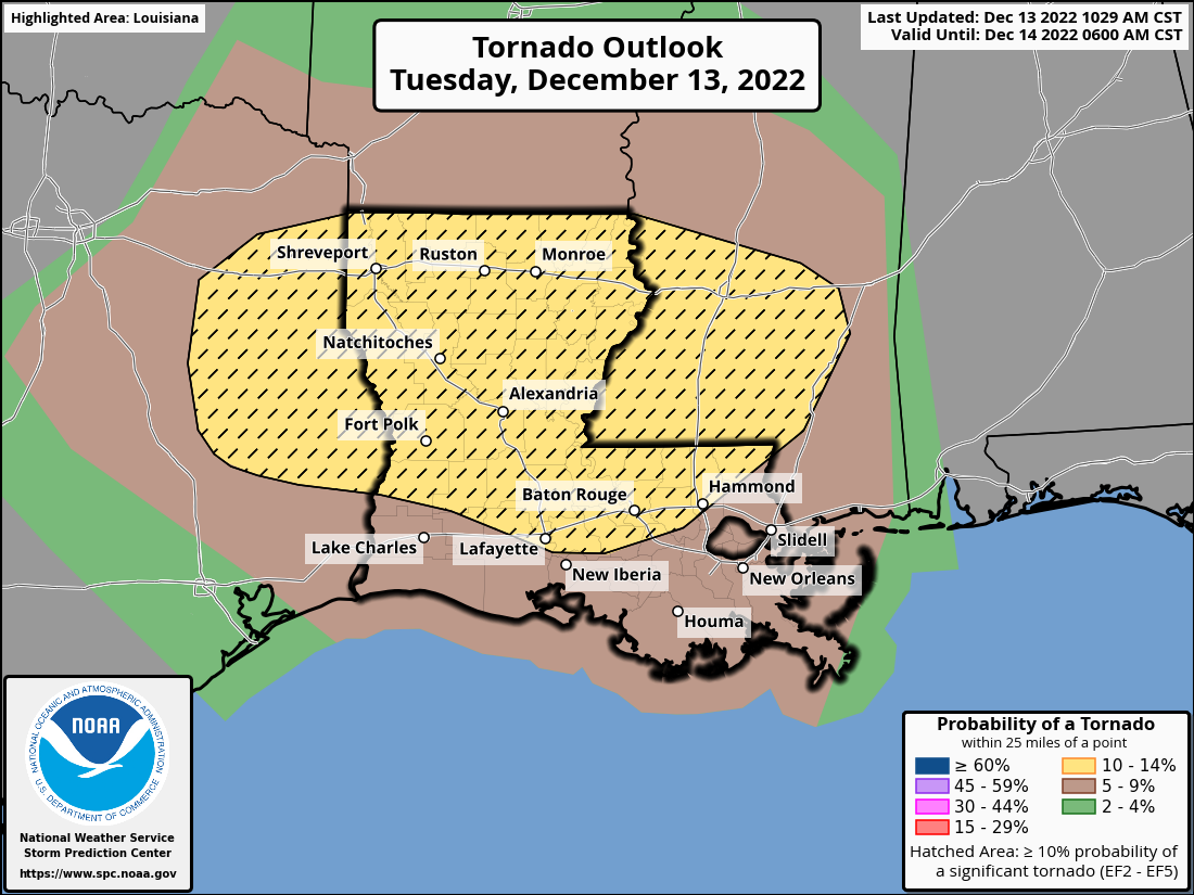
Here is the tornado risk graphic:
The storms will ramp down as they move into Alabama early tomorrow, but they will ramp back up in the afternoon giving us a severe weather threat in our state. Here is the Day Two Outlook for tomorrow:
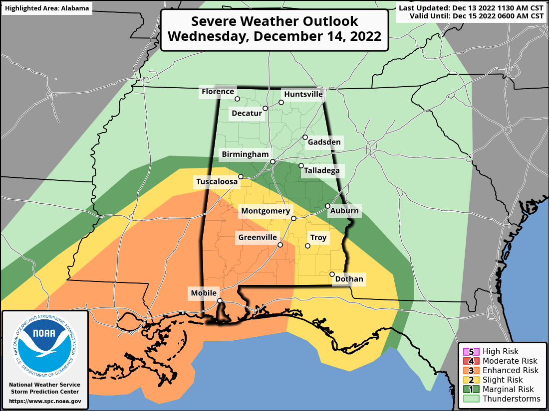
Areas southwest of a line from Sulligent to Birmingham to Talladega to Lanett have some severe threat tomorrow. The threat increases the further south and west you go.
Take time today to review your sources of receiving weather warning information. Think about your family and your business’ severe weather plan. What will you do if a tornado warning or severe thunderstorm warning is issued for where you are? Take time to let others in your circles know about the flooding and severe weather threat. We arm ourselves with information in order to stay safe from hazardous weather!
Category: Alabama's Weather, ALL POSTS, Severe Weather
About the Author (Author Profile)
Bill Murray is the President of The Weather Factory. He is the site's official weather historian and a weekend forecaster. He also anchors the site's severe weather coverage. Bill Murray is the proud holder of National Weather Association Digital Seal #0001 @wxhistorianSubscribe
If you enjoyed this article, subscribe to receive more just like it.


