New Tornado Watch for Southeastern Parts of Central Alabama Until 1 am; Old Watch Trimmed in Size
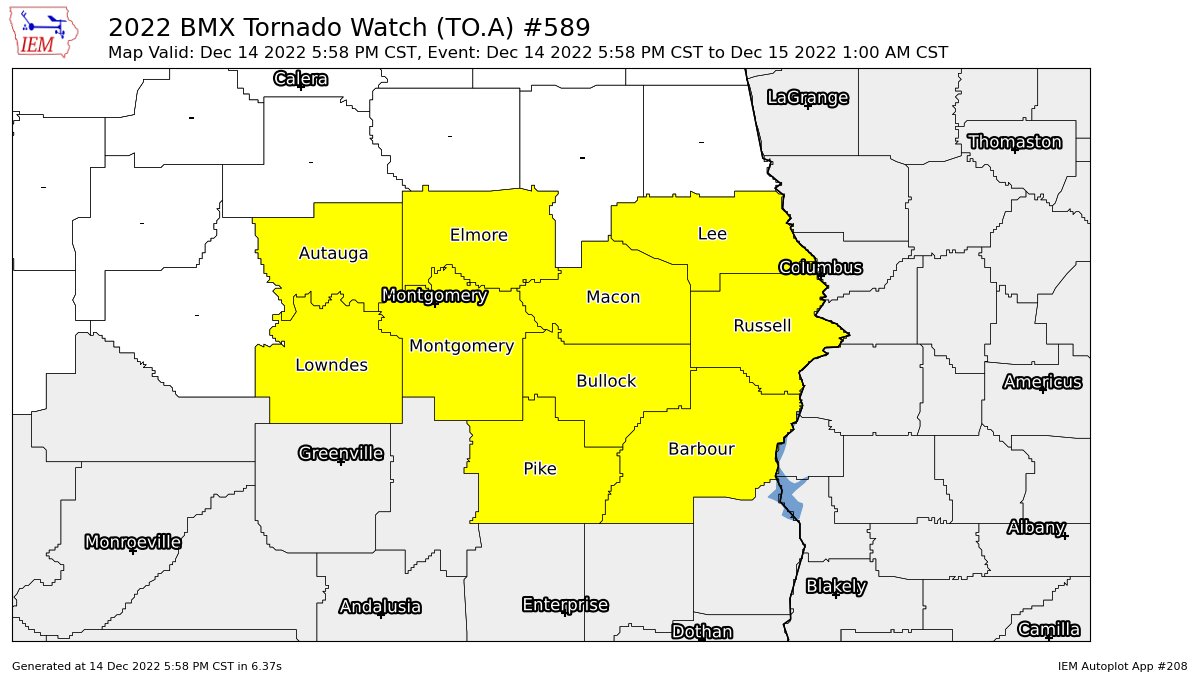
A new TORNADO WATCH has been issued by the SPC and NWS Birmingham effective immediately until 1 am Thursday morning for Autauga, Barbour, Bullock, Elmore, Lee, Lowndes, Macon, Montgomery, Pike, Russell counties in Central Alabama.
Several tornadoes likely with a couple intense tornadoes possible, along with scattered damaging wind gusts to 65 mph in the watch area.
Tornado potential is expected to increase across the region as bands of semi-discrete/cluster supercells move east-northeastward into the region, while additional storms develop within the increasingly moist warm sector and near the northwest/southeast-oriented warm front. Strengthening deep-layer/low-level winds will support tornado potential, including the possibility of strong/intense tornadoes (EF2+).
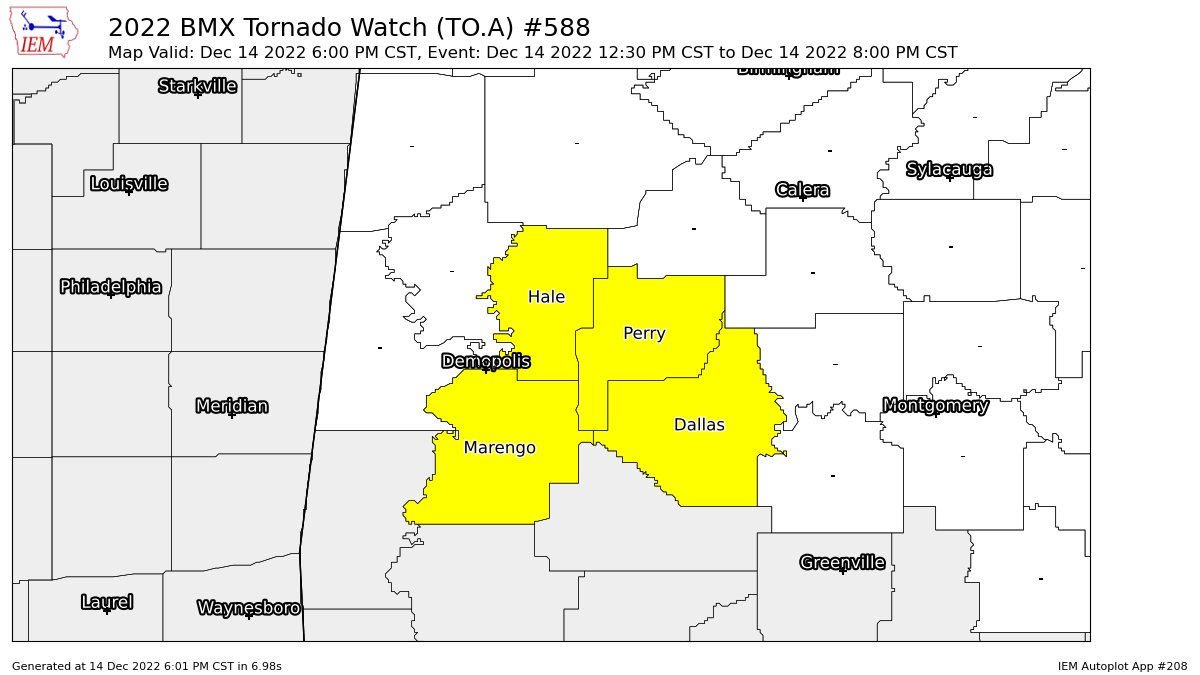
NWS Birmingham continues the older TORNADO WATCH until 8 pm tonight for Dallas, Hale, Marengo, Perry counties in Central Alabama, while removing Greene and Sumter counties.
Category: Alabama's Weather, ALL POSTS, Severe Weather
About the Author (Author Profile)
Scott Martin is an operational meteorologist, professional graphic artist, musician, husband, and father. Not only is Scott a member of the National Weather Association, but he is also the Central Alabama Chapter of the NWA president. Scott is also the co-founder of Racecast Weather, which provides forecasts for many racing series across the USA. He also supplies forecasts for the BassMaster Elite Series events including the BassMaster Classic.Subscribe
If you enjoyed this article, subscribe to receive more just like it.


