A Quick Late Evening Check on Our Weather Situation
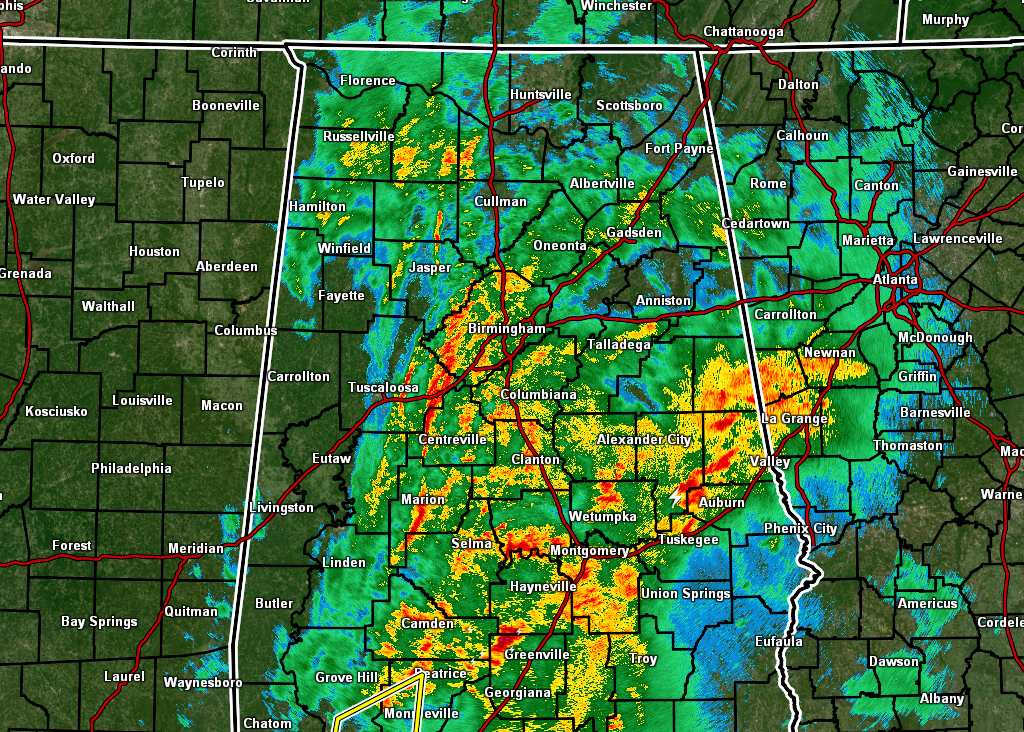
As of 8:20 pm, there are no active warnings in North/Central Alabama, with the only severe weather occurring in South Alabama in portions of Mobile and Washington counties. However, moderate to heavy rainfall continues to fall over much of the area. The good news is that we haven’t had any major flooding issues as of this time.
Instability continues to stay shunted to the southern parts of the state as dewpoints continue to stay too low for unstable air to survive north of Montgomery. Therefore, Significant Tornado Parameters only reach 1.0 in the extreme southern parts of Central Alabama, then climbs up to 5.0 as you approach the Alabama Gulf Coast.
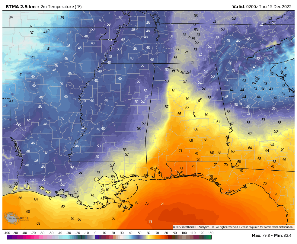
You can clearly see where the cold front is located over the western parts of the state where temperatures have already dropped into the 50s, while the rest of the area ahead of the front and below the warm front are well up into the upper 60s. Also, behind the front, rainfall has quickly come to an end over much of extreme western Alabama.
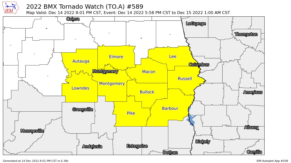
We still have the TORNADO WATCH in effect for Autauga, Barbour, Bullock, Elmore, Lee, Lowndes, Macon, Montgomery, Pike, and Russell counties until 1 am Thursday morning. Tornadoes and damaging winds will continue to be possible across the watch area until the front passes through. The end of the severe weather threat looks to be around 1 am for the eastern parts of the area.
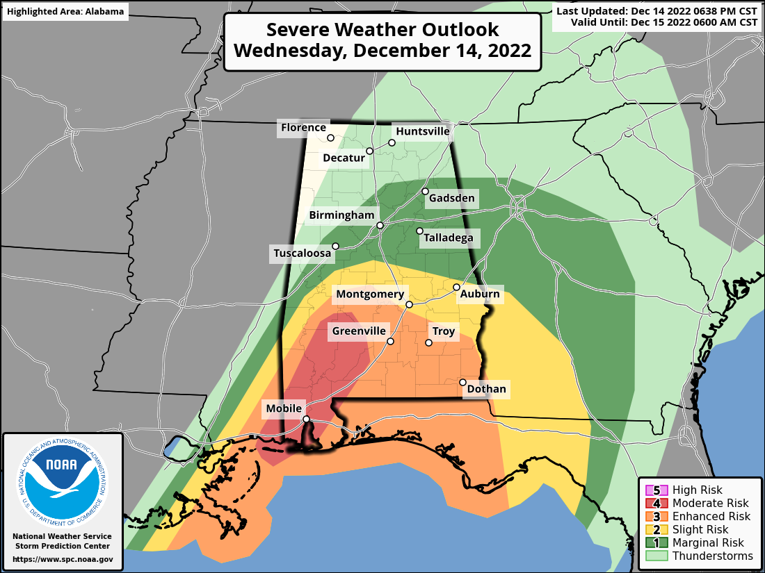
A MODERATE RISK – Along and south of a line from Sweet Water (Marengo Co.) to Tilden (Dallas Co.) and down into South Alabama.
An ENHANCED RISK – Along and south of a line from Myrtlewood (Marengo Co.) to just south of Marion (Perry Co.) to Autaugaville (Autauga Co.) to Pleasant Hill (Barbour Co.).
A SLIGHT RISK – Along and south of a line from Bellamy (Sumter Co.) to Centreville (Bibb Co.) to just north of Opelika (Lee Co.).
A MARGINAL RISK – Along and south of a line from just north of Cuba (Sumter Co.) to Hanceville (Cullman Co.) to Cedar Bluff (Cherokee Co.).
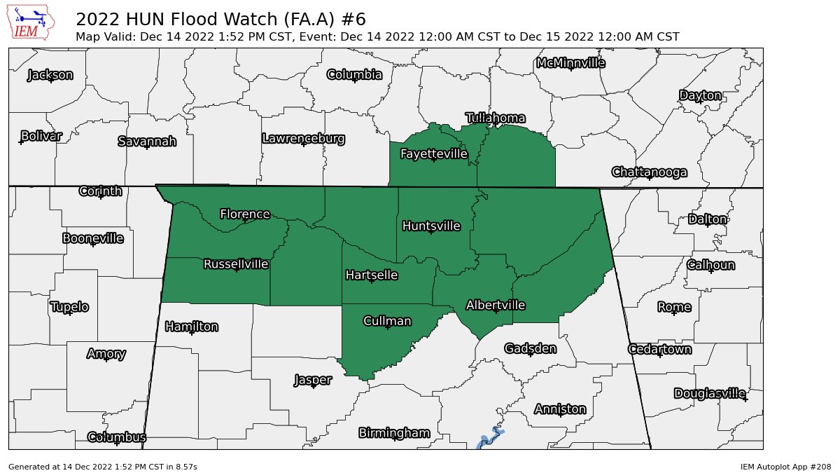
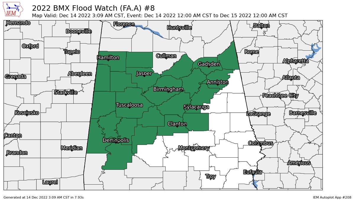
A FLOOD WATCH continues until midnight tonight for Colbert, Cullman, DeKalb, Franklin, Jackson, Lauderdale, Lawrence, Limestone, Madison, Marshall, and Morgan counties in North Alabama, and for Bibb, Blount, Calhoun, Cherokee, Chilton, Coosa, Etowah, Fayette, Greene, Hale, Jefferson, Lamar, Marengo, Marion, Perry, Pickens, Shelby, St. Clair, Sumter, Talladega, Tuscaloosa, Walker, and Winston counties in Central Alabama.
We’ll continue to bring you updates through the remainder of the evening and into the overnight hours, especially if any new warnings are issued.
Category: Alabama's Weather, ALL POSTS, Severe Weather
About the Author (Author Profile)
Scott Martin is an operational meteorologist, professional graphic artist, musician, husband, and father. Not only is Scott a member of the National Weather Association, but he is also the Central Alabama Chapter of the NWA president. Scott is also the co-founder of Racecast Weather, which provides forecasts for many racing series across the USA. He also supplies forecasts for the BassMaster Elite Series events including the BassMaster Classic.Subscribe
If you enjoyed this article, subscribe to receive more just like it.


