A Late Night Look At the Weather Situation
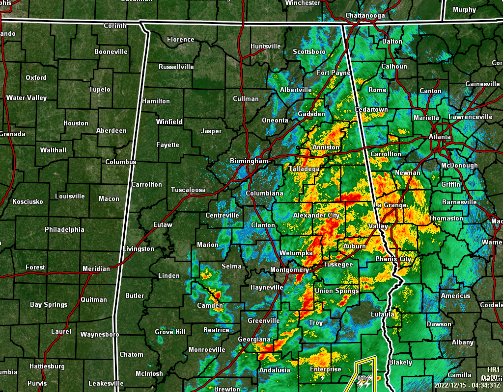
For much of the area, the severe threat has come to an end except for the extreme southeastern portions of the area, mainly east of I-65 and along and south of I-85. So, if you are along and east of a line from Valley to Auburn to Tuskegee to Union Springs to Troy, the threat of severe weather will continue until the front passes and should be out of the state by 1 am.
Rainfall mostly continues east of I-65 across the area with only a few showers remaining in the southern parts of Dallas County and up into the western portions of Chilton and eastern portions of Bibb and Perry counties.
As of 10 pm, temperatures range from as warm as 71º in Troy with light rain falling, to as cool as 48º in Haleyville with mostly cloudy skies. Birmingham was sitting at 59º with light showers.
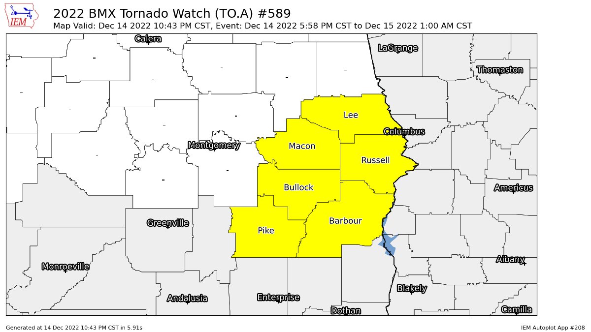
More counties continue to be removed from the TORNADO WATCH that is set to expire at 1 am. Autauga, Elmore, Lowndes, and Montgomery counties were the latest group to be removed from the watch, which leaves Barbour, Bullock, Lee, Macon, Pike, and Russell counties in the watch. Tornadoes and damaging winds remain possible in the watch area.
Category: Alabama's Weather, ALL POSTS, Severe Weather
About the Author (Author Profile)
Scott Martin is an operational meteorologist, professional graphic artist, musician, husband, and father. Not only is Scott a member of the National Weather Association, but he is also the Central Alabama Chapter of the NWA president. Scott is also the co-founder of Racecast Weather, which provides forecasts for many racing series across the USA. He also supplies forecasts for the BassMaster Elite Series events including the BassMaster Classic.Subscribe
If you enjoyed this article, subscribe to receive more just like it.


