The New Year’s Eve Midday Weather Report — Showers Are About Out of Here, but Fog May Make it Hard to See Fireworks Tonight
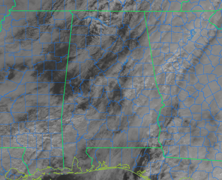
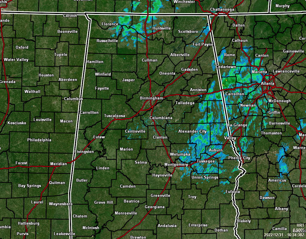
RADAR & SATELLITE CHECK: at 10:34 am, shower activity is pushing out of Central Alabama and into Georgia, but it may take another 2–3 hours for it to completely be out of here. There are also some showers over the central and western parts of the Tennessee Valley, but they will be out of the state within the next 2–3 hours as well. We are also seeing a good number of breaks in the cloud cover as well. Temperatures have made it up to the upper 50s to the lower 60s so far today, and afternoon highs will top out in the mid 60s to the lower 70s across Central Alabama.
THIS EVENING & OVERNIGHT: Skies will be partly to mostly cloudy across the area tonight, but we’ll also have fog developing that will make it hard to see the roadways and the fireworks in the sky. Overnight lows will only fall into the upper 40s to the mid 50s across the area.
NEW YEAR’S DAY: We’ll be in-between systems on Sunday, so get ready to enjoy the sunshine and warmth on the first day of 2023. Fog will lift by late morning, but we’ll continue to have some clouds mixed with sun. Afternoon highs in the upper 60s to the lower 70s.
NEXT WEEK: Humidity levels will begin to increase on Monday, and as a cold front slowly approaches the area, we’ll have enough lift for scattered showers and some thunder to form mainly over the western parts of the area by afternoon, but we can’t rule out a few showers east of I-65. No severe weather issues for our area, but an Enhanced Risk is up for portions of Texas, Oklahoma, Arkansas, and Louisiana, with a Marginal Risk extending as far east as East-Central Mississippi. Highs in the upper 60s to the mid 70s.
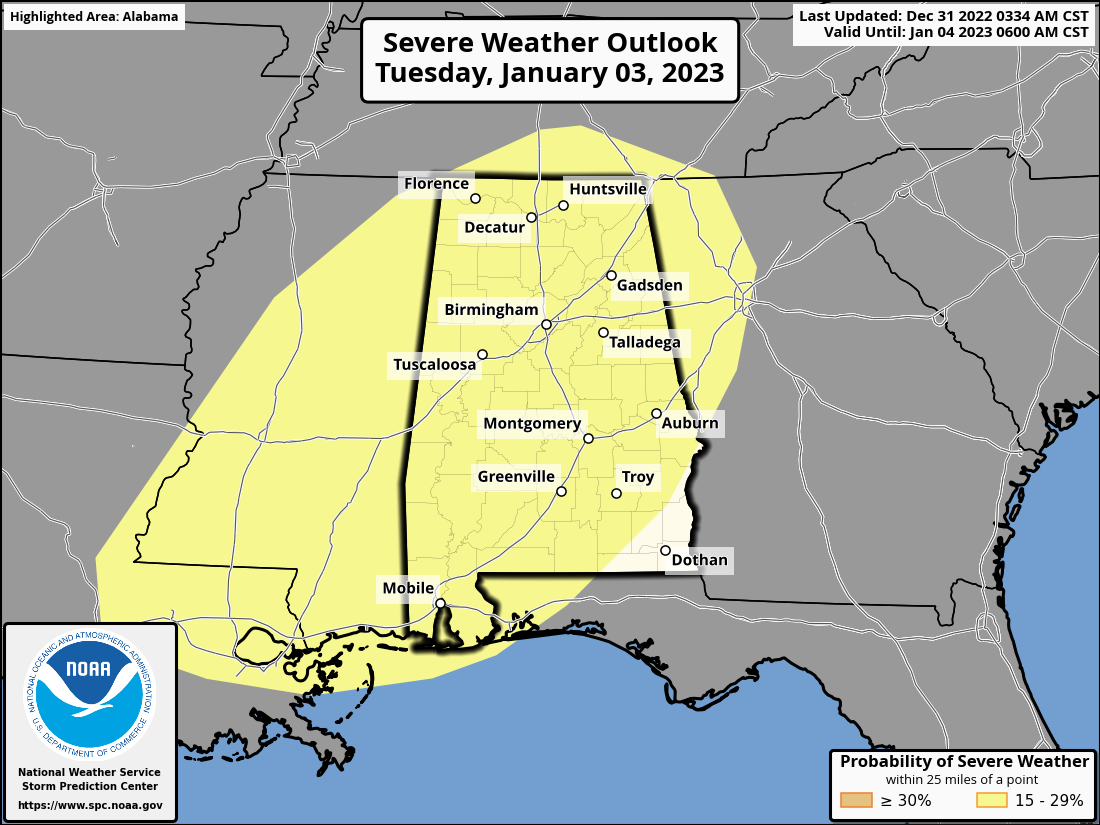
Tuesday will be our day to deal with the potential of severe weather. The SPC continues the Slight Risk for nearly the entire state of Alabama, along with portions of the surrounding states. Damaging winds, tornadoes, and large hail will be possible with any storm that goes severe, with the timing of that threat starting around midday and going through the rest of the day and into the pre-dawn hours on Wednesday. By tomorrow morning, we’ll start to get a better idea of the details as the higher-resolution models come into focus. Rainfall will be heavy at times as well, and a few flooding issues may arise. The good news is that forecast rainfall totals for Tuesday continue to drop, and we are now expecting 3/4 to 1-1/2 inches across the area with localized heavier amounts. Highs in the upper 60s to the mid 70s.
No severe weather is expected on Wednesday, but rain and storms will continue through the morning before we start to dry out from northwest to southeast. However, we can expect another 1/2 to 1-3/4 inches of rainfall before the front exits by late in the day. Highs will be in the upper 50s to the lower 70s.
And to end the week off, drier continental air will move in dropping our temperatures and the humidity levels. We’ll have plenty of sun and only a few passing clouds on both days, with Thursday’s highs in the upper 40s to the lower 60s, and Friday’s highs in the upper 40s to the upper 50s.
Category: Alabama's Weather, ALL POSTS, Severe Weather
About the Author (Author Profile)
Scott Martin is an operational meteorologist, professional graphic artist, musician, husband, and father. Not only is Scott a member of the National Weather Association, but he is also the Central Alabama Chapter of the NWA president. Scott is also the co-founder of Racecast Weather, which provides forecasts for many racing series across the USA. He also supplies forecasts for the BassMaster Elite Series events including the BassMaster Classic.Subscribe
If you enjoyed this article, subscribe to receive more just like it.


