Saturday Weather Briefing Video — Showers Possible Today; Severe & Flooding Threat on Tuesday
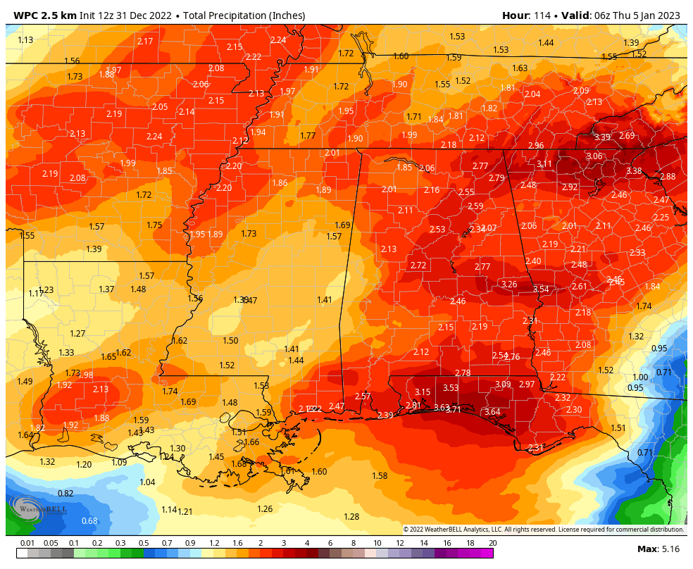
Projected rainfall totals through Wednesday night at midnight.
NEW YEAR’S EVE: We’re starting off with some fog and a few light showers over portions of Central Alabama today, but as a short wave moves through the area, we can expect more shower development through the morning and into the early afternoon. By late afternoon, the activity will be exiting the eastern parts of the area, but it will remain mostly cloudy. Patchy fog will be likely tonight, especially at midnight. Highs in the lower 60s to the lower 70s.
NEW YEAR’S DAY: We’ll start off the first day of 2023 with mostly cloudy skies and some patchy fog, but skies will eventually start clearing out by the late morning hours. We’ll end up with partly cloudy skies and highs in the upper 60s to the mid 70s.
NEXT WEEK: Increasing moisture levels and a southerly flow over Central Alabama on Monday will help to destabilize the atmosphere, and an approaching cold front will set the stage for scattered showers and storms to form and move across the western parts of the area. Best rain chances through the day will be over the western half of the area, but everyone will have a chance of rain. Highs in the upper 60s to the mid 70s.
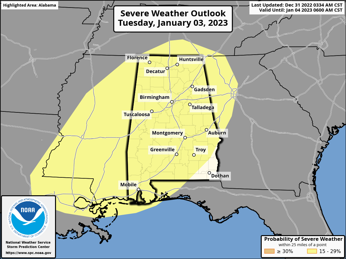
Conditions on Tuesday will bring the risk of severe weather to Central Alabama, and the SPC has a Slight Risk up for nearly the entire state. At this point, all modes of severe weather will be possible as dewpoints will be in the mid to upper 60s, instability values and shear rates will be high enough, and lapse rates will be supportive of robust updrafts. Timing on the severe threat looks to be from midday through the late-night hours. Rain will be heavy at times as well, and some flooding issues will be possible. We’ll have better detail on this threat when the high-resolution models come into play. Highs in the mid 60s to the mid 70s.
The cold front will finally begin to move through the area on Wednesday as we’ll start to dry out from northwest to southeast by midday. However, rain and storms will continue along and ahead of the front. Rain may be heavy at times once again, so we’ll have to continue to watch for flooding issues. At this point, we will not have to worry about a severe weather threat. Rain should be out of the southeastern parts of the area by sunrise on Thursday morning. Highs in the upper 50s to the lower 70s.
A continental flow moves in and takes over the pattern to end off the work week. Thursday will be mostly sunny with highs in the upper 40s to the lower 60s. Friday looks to be sunny with highs in the upper 40s to the upper 50s.
Category: Alabama's Weather, ALL POSTS, Severe Weather, Weather Xtreme Videos
About the Author (Author Profile)
Scott Martin is an operational meteorologist, professional graphic artist, musician, husband, and father. Not only is Scott a member of the National Weather Association, but he is also the Central Alabama Chapter of the NWA president. Scott is also the co-founder of Racecast Weather, which provides forecasts for many racing series across the USA. He also supplies forecasts for the BassMaster Elite Series events including the BassMaster Classic.Subscribe
If you enjoyed this article, subscribe to receive more just like it.


