Radar Update at 9:30 p.m.
Showers and thunderstorms are increasing across Alabama and Mississippi tonight ahead of an approaching cold front.
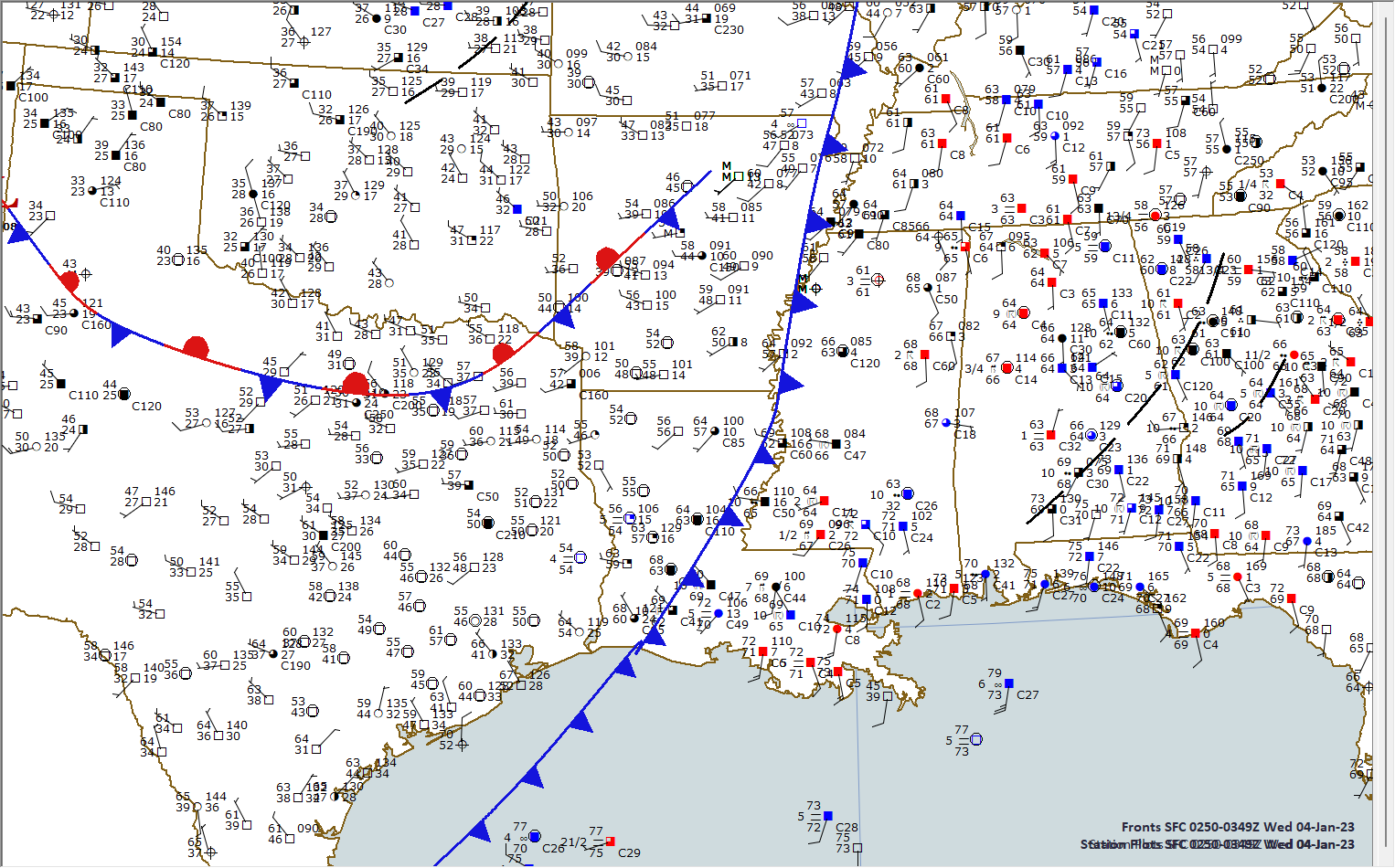
The front is located near the Mississippi River at this hour.
There are a couple of severe thunderstorm warnings along the line of storms in Mississippi, but no warnings in Alabama at this hour. The storm in western Jefferson County will have strong gusty winds and up to half inch hail. The strongest part will be approaching Rock Creek, Sylvan Springs, and Minor.
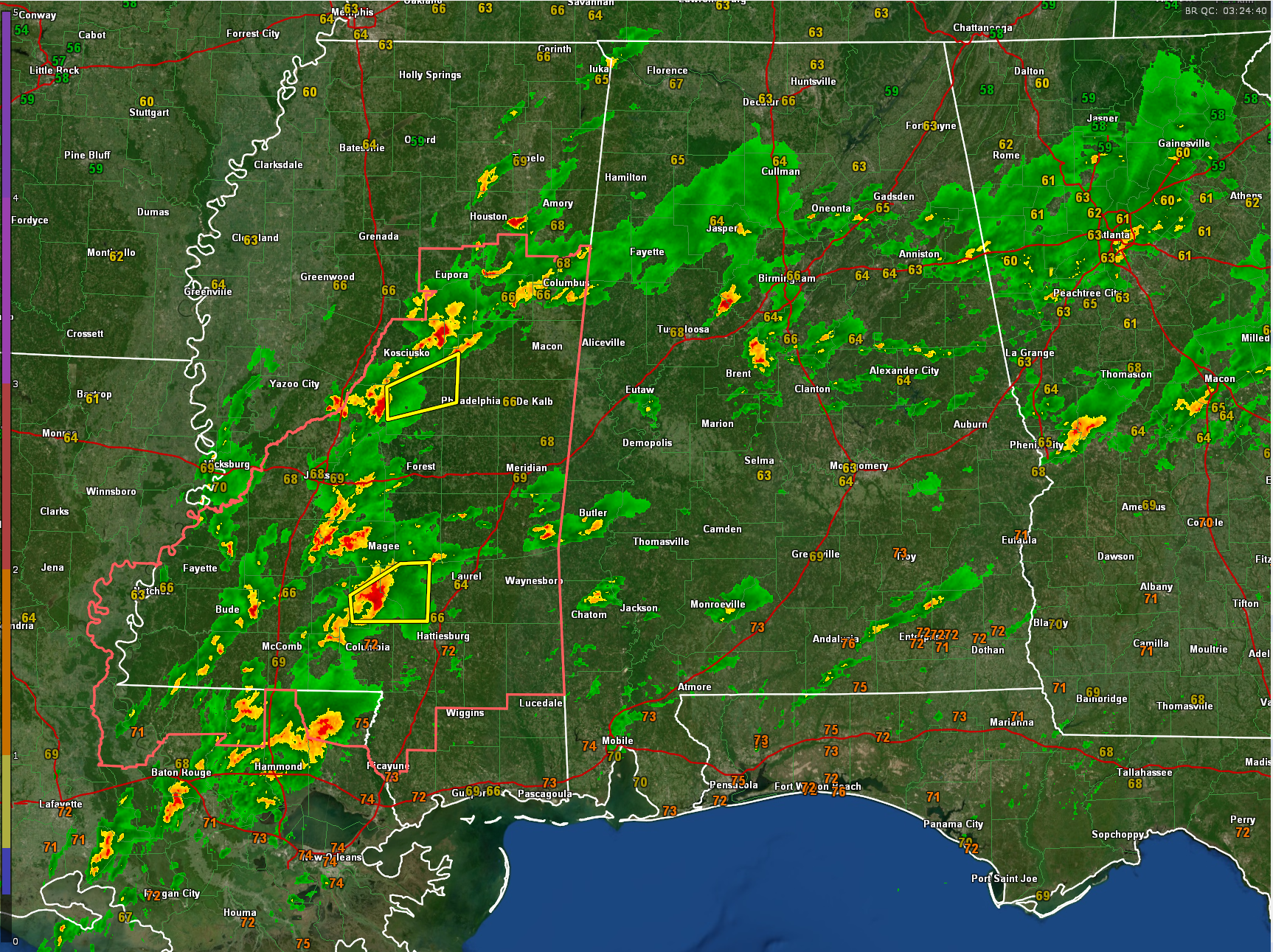
The storms will move into Alabama from Mississippi over the next three hours. They are already knocking on the door of Lamar and Pickens Counties.
The storms will continue into the pre-dawn hours.
The storms should maintain their strength with the warm and moist airmass across Alabama. Instabilities will still be near or above 1,000 joules south of US-82/I-20. Wind shear has moderated a bit, but there is still sufficient shear for organized storms and even the possibility of a tornado or two overnight.
Still, no watch for Alabama, but that possibility remains as well.
A flash flood watch continues for much of Central Alabama. The threat for flooding will remain high overnight.
Make sure you have reliable and redundant ways to receive warnings overnight. Make sure to take severe thunderstorm warnings seriously as all it takes as one tree limb to cause a tragedy.
Category: ALL POSTS
About the Author (Author Profile)
Bill Murray is the President of The Weather Factory. He is the site's official weather historian and a weekend forecaster. He also anchors the site's severe weather coverage. Bill Murray is the proud holder of National Weather Association Digital Seal #0001 @wxhistorianSubscribe
If you enjoyed this article, subscribe to receive more just like it.


