Severe Thunderstorm Warning for Portions of Madison County Until 230 pm
Strong storm is moving into Huntsville right now. Large hail is the main threat but winds could gust to 50 mph.
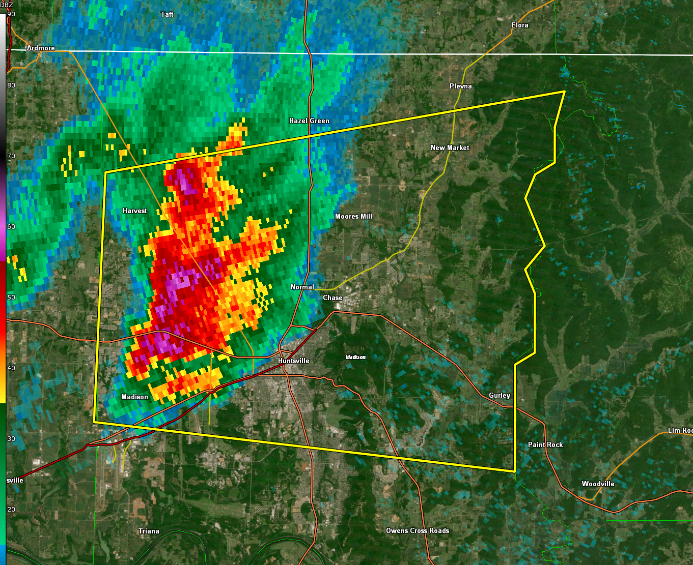
The National Weather Service in Huntsville Alabama has issued a
* Severe Thunderstorm Warning for…
Central Madison County in north central Alabama…
* Until 230 PM CST.
* At 202 PM CST, a severe thunderstorm was located over Madison,
moving east at 50 mph.
HAZARD…Quarter size hail.
SOURCE…Radar indicated.
IMPACT…Damage to vehicles is expected.
* Locations impacted include…
Huntsville, Madison, Moores Mill, Meridianville, Redstone Arsenal,
Hazel Green, Gurley, Alabama A And M University, University Of
Alabama In Huntsville and Harvest.
PRECAUTIONARY/PREPAREDNESS ACTIONS…
This storm is producing large hail. SEEK SHELTER NOW inside a sturdy
structure and stay away from windows!
Category: Alabama's Weather, ALL POSTS, Severe Weather
About the Author (Author Profile)
Bill Murray is the President of The Weather Factory. He is the site's official weather historian and a weekend forecaster. He also anchors the site's severe weather coverage. Bill Murray is the proud holder of National Weather Association Digital Seal #0001 @wxhistorianSubscribe
If you enjoyed this article, subscribe to receive more just like it.


