Severe Thunderstorm Warning for Parts of Lowndes and Montgomery Counties Until 315 pm
Winds have gusted to 62 mph at Dannelly Field in Montgomery.
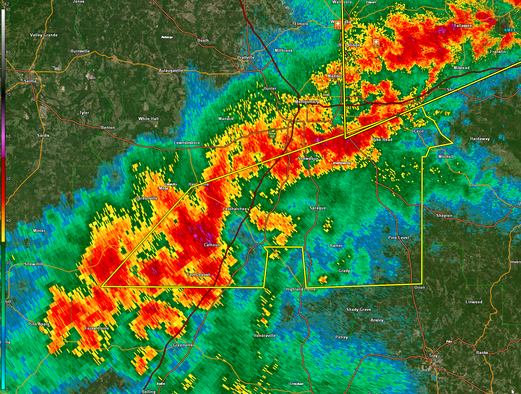
The National Weather Service in Birmingham has issued a
* Severe Thunderstorm Warning for…
Southeastern Lowndes County in south central Alabama…
Montgomery County in south central Alabama…
* Until 315 PM CST.
* At 225 PM CST, severe thunderstorms were located along a line
extending from near Hope Hull to 6 miles west of Lowndes County
Airport, moving east at 65 mph.
HAZARD…60 mph wind gusts and quarter size hail.
SOURCE…Radar indicated.
IMPACT…Hail damage to vehicles is expected. Expect wind damage
to roofs, siding, and trees.
* Locations impacted include…
Southeastern Montgomery, Fort Deposit, Hayneville, Meadville, Pike
Road, Pine Level, Beechwood, Dublin, Snowdoun, Grady, Sellers,
Davenport, Ramer, Pintlala, Lowndes County Airport, Strata, Naftel,
Logan, Sprague and Lapine.
PRECAUTIONARY/PREPAREDNESS ACTIONS…
A Tornado Watch remains in effect until 500 PM CST for south central
Alabama. A Tornado Watch also remains in effect until 600 PM CST for
southeastern Alabama.
For your protection move to an interior room on the lowest floor of a
building.
Category: ALL POSTS
About the Author (Author Profile)
Bill Murray is the President of The Weather Factory. He is the site's official weather historian and a weekend forecaster. He also anchors the site's severe weather coverage. Bill Murray is the proud holder of National Weather Association Digital Seal #0001 @wxhistorianSubscribe
If you enjoyed this article, subscribe to receive more just like it.


