Midday Nowcast: More Spring-like Warmth
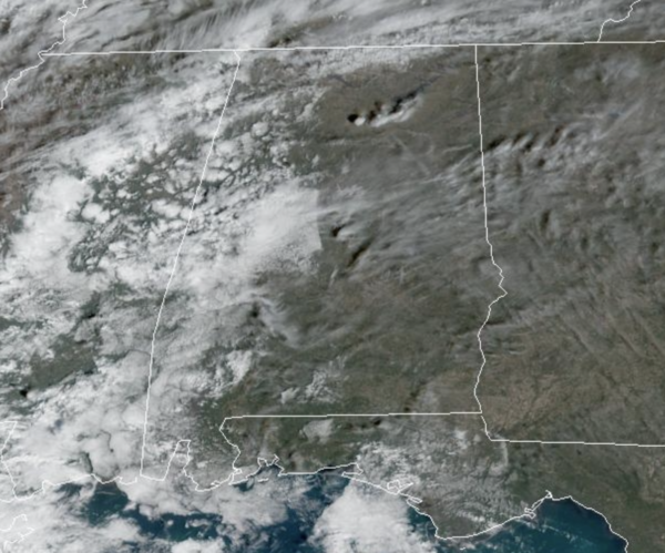
Another amazing day of weather across Alabama with more sunshine than clouds and mild temperatures as 70s are more common today. A few showers are possible later this evening across West Alabama, but for the most part today is a dry day. Tonight, will feature more clouds and some scattered showers with lows in the 50s.
USA BRIEF: A stream of moisture into the Northwest and northern Rockies today will produce locally heavy rain, mountain snow and gusty to high winds. Meanwhile, a storm system will gradually develop across the southern Plains today for heavy to excessive rainfall, possible flooding and isolated strong to severe thunderstorms in portions of Texas, Oklahoma and Arkansas.
FRONT ON THE WAY: Clouds continue to increase tomorrow and with breezy southerly winds expect high again in the 70s statewide. An approaching cold front will being rain and storms back to Alabama tomorrow night into Thursday. The SPC maintains a “marginal risk” (level 1/5) of severe thunderstorms for much of the state tomorrow night, while they’ve highlighted much of Mississippi, Louisiana, and Arkansas in a “slight risk”.
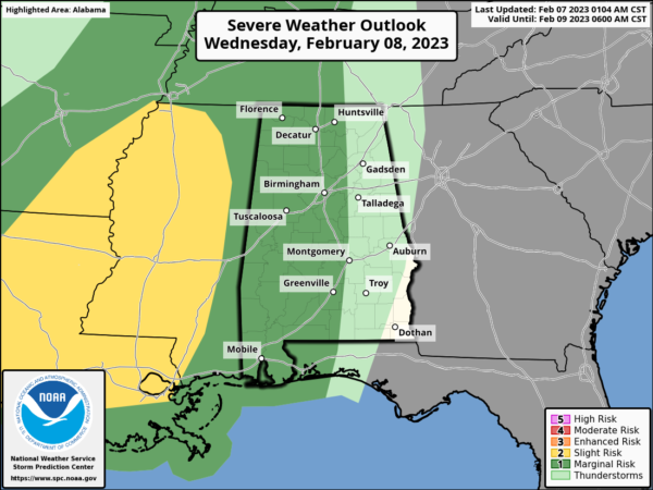
It still looks like the main batch of rain and storms will arrive after midnight Wednesday night, but with very little surface based instability, the severe weather threat is low, but still we will be watching things carefully. As the storms move through, they could produce gusty winds, and brief, isolated tornado can’t be totally ruled out. Most of the rain will shift into East and South Alabama by Thursday afternoon with highs in the 60s.
FRIDAY AND THE WEEKEND: Friday will be cloudy and cooler as an upper trough moves through, and with wrap-around moisture, we expect patches of light rain/drizzle at times through the day, with highs in the 50s. The weekend will be dry with sunny days and fair nights. Highs will be in the 40s over the northern third of Alabama Saturday, with 50s to the south. Highs Sunday will be mostly in the 50s, after a sub-freezing start to the day.
NEXT WEEK: The weather will be dry Monday and Tuesday; rain returns at mid-week Wednesday. Temperatures rebound with highs in the 60s and 70s on most days, which would be above average for mid-February in Alabama.
BEACH FORECAST CENTER: Get the latest weather and rip current forecasts for the beaches from Fort Morgan to Panama City on our Beach Forecast Center page. There, you can select the forecast of the region that you are interested in visiting.
WORLD TEMPERATURE EXTREMES: Over the last 24 hours, the highest observation outside the U.S. was 110.8F at Laverton, Australia. The lowest observation was -66.6F at Ojmjakon, Russia.
CONTIGUOUS TEMPERATURE EXTREMES: Over the last 24 hours, the highest observation was 93F at Rio Grande Village, TX. The lowest observation was -24F at Estcourt Station, ME.
Category: Alabama's Weather, ALL POSTS
About the Author (Author Profile)
Macon, Georgia Television Chief Meteorologist, Birmingham native, and long time Contributor on AlabamaWX. Stormchaser. I did not choose Weather, it chose Me. College Football Fanatic. @Ryan_StinnetSubscribe
If you enjoyed this article, subscribe to receive more just like it.


