Midday Nowcast: Sun and Clouds for our Friday
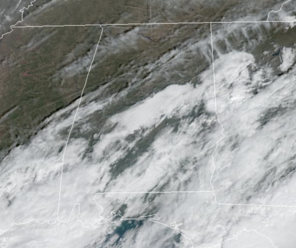
It is a mostly cloudy day with some areas of scattered rain, mainly across areas of South Alabama. The northern half of the state is mainly dry with some areas of sun and afternoon temperatures in the lower 60s for most places. Tonight will continue to feature more clouds with some scattered showers mainly to the south. Lows tonight will range from the upper 30s to lower 40s.
WEEKEND WEATHER: A deep upper low will move slowly through the state Saturday with periods of rain and colder temperatures. We have been saying it all week that upper-level lows can bring excitement this time of year and it is starting to look more likely that some locations in the state may see some bursts of snow at times tomorrow and tomorrow night, especially across North and East Alabama. Temperatures should remain too warm for accumulations or impacts, but still you never know with features like this..highs tomorrow will range from the 40s into the 50s. Much better weather returns Sunday as the sky becomes sunny, highs again will be in the 50s.
NEXT WEEK: Monday will be dry, but then our next front brings rain and storms back to the state Tuesday. The front then stalls across the state, keeping our weather unsettled on Wednesday. Highs most of next week will be in the 60s to low 70s. A more dynamic system will impact the state Thursday, and it looks like strong to severe will be possible with this one.
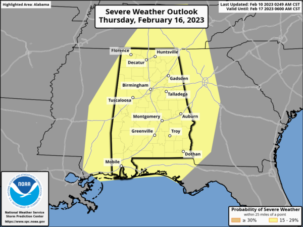
The SPC has already issued a “slight risk” of severe weather for all of Alabama next Thursday. Way too early to be specific, but definitely something to keep an eye on next week. Then, drier and colder air returns by Friday and the following weekend.
BEACH FORECAST CENTER: Get the latest weather and rip current forecasts for the beaches from Fort Morgan to Panama City on our Beach Forecast Center page. There, you can select the forecast of the region that you are interested in visiting.
WORLD TEMPERATURE EXTREMES: Over the last 24 hours, the highest observation outside the U.S. was 109.4F at Warburton Airfield, Australia. The lowest observation was -72.2F at Ojmjakon, Russia.
CONTIGUOUS TEMPERATURE EXTREMES: Over the last 24 hours, the highest observation was 88F at Everglades City, FL. The lowest observation was -26F at Peter Sinks, UT.
Category: Alabama's Weather, ALL POSTS
About the Author (Author Profile)
Macon, Georgia Television Chief Meteorologist, Birmingham native, and long time Contributor on AlabamaWX. Stormchaser. I did not choose Weather, it chose Me. College Football Fanatic. @Ryan_StinnetSubscribe
If you enjoyed this article, subscribe to receive more just like it.


