Midday Nowcast: Continued Cloudy, Cooler for Some
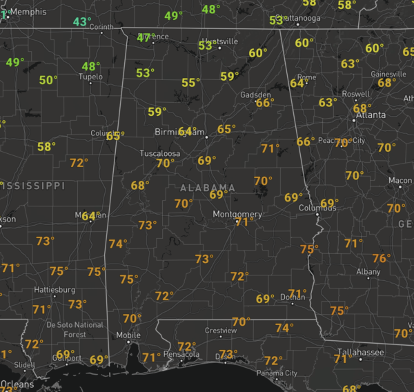
A weak cold front has moved into the state, bringing cooler weather today for the northern half of the with 50s and 60s, while 70s and 80s are most common across South Alabama. It remains mainly cloudy with some scattered passing rain showers.
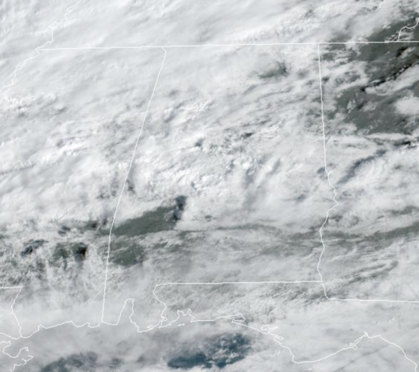
Tonight, will continue to feature more clouds and some light rain at times with lows in the 50s.
USA BRIEF: An unusually cold winter storm will produce multiple rounds of heavy snowfall and strong winds that will lead to blizzard conditions over some of the higher terrain and mountain passes and lower snow levels where snow is unusual in California and adjacent areas. Heavy rainfall and flooding is possible in southern California. Snow, gusty winds, and ice continue to impact the Northeast.
WEEKEND WEATHER: For tomorrow, we will maintain the chance of widely scattered showers over the north and central counties of the state. Expect more clouds than sun with highs mostly in the 70s. Sunday will continue to be mainly cloudy, but we should see a decrease in the rain, while highs remain in the 70s. South Alabama, looks to remain dry both days with highs in the 80s.
NEXT WEEK: A dynamic system will lift northward toward the Great Lakes Monday, and we will mention a chance of showers and possibly a thunderstorm. But the strong upper ridge over the Gulf of Mexico should prevent severe storms from forming across Alabama. SPC does have a risk of severe thunderstorms defined Monday for parts of East Tennessee and East Kentucky north of the ridge.
Tuesday looks dry, but showers return to the forecast Wednesday and Thursday. Strong storms are possible Friday, but models are in good agreement concerning the placement of the surface and upper air features of that system. Too early to know if there will be a severe weather threat. Highs through the week will be mostly in the 70s.
BEACH FORECAST CENTER: Get the latest weather and rip current forecasts for the beaches from Fort Morgan to Panama City on our Beach Forecast Center page. There, you can select the forecast of the region that you are interested in visiting.
WORLD TEMPERATURE EXTREMES: Over the last 24 hours, the highest observation outside the U.S. was 113.2F at Vioolsdrif, South Africa. The lowest observation was -69.2F at Delyankir, Russia.
CONTIGUOUS TEMPERATURE EXTREMES: Over the last 24 hours, the highest observation was 102F at Falcon Lake, TX. The lowest observation was -32F at Hettinger, ND.
WEATHER ON THIS DATE IN 1936: Vermont and New Hampshire received brown snow due to dust from storms in the Great Plains Region. A muddy rain fell across parts of northern New York State (24th-25th).
Category: Alabama's Weather, ALL POSTS
About the Author (Author Profile)
Macon, Georgia Television Chief Meteorologist, Birmingham native, and long time Contributor on AlabamaWX. Stormchaser. I did not choose Weather, it chose Me. College Football Fanatic. @Ryan_StinnetSubscribe
If you enjoyed this article, subscribe to receive more just like it.


